
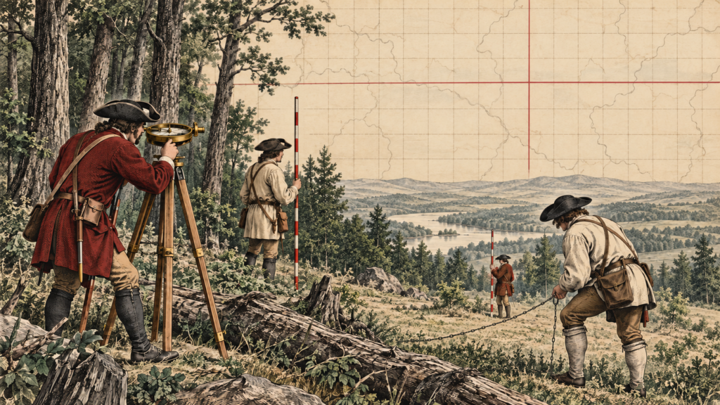
Before the Grid
When the United States emerged from the Revolutionary War, it possessed an enormous territorial claim but lacked a consistent way to describe, divide, sell, and govern much of that land. Colonial property descriptions commonly followed rivers, ridges, roads, trees, stones, and neighboring owners. These metes-and-bounds descriptions could work well when witnesses and landmarks remained available. They could also become uncertain when a tree died, a stream shifted, or several descriptions overlapped.
The young federal government needed another approach for the lands northwest of the Ohio River. Congress viewed western land as a source of revenue, a place for settlement, and a test of whether orderly government could extend across a continental republic. The solution was not merely a better map. It was a repeatable surveying system that could create parcels before most of them were occupied.
The Land Ordinance of 1785
The Land Ordinance of 1785 established the foundation of what became the Public Land Survey System. Surveyors were directed to divide territory into townships six miles square and then into one-mile-square sections. In principle, a prospective buyer could identify a tract by its position within a township and range rather than by reciting a long journey from one tree or creek to another.
This rectangular ideal was elegant on paper. The Earth, however, is curved, irregular, and already filled with mountains, rivers, prior claims, Indigenous homelands, and older systems of land use. Surveyors had to carry the grid into real terrain. They ran lines through forests and swamps, measured with chains, observed direction with compasses, kept field notes, and marked corners so later parties could recover the work.
The system also served a federal policy of transferring public-domain lands into private ownership. That history cannot be separated from the displacement of Native nations and the transformation of Indigenous landscapes into federally surveyed and conveyed parcels. A complete history of American surveying must therefore recognize both the technical achievement of the grid and the human consequences of the land policies it supported.
Townships, Ranges, and Sections
A principal meridian supplies a north-south reference line, while a base line supplies an east-west reference. Townships are numbered north or south of the base line, and ranges are numbered east or west of the principal meridian. A township is nominally six miles on a side and contains thirty-six sections, each nominally one square mile or 640 acres.
The word nominally matters. Meridians converge as they run toward the poles, measurements contain error, and the ground refuses to behave like graph paper. Surveyors introduced correction lines, guide meridians, standard parallels, and fractional lots to manage these realities. The irregular pieces that appear along township boundaries are not necessarily mistakes. They are often the visible record of how surveyors reconciled a geometric plan with a curved Earth.
The Work Behind the Lines
Early public-land survey parties combined technical judgment with physical endurance. A deputy surveyor might lead chain carriers, axmen, flagmen, and other assistants. The crew measured distances, established bearings, marked trees, set posts or stones, described soil and vegetation, noted watercourses, and recorded evidence that would help future surveyors identify each corner.
Field notes were not secondary paperwork. They were part of the survey itself. A plat reduced the work to a mapped form, while the notes preserved observations about monuments, line trees, topography, and the sequence of the survey. Together, these records formed the documentary bridge between the original party and every retracement that followed.
From General Land Office to Bureau of Land Management
The General Land Office was created in 1812 to oversee federal land records and the disposal of public lands. Its surveyors and contractors extended the rectangular system across much of the country. In 1946 the General Land Office merged with the Grazing Service to form the Bureau of Land Management, which continues the federal cadastral-survey function.
The scale is difficult to grasp. The Bureau of Land Management reports that nearly 1.5 billion acres have been surveyed into townships and sections and monumented over more than two centuries. The agency’s General Land Office Records system now provides digital access to millions of land-title records as well as historical plats and field notes.
Why the Original Survey Still Matters
A modern GNSS receiver can determine a coordinate with extraordinary precision, but a coordinate alone does not decide where a legally created boundary was established. In public-land retracement, the original corners and the evidence of the original survey remain central. Later measurements may reveal that a section is not exactly one mile wide or that an old line does not fit an ideal bearing. The surveyor’s task is usually to recover the boundary that was created, not to redesign it into mathematical perfection.
This distinction is one of the profession’s most important lessons. Measurement technology improves, datums change, and coordinates are updated, but the legal and historical acts that created parcels remain part of the evidence. A stone, bearing tree record, or worn mound can outweigh an elegant coordinate if that evidence better identifies the original corner.
A Grid That Became a Landscape
The rectangular survey shaped more than deeds. It influenced roads, farm fields, county lines, town layouts, and the way Americans speak about location. From an aircraft, the checkerboard pattern of sections is visible across broad portions of the Midwest and West. On a plat, the same framework still organizes mineral rights, easements, subdivisions, and public-land management.
The system’s endurance comes from the union of geometry, monuments, records, and law. Its lines began as instructions issued by a distant government, but they became physical marks on the ground and eventually familiar features of the landscape. For an entry-level surveyor, learning the Public Land Survey System is therefore not simply learning how to number sections. It is learning how a nation attempted to translate an idea of order onto the Earth—and how every generation of surveyors has had to interpret the result.
Sources and Further Reading
Bureau of Land Management: Cadastral Survey History
Bureau of Land Management: Cadastral Survey