
A Survey Before Settlement
The first federal surveyors who entered the country northwest of the Ohio River were doing something historically unusual. Instead of waiting for settlement and then describing claims around existing occupation, Congress intended to survey much of the land first. The rectangular framework created by the Land Ordinance of 1785 would make land easier to identify, sell, tax, and govern.
That decision placed surveyors at the leading edge of federal expansion. Their work was technical, but it was also administrative and political. The lines they established helped convert a vast and complex landscape into numbered parcels recognized by federal law. Those parcels were laid across places already known, traveled, and inhabited by Native nations, a fact that belongs in any honest account of the survey.
The Geographer and the Seven Ranges
Thomas Hutchins, appointed Geographer of the United States, directed the earliest federal work under the 1785 ordinance. The first major project became known as the Seven Ranges, located in what is now eastern Ohio. A point on the north bank of the Ohio River near the Pennsylvania boundary served as the beginning for a line run westward, with townships laid out in ranges.
The Seven Ranges survey was experimental. Congress had supplied a legislative pattern, but the field parties still had to determine how that pattern would operate on actual ground. The work exposed ambiguities in instructions, the difficulty of maintaining direction over long distances, the effect of magnetic variation, and the practical challenge of coordinating separate crews.
It also showed that a national survey could not be produced merely by drawing squares on a map. Corners had to be established, lines marked, notes kept, plats prepared, and the work connected to a known beginning point. Each step required a chain of evidence that future surveyors could follow.
Life in an Early Survey Party
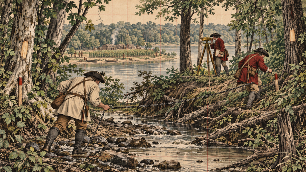
A survey party depended on many hands. The deputy surveyor or party chief carried responsibility for the line and record. Chain carriers measured distance using a surveyor’s chain. Axmen cleared sight lines and blazed trees. Flagmen or markers helped maintain alignment, while other assistants carried provisions and equipment.
The work could be monotonous one moment and hazardous the next. Crews crossed streams, climbed steep ground, endured insects and weather, and worked far from established supply lines. A broken chain, wet field book, lost monument, or misunderstood instruction could affect miles of subsequent work. The surveyor therefore needed practical judgment as much as mathematical knowledge.
Early instruments were simple by modern standards, but they were capable when carefully handled. The compass supplied direction. The chain supplied distance. Astronomical observations and later refinements helped control orientation and account for magnetic behavior. What mattered most was a disciplined procedure and a record clear enough to survive the people who created it.
Why the First Grid Did Not Stay Simple
The original concept called for orderly townships and sections, yet surveyors quickly encountered the geometry of a spherical Earth. Lines intended to run north are meridians, and meridians converge. A grid extended indefinitely without correction would distort or overlap. Survey systems therefore evolved to include standard parallels, guide meridians, correction lines, and fractional subdivisions.
Different principal meridians and base lines were established as surveying advanced into new regions. Local practice also changed as Congress revised the laws and the General Land Office issued increasingly detailed instructions. The result is not one perfectly uniform grid but a family of connected systems, each with its own origin, history, and record.
The Surveyors’ Record
A plat gives a visual summary of the survey, but the field notes often carry the richer story. Notes may identify the species and size of bearing trees, describe streams and land quality, record distances to roads or improvements, and explain how a monument was constructed. These details were practical aids for recovering corners. They also became an accidental archive of environmental and settlement history.
Modern researchers use General Land Office notes and plats to study historic vegetation, waterways, transportation routes, and early communities. Surveyors use them for a more immediate purpose: retracing the footsteps of the original party and weighing the surviving evidence. The same page can therefore serve a boundary survey, an ecological study, and a family-history investigation.
The Northwest Territory Becomes a Pattern
The work begun in Ohio became a pattern for public-domain lands across much of the United States. As the nation acquired territory, surveyors extended township-and-range systems across plains, deserts, forests, and mountains. The framework facilitated land sales and settlement, but it also carried the assumptions of federal policy into places where land had long been understood through other cultural, communal, and ecological relationships.
Recognizing that context does not diminish the skill of the survey parties. It helps explain why their lines mattered. A survey can be simultaneously a measurement, a legal act, a government record, and an instrument of historical change.
What Today’s Surveyor Can Learn
The Surveyors of the Northwest worked without satellites, electronic data collectors, or instant communication, yet their surviving work still controls boundaries. That endurance came from monumentation and documentation. They understood that a measurement becomes useful only when another person can identify what was measured and how it was connected.
An entry-level surveyor reading an old field book should resist the temptation to see only obsolete bearings and distances. Look instead for the logic of the party: the starting evidence, the sequence of lines, the kind of corner set, the calls to natural features, and the relationship between plat and notes. That habit turns a historic record into a field workflow.
The first federal grids were imperfect, difficult, and consequential. Their surveyors left more than a checkerboard. They left a continuing professional problem: how to preserve an intended boundary through changing instruments, changing landscapes, and changing generations.
Sources and Further Reading
Bureau of Land Management: A History of the Rectangular Survey System
Bureau of Land Management: Cadastral Survey History