
Maps & Plats
Lines Across a Young Nation: How the Rectangular Survey Organized the American West
How the Land Ordinance of 1785, field crews, monuments, and public records transformed a geometric idea into the framework of the American landscape.
On This Page
- 01 — Introduction
- 02 — A national problem, measured on the ground
- 03 — What Congress actually ordered in 1785
- 04 — Finding a parcel: meridian, township, section
- 05 — Why the squares are not all square
- 06 — Making an administrative idea survive outdoors
- 07 — A historical framework in a digital world
- 08 — Sources and further reading
Seen from an airplane, much of the American landscape looks as though someone laid a ruler across it. Roads turn at right angles. Fields line up in broad squares. County boundaries sometimes run straight for miles, then make a small, surprising jog. These patterns are among the most visible consequences of a decision made by Congress in 1785: much of the nation’s public land would be surveyed into an orderly framework before it was sold.
That framework became the Public Land Survey System, usually shortened to PLSS. It supplied addresses for land before street addresses existed, helped organize the transfer of federal land into other ownership, and left a record that surveyors still use. Its history also explains why a township is not necessarily a town, a section does not always contain exactly 640 acres, and a modern coordinate cannot by itself settle the position of an old boundary.
A national problem, measured on the ground
After independence, the United States faced debts and competing expectations about western land. Several states had asserted extensive western claims; their cessions helped create a federal public domain. Congress needed a workable way to identify parcels, reserve land for public purposes, and sell land without having each purchaser invent an independent description.
The region was not an empty inventory. Indigenous nations already lived in, used, and claimed these landscapes. Federal land disposal rested on assertions of sovereignty and on treaties, cessions, warfare, and displacement. The regularity of the eventual map should not obscure that contested history. A survey could describe the land the government claimed authority to sell; it could not make the political and human consequences of that claim disappear.
Many earlier colonial descriptions used metes and bounds: courses and distances around a tract, connected to such evidence as trees, stones, streams, and neighboring holdings. These descriptions could be entirely serviceable, but they did not automatically fit every new parcel into one regional index. The rectangular system approached the task from the other direction. It established a larger framework into which smaller descriptions could fit.
What Congress actually ordered in 1785
The Land Ordinance of May 20, 1785 called for townships six miles square, bounded by north–south and east–west lines as nearly as practicable. Each township was to be represented on a plat as thirty-six one-mile-square lots, nominally 640 acres apiece. The ordinance also reserved section 16 in each township for the maintenance of public schools. These were decisions about finance and public institutions as much as geometry.
There is an important distinction between that first plan and the mature system familiar today. The early work established township exteriors and mile corners along them; the interior one-mile squares were initially drawn on the plats rather than all surveyed on the ground. Nor did the first surveys use today’s section-numbering pattern. In the original Seven Ranges, numbering began in the southeast corner and proceeded northward in columns. Legislation in 1796 introduced the familiar arrangement beginning with section 1 in the northeast and reversing direction in successive rows.
The system developed through experience, later laws, and increasingly detailed instructions. Treating every surviving township as the product of one unchanged 1785 recipe can lead a reader—and a surveyor—astray. C. Albert White’s A History of the Rectangular Survey System follows that development and reproduces the early legislation.
Finding a parcel: meridian, township, section
In the developed system, a named principal meridian and an associated base line provide the reference framework. Township designations count north or south of the base line; range designations count east or west of the principal meridian. A survey township is therefore a unit of land identification, not necessarily a municipality. Its designation is incomplete without the appropriate meridian, because many survey systems reuse the same township and range numbers.
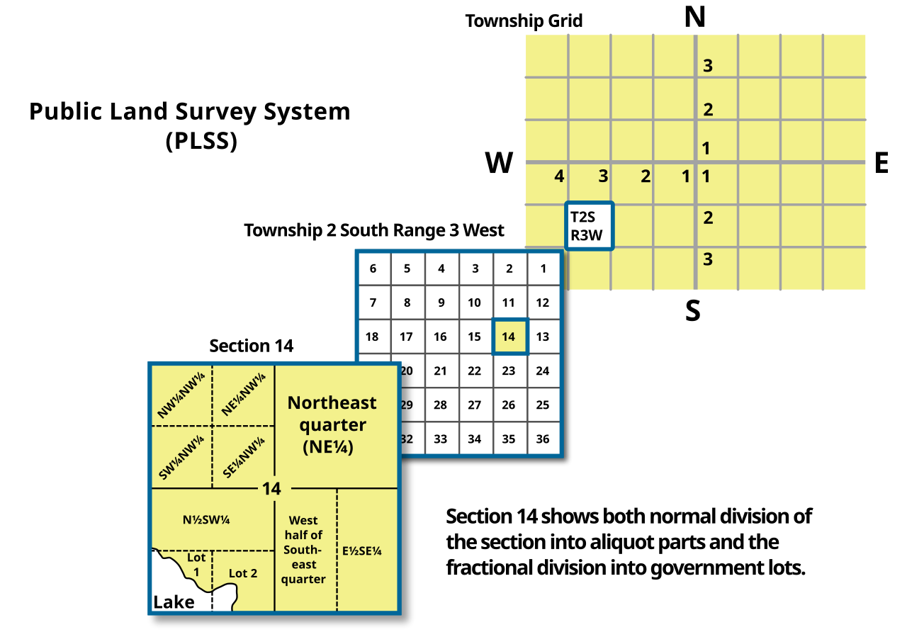

Within a regular township, the thirty-six sections are numbered back and forth. Section 1 occupies the northeast corner, section 6 the northwest, section 7 lies immediately south of 6, and the pattern continues to section 36 in the southeast. Learning that sequence makes an unfamiliar township plat much easier to navigate.
Consider an illustrative description: the northeast quarter of the southwest quarter of section 14, Township 2 South, Range 3 West, Sixth Principal Meridian. Work from the largest unit inward. Locate the named survey system, then the township, then section 14. Within that section, select the southwest quarter; within that quarter, select its northeast quarter. The final parcel is nominally forty acres. Reversing the order of the two quarter descriptions identifies a different piece of land.
These fractional descriptions are called aliquot parts. The convenient arithmetic comes from a regular section’s nominal 640 acres: one quarter is 160 acres, and a quarter of a quarter is 40. The historical units also fit the arithmetic. A standard Gunter’s chain is 66 feet long, a mile is 80 chains, and ten square chains equal an acre. A nominal square quarter-quarter section, 20 chains on each side, therefore contains 400 square chains, or 40 acres.
Why the squares are not all square
The Earth does not behave like graph paper. Meridians converge toward the poles, while the measurements made by any field crew contain some error. A six-mile survey also has to meet earlier surveys, shorelines, reservation boundaries, and other controlling limits. The instructions developed methods for managing these conflicts rather than pretending they did not exist.
Standard parallels, also called correction lines, and guide meridians helped control the extension of the framework. Within a regular township, the established subdivision procedure generally concentrated excesses or deficiencies along the north and west boundaries. This helps explain the fractional tracts and numbered lots commonly found there. Water and other interruptions can produce additional lots elsewhere.
A government lot is not necessarily a small urban building lot. On a township plat it may be an irregular tract identified by a lot number and a recorded acreage. Likewise, a section labeled as one square mile in an introductory diagram is a nominal unit, not a guarantee about the area enclosed by its legally established boundaries. The approved plat, field notes, and governing survey history supply the particulars.
Making an administrative idea survive outdoors
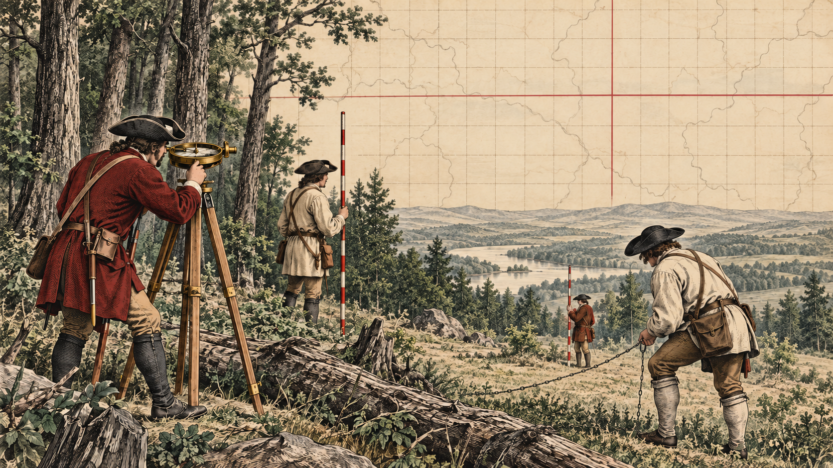
On paper, a line can cross a mountain without effort. On the ground, someone had to establish direction, measure horizontal distance, cross water, clear a sight line, and record what was done. Surveyors set monuments at prescribed positions and described accessories such as bearing trees. The plat summarized the arrangement; the field notes preserved observations and calls that could help another surveyor recover it.
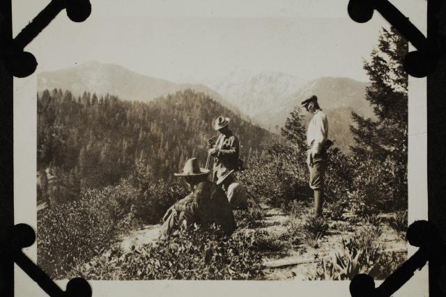
The General Land Office, established in 1812, became central to federal land administration. In 1946 it was combined with the Grazing Service to form the Bureau of Land Management. The BLM now maintains the federal cadastral survey tradition and extensive collections of plats, field notes, and land patents. A cadastral survey concerns land parcels and their boundaries; the associated records connect measurements to the history of land ownership.
A historical framework in a digital world
For a modern retracement, the problem is to recover the boundary established by the controlling survey, not to lay a mathematically improved grid over it. Authentic original corners and reliable evidence of their positions matter even where their spacing differs from ideal dimensions. A neat GIS square can be useful for finding the general neighborhood. It is not automatically evidence of where a corner was actually established.
The BLM’s 2009 Manual of Surveying Instructions explains the federal system’s subdivision and corner-restoration procedures. Applying those procedures to a particular property still requires attention to the survey’s date, the status of the land, and the applicable law. The useful habit is to ask which records and which established corners control the particular problem, rather than assuming every rectangular description works identically.
The rectangular survey’s lasting achievement was to make individual parcels part of a connected, searchable record. Its straight lines shaped farms, roads, schools, and towns, but its durability rests on more than the grid’s appearance. It rests on the relationship between an authorized survey, the evidence left on the ground, and a record another generation can understand. Read together, those three things reveal the human work behind the squares.
Sources and further reading
C. Albert White, A History of the Rectangular Survey System (Bureau of Land Management, 1983), especially the Land Ordinance of 1785, the Seven Ranges, and the Act of May 18, 1796; BLM, Manual of Surveying Instructions (2009), chapters III, VI, and VII; and the BLM’s Cadastral Survey History and General Land Office Records.
Continue with The Surveyors of the Northwest for the story of the first field crews, or Reading the Old Plats for a closer look at the records.
[…] For more on the different kinds of evidence in these documents, see Reading the Old Plats and Lines Across a Young Nation. […]