
Engineering & Infrastructure
When the Survey Guides the Machine: Bringing a Digital Design to the Ground
A blade or bucket can follow a digital design, but the real story begins with survey control, a dependable model, and the people who connect them to the ground.
On This Page
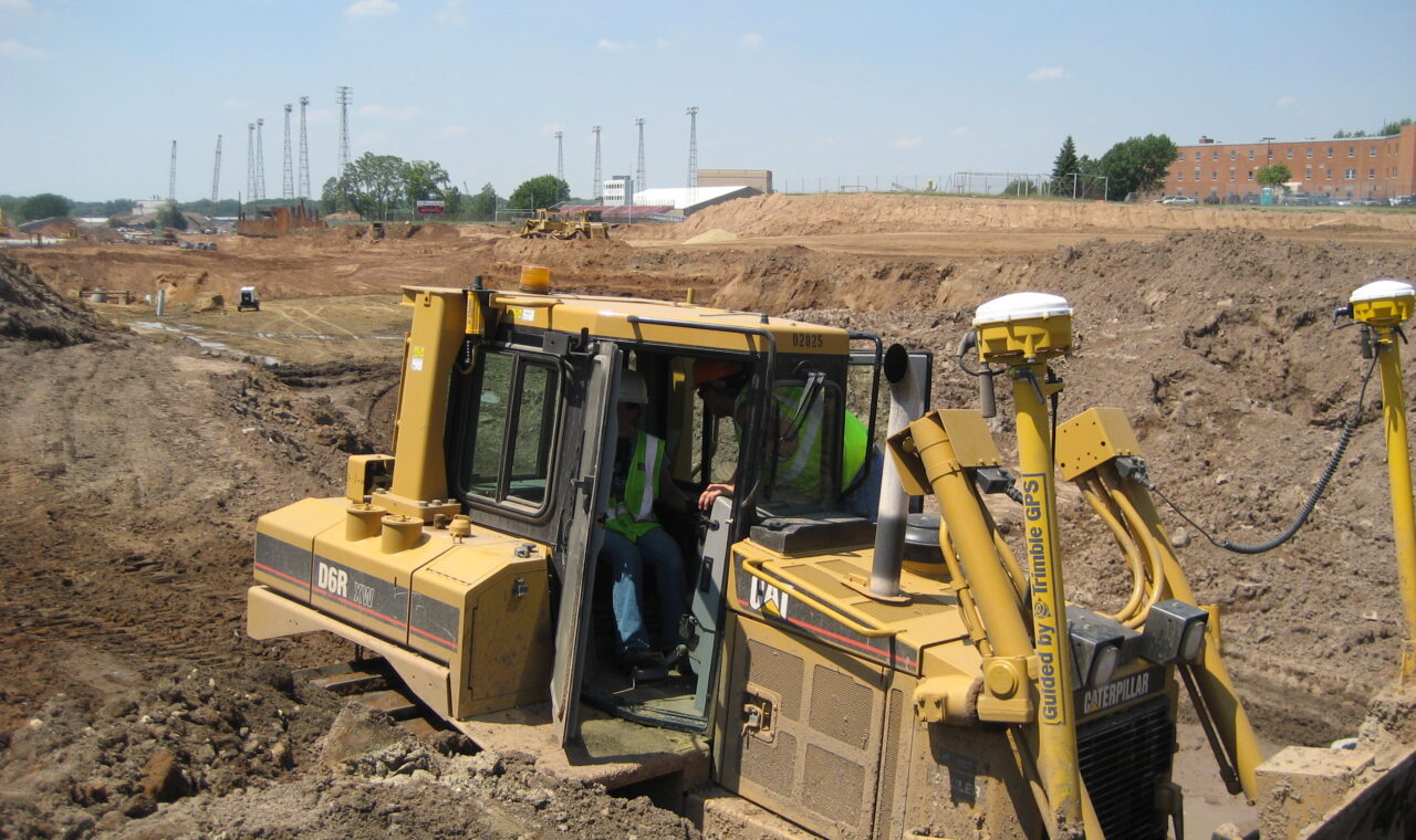
Picture a bulldozer operator watching a screen as a blade moves across a construction site. The display shows the machine against a proposed surface, with numbers describing how far the blade is above or below the intended grade. Somewhere inside that cab, a set of coordinates has become a very practical question: how much dirt needs to move?
That is the appeal of machine control. A survey and a design can travel all the way to the working edge of a machine. The technology joins satellite positioning, optical instruments, sensors, software, and heavy equipment in a shared task: turning a plan into something you can stand on.
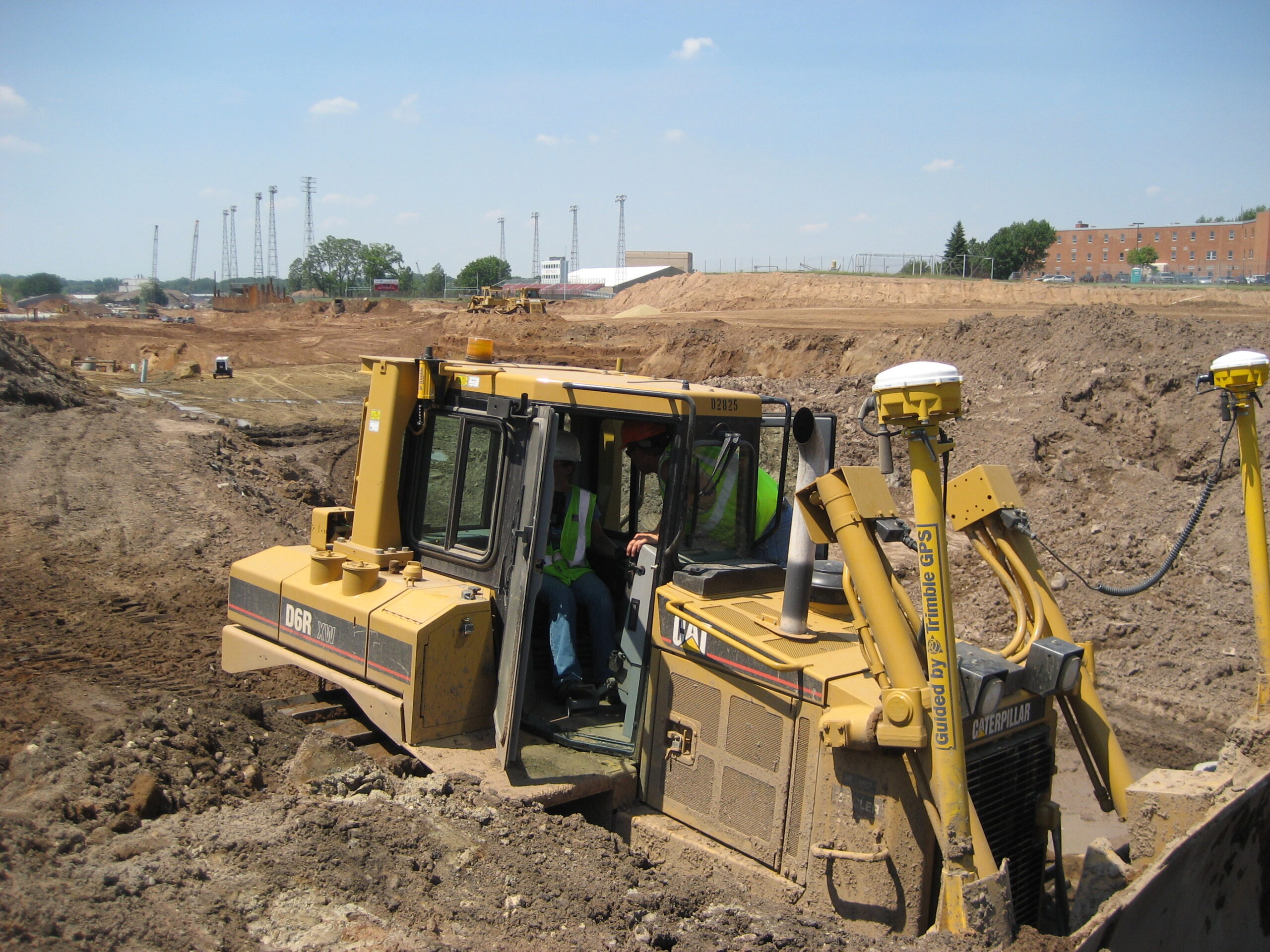
Federal Highway Administration, Wikimedia Commons, CC BY 2.0. Resized by WordPress.
.jpg)
A guide in the cab
The term covers a range of arrangements. A guidance system shows an operator where the blade or bucket is relative to the desired grade. The operator uses that information to make the movement. With automatic control, the system can also command certain hydraulic movements to help the implement follow the design.
Automatic blade or bucket control does not make every machine a driverless vehicle. The operator still has a machine to run, a work area to understand, and decisions to make. What changes is the information available during the task—and, in some systems, which adjustments the electronics can make directly.
Survey information can now participate in construction as it happens. The coordinates are present in the cab, alongside the operator’s view of the ground.
The receiver is not the cutting edge
A satellite receiver on a bulldozer is easy to spot. GNSS—the collective name for satellite navigation systems, including GPS—can provide the machine with a position when suitable corrections and conditions are available. A robotic total station offers another route, measuring to a prism on the machine. Different jobs and surroundings can favor different positioning sources.
The clever part is connecting that measurement to the tool. A receiver mounted above a blade is not measuring the blade’s edge directly. An excavator adds another puzzle: its bucket moves as the boom, stick, and bucket change their angles. Machine dimensions, offsets, and sensors let the system relate the measured position to the working part of the equipment.
That relationship needs to match the actual machine and attachment. A beautiful position for an antenna is only useful if the system also knows where the steel is.
A surface worth following
The model provides the destination. Its surface represents an intended grade: perhaps a road layer, a building pad, or an excavation. Comparing the working edge with that surface gives the familiar language of cut and fill.
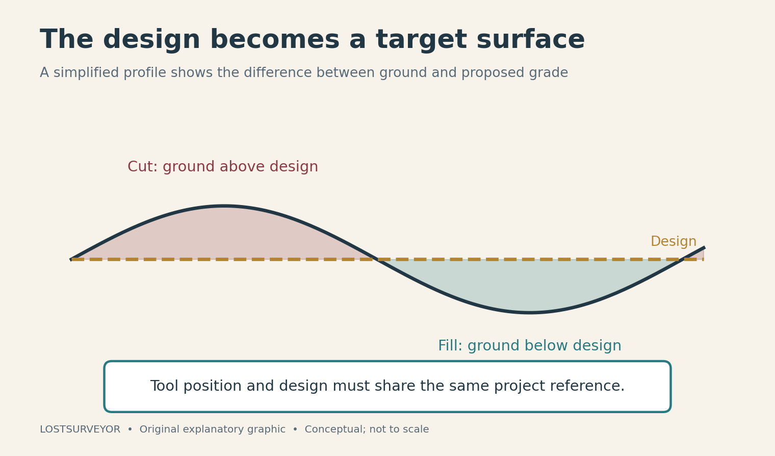
Original explanatory graphic for LostSurveyor.
But a model is more than a handsome three-dimensional picture. It must represent the right part of the project. A finished pavement surface and the prepared ground beneath it are different targets, even when they belong to the same road. Following one perfectly when the work calls for the other still produces the wrong result.
The machine and model also need a common reference. Satellite coordinates and a project’s local northings, eastings, and elevations do not automatically describe the ground in the same way. Site calibration can establish that connection for a local project. It is a separate relationship from the machine geometry that connects an antenna or prism to a blade or bucket.
A Florida road, rebuilt in the model
An FHWA case study of Florida’s State Road 417 makes this tangible. The project used automated machine guidance for variable-depth pavement milling, cutting the existing surface toward a modeled profile.
Creating that profile involved more than choosing a smooth line. Existing and proposed surfaces were compared, with adjustments around ramps, bridges, drainage, and other connections. The model had to work within the physical road and its constraints. Field grade markers also helped crews build confidence in the system.
The report describes situations where the pavement’s remaining thickness required additional attention and another milling pass. That detail gives the story its value: the digital surface was part of an engineering process, with the existing road still having a say.
Keeping the design connected to the day’s work
A model can be accurate and still be yesterday’s model. If a design changes, the revision must reach the equipment using it. Version names, clear responsibility for updates, and checks against the project reference are unglamorous subjects beside a satellite-equipped dozer, but they help keep the whole chain dependable.
There is a similar distinction at the other end of the job. Machine systems can record information about the work, and digital records can be useful for construction review. What those records establish depends on how they were collected and checked. A stream of machine positions and an independently verified account of the finished ground answer different questions.
Surveying at the working edge
What appeals to me about this technology is the continuity. The reference established by a survey, the intentions carried by a design, and the movements made by an operator can meet at the same blade or bucket.
That makes machine control an especially visible expression of a surveying idea: a measurement becomes useful when everyone understands what it refers to. On a construction site, the explanation eventually has to survive contact with soil, steel, and the next truckload of material.
Sources and further reading
- Topcon: Basics of excavator machine control — An accessible manufacturer introduction to guidance, automation, and digital designs.
- Topcon: Excavator positioning and control — How positioning sources and machine sensors work together; product claims should be read as manufacturer information.
- Trimble Siteworks: Calibrating the site — The relationship between satellite coordinates and a local project reference.
- FHWA: Automated machine guidance for Florida SR 417 — A case study of digital models and variable-depth milling on a Florida highway.
- FHWA: 3D engineered models for construction engineering and inspection — The importance of useful models, verification, and construction records.