
Surveying History
When Distance Became a Signal: The Geodimeter and Tellurometer Revolution
Before a total station could return a distance at the press of a button, surveyors carried bulky instruments that measured with light and microwaves. Their story is still inside today’s equipment.
On This Page
The future of surveying once looked rather like a portable television with a small dish on the back. That is how a 1958 Coast and Geodetic Survey report described the Tellurometer, a microwave distance-measuring instrument. Its appearance was a fair warning that electronics had entered the field—and had brought some luggage.
Alongside the light-based Geodimeter, it helped change a long-distance survey from the repeated placement of a physical length into a comparison of signals. Distance could be measured across terrain that made a tape crew’s assignment slow or awkward. The landscape stayed large. The way surveyors reached across it changed.
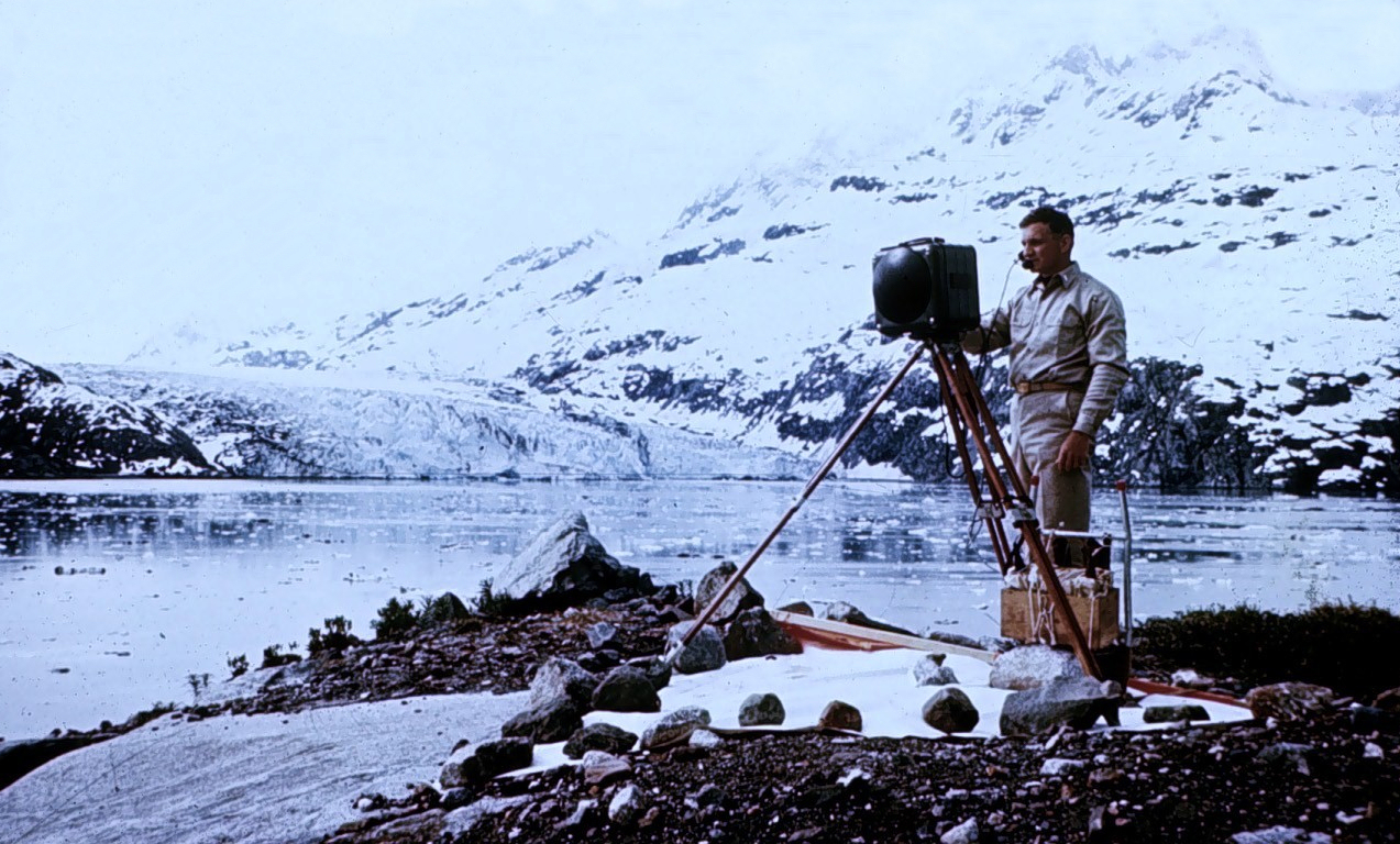
NOAA National Geodetic Survey, public domain in the United States; Wikimedia Commons source. Resized by WordPress.

Bergstrand turns the question around
The Geodimeter’s story begins with Swedish physicist Erik Bergstrand and a question bigger than any property line: how fast does light travel? In 1938, he began investigating an electronic optical shutter for experiments on the speed of light.
There was a useful reversal waiting inside the experiment. Measure a known distance and a signal’s travel time, and you can investigate its speed. If the speed is known well enough, the travel time can reveal an unknown distance. At an international geodesy meeting in Oslo in 1948, Bergstrand explained that possibility.
Sweden’s AGA company brought the idea into commercial equipment. The Smithsonian records ten Model 1 Geodimeters produced in 1953, with five purchased by United States government geodetic agencies. A physics experiment had found an audience that cared deeply about the space between two survey stations.
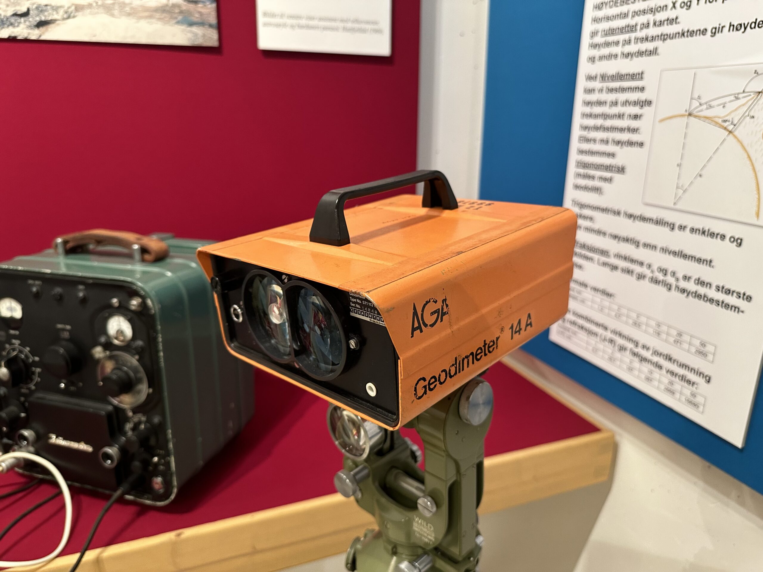
Photo by Ssu, Wikimedia Commons, CC BY-SA 4.0. Resized by WordPress.
.jpg)
A rhythm in the light
The early instrument sent modulated light toward a distant reflector. “Modulated” means that the light carried a controlled, rapidly repeating variation. The returning signal could be compared with a reference inside the instrument.
The comparison involved phase: where one repeating pattern sat relative to another. The journey’s delay shifted that relationship, providing an electronic measure of a tiny travel time. Repeating patterns also introduce ambiguity, so one phase comparison alone does not uniquely identify every possible distance.
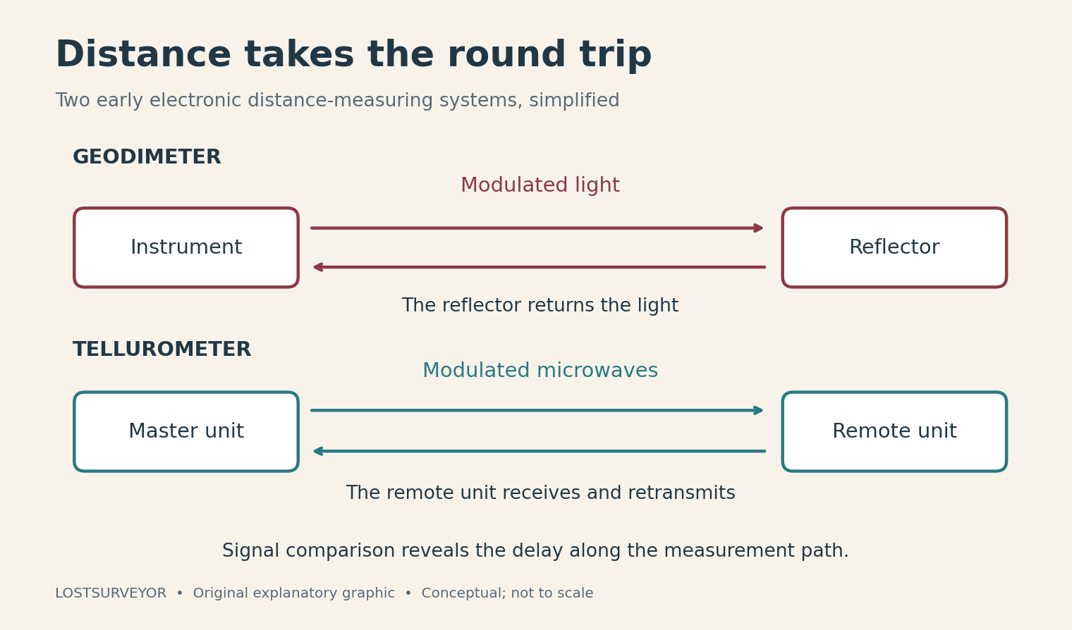
Original explanatory graphic for LostSurveyor.
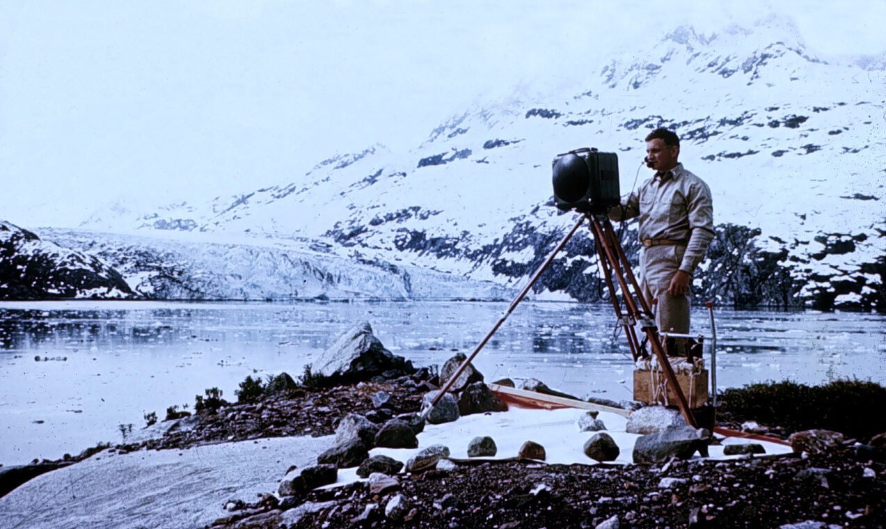
Early optical EDM—electronic distance measurement—often favored night work, and the light path needed to remain clear. These were demanding instruments. A NOAA history records early Coast and Geodetic Survey Geodimeters weighing more than 300 pounds. Their promise was substantial enough for crews to organize fieldwork around the equipment.
Wadley’s microwave partnership
The Tellurometer approached the problem with microwaves. Trevor Lloyd Wadley developed it at South Africa’s Council for Scientific and Industrial Research, or CSIR. The Smithsonian’s account also credits survey official Harry A. Baumann with the original invention, a reminder that an instrument’s history can include several kinds of contribution.
The commercial instrument emerged in 1957. Its purpose included geodetic work: measurements that establish positions across broad areas and help describe the Earth’s shape. The Science Museum Group’s surviving early set shows the two-part arrangement, with a master instrument and a remote instrument.
The remote unit received and retransmitted the signal. Comparing the signals allowed the system to determine distance. Microwaves also offered practical opportunities in daylight and through haze that troubled optical work. The equipment gave surveying crews another way to connect distant stations.
Two stations, and a conversation
The human partnership was as interesting as the electronic one. An instrument stood at each end of the line, and a built-in radiotelephone let the operators talk to each other. The technology that measured the distance also helped people coordinate across it.
The 1958 federal report describes a normal measurement taking about half an hour, including setup, warmup, observations, and repacking, with trained operators and suitable weather. That is a much more revealing picture than imagining an early EDM behaving like a modern button press.
The signal still needed an appropriate path. The report stresses clearance above terrain and projecting objects; simply being able to see the other station through a theodolite did not always establish enough clearance for the microwave measurement. Crews also recorded weather observations because the atmosphere affected the result.
The new distance enters the survey
NOAA’s historical account describes the Geodimeter reducing demanding baseline work from weeks to hours. A baseline is a carefully measured line that gives a survey network its scale. Being able to measure longer lines directly also opened possibilities beyond that foundational task.
The change continued as equipment became smaller and distance measurement joined angle measurement in the total station. The early machines explain how much development sits behind an apparently ordinary reading today. An instrument can report a distance so casually that the journey from a large box on a remote station becomes easy to overlook.
Yesterday’s high technology
I find that history especially appealing. Museum equipment has a way of looking inevitable after the fact: of course somebody would put electronics in a survey instrument. Bergstrand, Wadley, and the crews who took these machines into the field were working through the less comfortable part, when a promising idea still needed to earn its place.
Their equipment made a signal into a useful length. Every time a modern survey instrument returns a distance, it offers a small reminder of the period when that familiar act was a remarkable new possibility.
Sources and further reading
- Smithsonian: AGA Geodimeter Model 2A — Bergstrand’s experiments and the first commercial Geodimeters.
- NOAA: Geodetic Surveying, 1940–1990 — A historical account of field adoption, equipment, and the later move toward total stations.
- Coast and Geodetic Survey: Tellurometer Traverse Surveys — A 1958 report describing the equipment, crews, and field measurements.
- Science Museum Group: Tellurometer MRA 1 set — A surviving instrument set, with collection details and an explanation of its operation.
- Smithsonian: Tellurometer M/RA 1 — The roles of Harry A. Baumann, Trevor Lloyd Wadley, and South Africa’s CSIR.
- NOAA archive: Electronic positioning systems — Period descriptions of the Geodimeter and other systems; historical reading rather than current operating guidance.