
Engineering & Infrastructure
The Instrument That Follows You: Inside the Robotic Total Station
A telescope on a tripod can now follow its own target. Robotic total stations change the pace of surveying, while preserving a surprisingly familiar kind of geometry.
On This Page
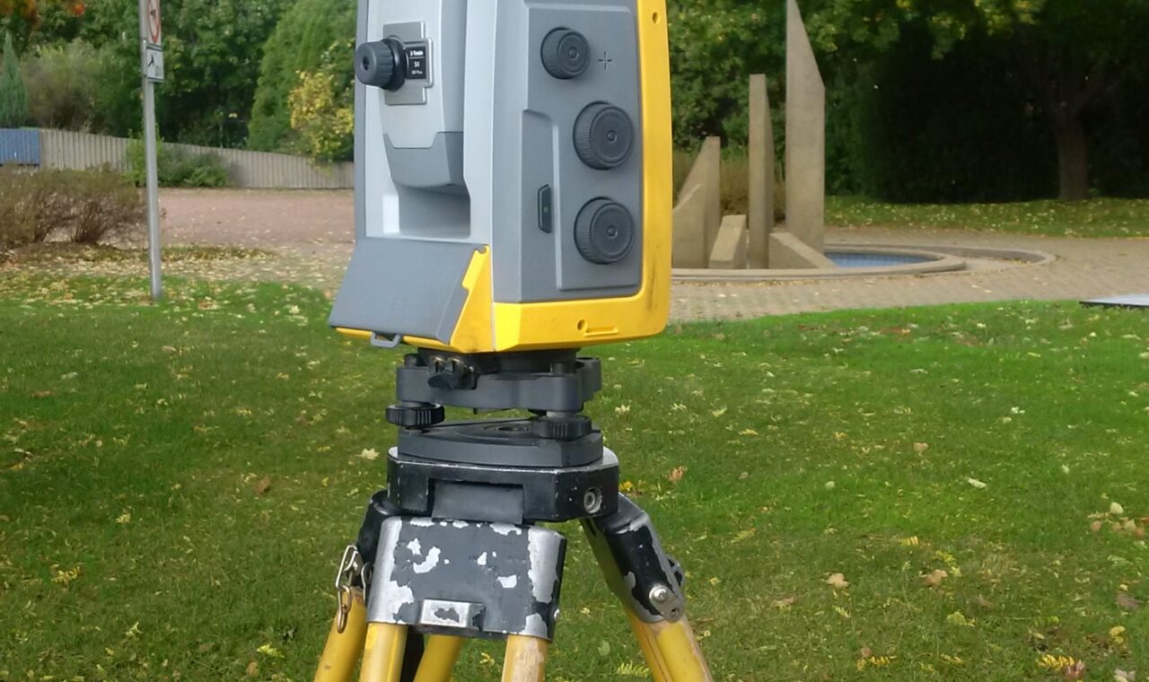
Imagine a tripod beside a building pad. Someone walks away carrying a prism pole, and the instrument’s telescope turns to follow. No one has a hand on the tangent screw. For a newcomer, the little performance can seem almost comic: a surveying instrument with the manners of an attentive bird.
The movement is the most visible part of a robotic total station. The more consequential change is where the surveyor can stand. Instead of remaining behind the telescope, an operator can work at the point being measured, with a controller in hand and the instrument watching from a distance.
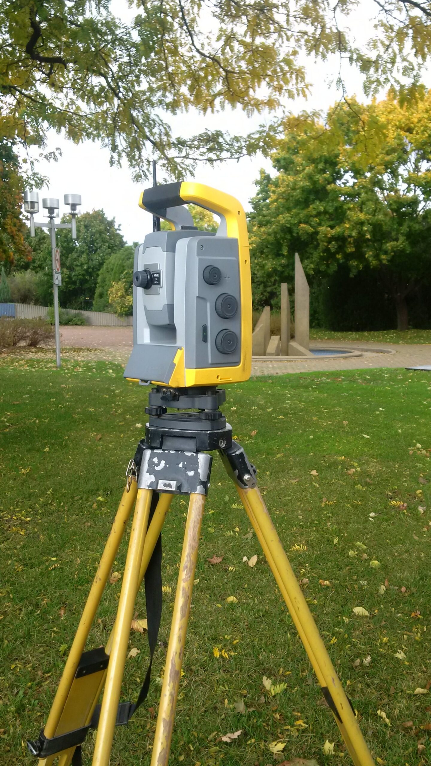
Photo: Pierre5018, Wikimedia Commons, CC BY-SA 4.0. WordPress resized the original.

The old geometry inside the new machine
A total station combines an electronic theodolite, which measures horizontal and vertical angles, with an electronic distance meter. Together, those observations describe the direction and distance from instrument to target. With the station’s position, orientation, and relevant heights established, the software can turn that relationship into coordinates.
A sloping line of sight is not the same thing as a horizontal distance. The vertical angle allows the instrument’s measurements to be resolved into useful horizontal and vertical components. Much of the apparent magic on the controller is geometry performed quickly and consistently.
The robotic part adds motorized movement, automatic aiming and tracking, and remote control. It does not replace the angle-and-distance foundation. That continuity is one reason I like this technology: it changes the choreography of fieldwork without making the basic observation mysterious.
Following the right sparkle
A surveying prism returns the instrument’s measuring signal toward its source. Automatic target systems find and aim at a suitable target, then keep following as it moves. Some arrangements use target identification or active targets to help distinguish the intended prism from competing reflections or other prisms.
The details differ among instruments. A manufacturer’s name for a tracking feature is not an industry-wide promise that every robot behaves the same way. What the systems share is a practical goal: make repeated aiming less dependent on someone continually looking through the telescope.
That changes a simple topo observation. The person choosing a curb break or a pavement detail can also initiate and describe the measurement. During layout, the controller can show how the prism’s current location differs from the intended design point. The conversation between instrument end and pole end becomes a conversation with the display.
When a truck walks into the story
A moving vehicle, a stack of materials, or a turn around a corner can break the optical path. Tracking software may predict the target’s short-term motion and continue turning to improve the chance of finding it again. Search functions can then help reacquire the prism.
The important word is “predict.” Continuing to turn during an obstruction is not the same as continuing to measure a hidden target. Manufacturer documentation makes the distinction clear, even when a product demonstration makes the whole sequence look effortless.
An interrupted line of sight also changes the operator’s attention. A robot can free someone from repeated aiming, but it introduces questions about lock, target identity, communication, and the route through the site. The best working path is not necessarily the shortest walk.
A prism is not always required
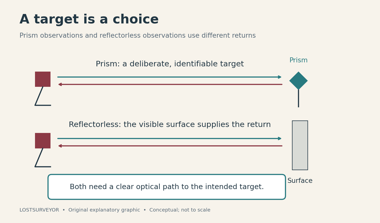
Original explanatory graphic for LostSurveyor. Conceptual; not to scale.
Many total stations also measure without a prism, using reflected energy from a visible surface. Reflectorless measurement can be useful for an inaccessible wall, a high beam, or another feature where placing a pole would be inconvenient.
This is a different choice of target, not a universal replacement for the prism. The instrument has to receive a suitable return from the surface being measured. Surface properties and viewing conditions matter, and the measured surface must actually be the one intended. A neat coordinate attached to the wrong face of an object is still the wrong observation.
The appeal is easy to appreciate: the surveyor can gather certain details without physically occupying them. But a point on a wall and the ground point beneath a prism are different things. The target choice belongs to the story the survey is trying to tell.
The job still needs a reference
Before any of this motion becomes meaningful, the instrument needs an established relationship to the project. A station setup supplies position and orientation; familiar information such as instrument and target heights remains relevant. Observations to reference points connect the robot’s measurements with the larger survey.
Remote operation can make one-person measurement possible. It does not establish that one person is the right crew for every setting. Access, traffic, the work itself, and the handling of equipment still shape how a job should be organized.
The lasting attraction of the robotic total station is the transfer of attention. The telescope can take care of much of its own following, while the surveyor spends more time where the details are. The robot watches a prism. A good surveyor watches the job.
Sources and further reading
- Leica Geosystems: What is a total station? — The combination of angle and distance measurement.
- Leica Geosystems: Automatic target aiming and locking — Manufacturer explanation of motorized aiming, tracking, and remote operation.
- Trimble Access: Target control settings — What predictive tracking and interrupted observations actually do.
- Leica Geosystems: Prism versus reflectorless — Different measurement targets and practical uses; specifications vary by instrument.
- Trimble Access: Standard station setup — The reference information that gives observations their position and orientation.