

Boundaries & Land Rights
Land and Law in Mesopotamia: Hammurabi, Canals, and Boundary Records
Long before a courthouse recorded subdivision plats, Mesopotamian cities used tablets, witnesses, field measures, canal rules, and royal authority to make land legible.
On This Page
- 01 — Introduction
- 02 — The river landscape behind the rules
- 03 — What Hammurabi’s monument records
- 04 — When water crossed into the next field
- 05 — Clay made a transaction durable
- 06 — The “boundary stone” was not always a corner marker
- 07 — Reading land through its obligations
- 08 — Sources and further reading
A broken canal bank can turn one person’s neglected maintenance into another person’s ruined crop. Babylonian law recognized that problem almost four thousand years ago. Among the provisions associated with Hammurabi are rules about irrigation, flooded fields, and who must answer for the damage. For a reader interested in land surveying, these passages are more revealing than the familiar phrase “an eye for an eye.”
They put location inside the legal problem. Which bank failed? Whose field received the water? What crop was lost? A rule about compensation becomes usable only when people can connect it to particular land and particular responsibilities.
The river landscape behind the rules
Southern Mesopotamian agriculture depended on managed water. Canals and banks helped bring river water to fields, but the same connected system could carry a failure beyond the place where it began. The Louvre’s account of water in Mesopotamia places irrigation, its benefits, and its hazards at the center of that landscape.
A parcel in such a setting was not simply an enclosed area. Its usefulness also depended on how it received water and how neighboring land was managed. That is the spatial problem running through the legal material: a boundary divides holdings, while water crosses between them.
What Hammurabi’s monument records
Georgezhao. CC BY-SA 3.0. Source. Resized by WordPress.

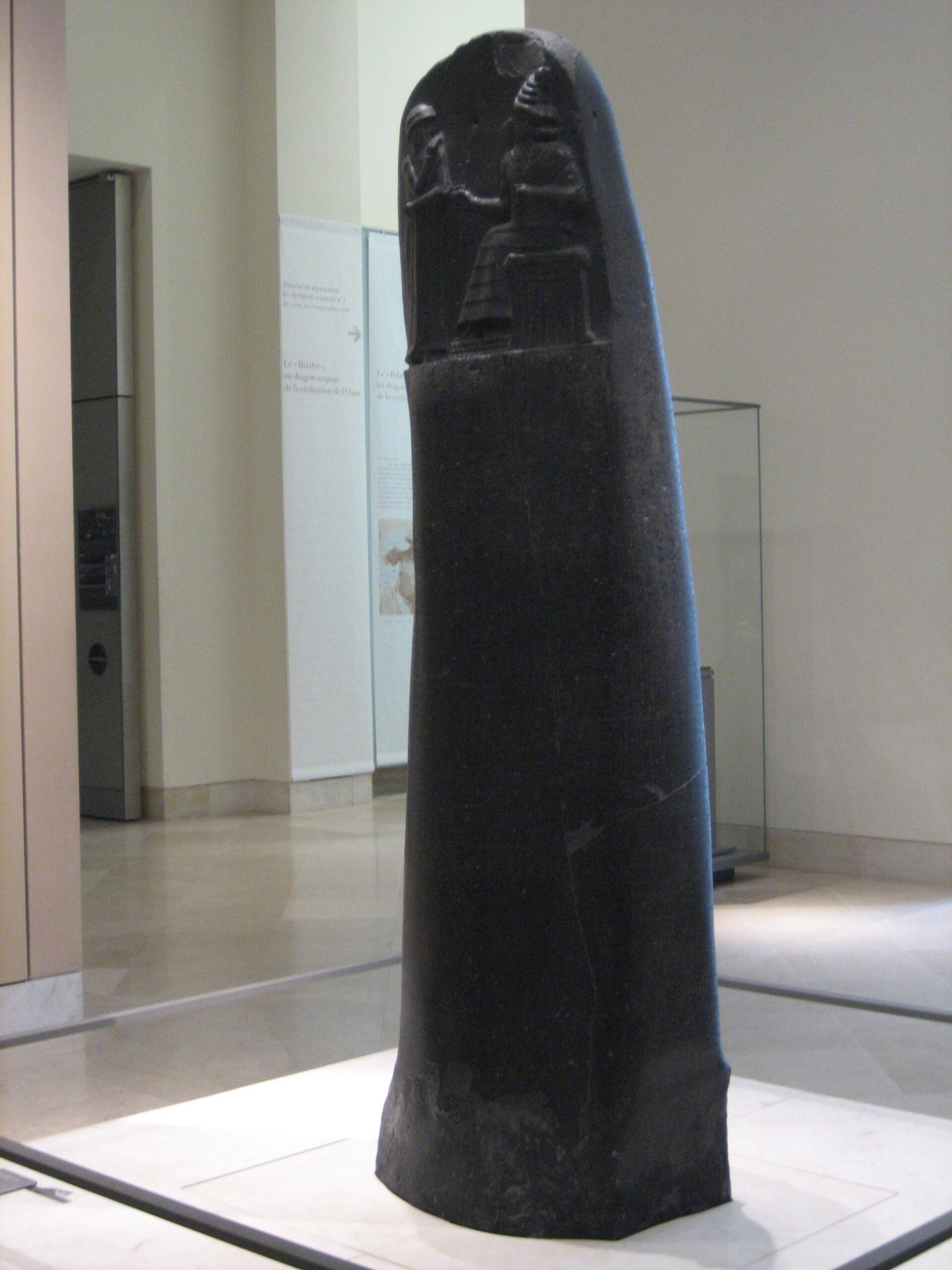
The famous stele now in the Louvre was inscribed around 1750 BCE. It presents a collection of legal judgments under royal authority, rather than a modern codebook that comprehensively states every rule. The Louvre describes its recurring form: a situation is set out, followed by the consequence. The carved scene above the text connects the king’s authority with the god Shamash.
That form is worth keeping in mind. The text tells us how cases were framed and what outcomes the collection prescribed. It does not supply a complete record of how every village settled every dispute, and it is not a manual explaining how to survey a field.
When water crossed into the next field
In the traditional numbering, laws 53–56 address neglected banks and careless irrigation. The translation preserved by Yale’s Avalon Project distinguishes a bank failure that floods fields from water released carelessly onto a neighbor’s crop. The remedies include replacing lost grain; some penalties are severe and reflect a very different social order.
The same collection also considers cultivated fields left unworked and agreements about rent or shares of a harvest. These cases depend on identifying the field, its holder, and the obligation. Measurement gives an area, but the area alone cannot tell us who undertook to cultivate it or who should bear a loss.
Consider the irrigation case as a way of reading the text, not as a reconstructed lawsuit. Establishing responsibility would require connecting the escape of water with the affected ground. A neat parcel outline would be only part of the explanation. The bank, canal, adjoining fields, and movement of water would all matter.
Clay made a transaction durable
The Metropolitan Museum of Art. CC0. Source. Resized by WordPress.

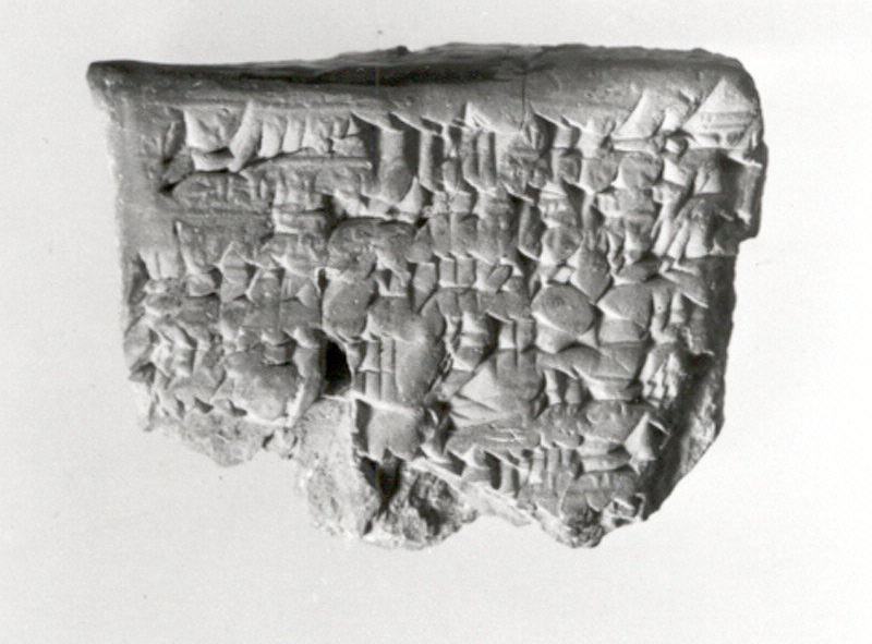
Clay tablets preserved another side of land administration: particular transactions. The field-sale tablet shown here carries a seal impression as well as writing. Names, witnesses, and recorded terms could give a transaction an identity that survived its participants.
It is tempting to treat every ancient tablet as an early version of a modern deed. A more useful approach is to ask what this object records, when it was made, and how it was authenticated. The fact that clay survived does not guarantee that all of the surrounding records survived with it.
The “boundary stone” was not always a corner marker
Gary Todd. CC0. Source. Resized by WordPress.

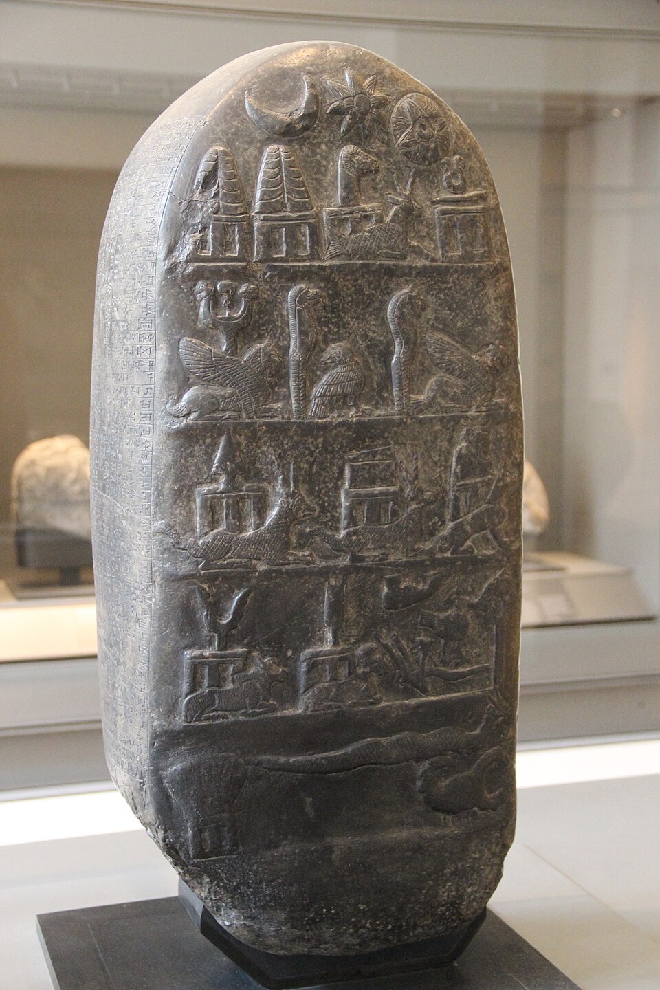
The monuments called kudurrus belong to later Mesopotamian settings, especially Kassite Babylonia, centuries after Hammurabi. They recorded and protected grants of land. The familiar English label “boundary stone” can mislead: the Metropolitan Museum of Art explains that these monuments were more likely placed in temples than used as ordinary field-corner markers.
Their inscriptions could nevertheless describe land quite specifically. A British Museum kudurru recording a grant to Gula-eresh, dated approximately 1125–1100 BCE, names neighboring holdings and the Edina Canal. It even names a surveyor, Amurru-bel-zeri, along with officials involved in completing the transfer. The surviving record joins land, people, and authority in one document.
Divine symbols and curses protected the grants in the language of their own institutions. They were part of the record’s claim to permanence. That does not make a temple monument interchangeable with a marker set at the corner of the land itself; the document’s function and physical setting still have to be distinguished.
Reading land through its obligations
Hammurabi’s collection, a field-sale tablet, and a later kudurru do not belong to one timeless Babylonian land office. Their dates and purposes differ. Read with those differences intact, they show several ways people made rights and responsibilities last: specifying land, recording an agreement, naming witnesses, and giving the record authority.
The canal bank brings the story back to the ground. Its position matters because what happens there affects someone else’s field. Mesopotamian land records are compelling for precisely that reason: they preserve more than the size of a parcel. They show why it mattered to know which land, whose obligation, and what evidence could still be trusted after the original agreement was gone.
Sources and further reading
Louvre: Code of Hammurabi; Yale Avalon Project: translated laws, especially 42–56; Louvre: water in Mesopotamia; Metropolitan Museum: kudurru function; British Museum: Gula-eresh grant.