
Surveying History
Small Mark, Big Meaning: How Survey Monuments Carry Boundaries Through Time
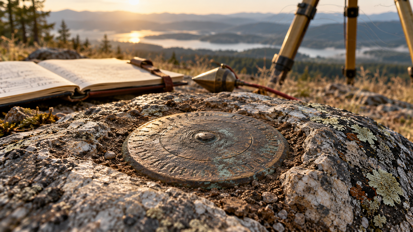
A brass disk, stone, pipe, or driven rod may look small, but its record can preserve a boundary or geodetic position across generations.
On This Page
- 01 — Introduction
- 02 — A corner, a monument, and the evidence around them
- 03 — How ordinary materials became durable evidence
- 04 — Existing, obliterated, and lost are different findings
- 05 — Following a corner through time
- 06 — What modern coordinates contribute—and what they do not
- 07 — Leaving evidence another surveyor can use
- 08 — Sources and further reading
A weathered stone beside a fence may look like an object someone forgot to remove. To a surveyor, it may be the surviving link between a written description and the ground that description identifies. Its importance does not come from being large, expensive, or precisely machined. It comes from evidence that it marks—or helps recover—a particular position in an established survey.
Survey monuments allow boundaries to outlast their creators. Wooden posts decay, trees grow and fall, and iron corrodes, but records and related evidence can carry a corner’s identity forward. Understanding that process begins with a distinction that is easy to miss: the corner is a position; the monument is the physical object used to mark it.
A corner, a monument, and the evidence around them
In a land survey, a corner is a point established to identify a boundary or subdivision of land. A monument may be a marked stone, a post, an iron pipe, a capped rod, a disk in concrete, or another suitable object. The object makes the position findable, but it is not interchangeable with the position. If someone pulls out a corner rod and throws it beside a shed, the boundary does not follow the rod.
Nor is every surveying mark a property corner. A temporary instrument station may support a construction layout. A geodetic control mark may carry a published horizontal position or elevation. A witness corner may deliberately stand away from an inaccessible corner, with a recorded relationship to it. Before using any mark, a surveyor has to establish its purpose and identity, not merely observe that metal has been found.
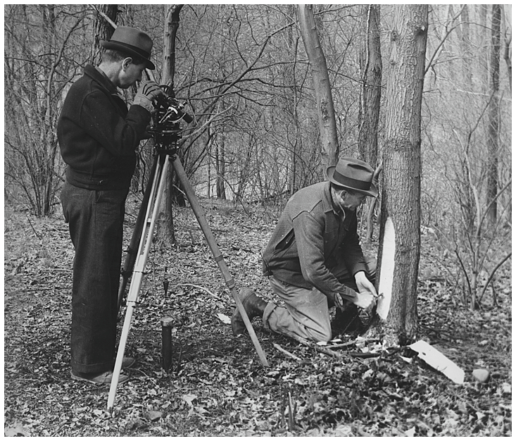
Historical surveyors often strengthened a monument’s usefulness with accessories. Bearing trees are a familiar example: trees marked and described at measured directions and distances from the corner. Their purpose was to help identify or recover the corner. A tree mentioned in a boundary description can have a different role, so the record must tell us whether we are dealing with a corner tree, a bearing tree, or some other call.
How ordinary materials became durable evidence
Early survey crews used materials available in the country they were crossing. A stone could be shaped or marked to distinguish it from neighboring rocks. A post could be set firmly in a mound or associated with pits and other prescribed evidence. Trees could receive blazes and identifying marks. The detailed requirements changed with the jurisdiction, period, and kind of survey.
The field notes gave these objects a documentary identity. A useful description might include the monument’s dimensions, markings, depth of setting, and relationship to accessories. The approved plat placed it within a larger arrangement of lines and corners. These details mattered because no single material was permanent in all environments. Evidence had to be distributed between the ground and the record.
A striking example appears in the BLM’s account of surveyor Bradley Dillon’s work in Wyoming. An original sandstone quarter-section marker, established in 1878, had broken into pieces. The quarter-section marking became recognizable when the pieces were fitted together. The damage made interpretation more difficult, but it did not make the surviving material meaningless.
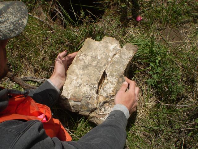
The example illustrates a larger principle: identification depends on agreement among several kinds of evidence. A suggestive scratch on a stone is weak by itself. A compatible marking, the recorded material and dimensions, the expected setting, and relationships to other established corners can form a much stronger case. The surveyor must also account for disagreements instead of quietly discarding whatever fails to fit an initial assumption.
Existing, obliterated, and lost are different findings
The BLM’s 2009 Manual of Surveying Instructions supplies an especially useful vocabulary for federal cadastral surveys. It treats an existent corner as one whose position can be identified through substantial evidence of the original monument or accessories, the survey record, physical evidence, or reliable testimony. “Existent” is the Manual’s term; it does not mean the original object must remain pristine and standing in plain sight.
An obliterated corner is an existent corner for which the original monument and accessories no longer leave traces at the position, but whose location has been preserved or can be recovered through sufficient other evidence. Historical ties, later surveys, acts of landowners, and reliable testimony may help establish that location. The missing post is therefore a problem of evidence, not automatic proof that the corner is lost.
A lost corner, in the Manual’s sense, is one whose original position cannot be established by substantial evidence and must be restored by reference to interdependent corners. This is a conclusion reached after investigation. “We did not find it this morning” is not an equivalent finding.
The distinction affects the next step. Where substantial evidence identifies the original position, that position is used rather than a calculation appropriate only to a lost corner. For a genuinely lost corner, the prescribed restoration method may involve proportionate measurement from established controlling corners. The appropriate method depends on the particular survey and the relationships being restored; it is not simply a matter of placing a point at an attractive midpoint.
These definitions come from federal survey instructions. They are valuable teaching tools, but their application to private boundaries must be considered with the governing deeds, survey history, and state law. A single slogan about monuments “always winning” cannot replace that analysis.
Following a corner through time
Imagine an original survey that set a wooden post and recorded two bearing trees. Decades later, a surveyor found the post, documented its condition, and perpetuated the position with an iron pipe. A later road project recorded ties to that pipe. Today the pipe is gone, but the intervening records and surviving reference points may still preserve a coherent history of the position.
This is an illustrative sequence, not a rule that any later pipe must be accepted. The essential question is how each piece of evidence connects to what came before. Who observed the earlier monument? What did that person record? Were measurements made to a definite point? Can the claimed relationships be checked independently? Each reliable link helps carry the original survey forward.
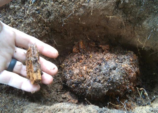
The surviving 1894 wood-post mineral corner shown here is a reminder that recovery can involve modest remains rather than an impressive object. Wood, a socket, a stone arrangement, or the base of a marked tree can be informative when examined in context. Investigation also has to distinguish evidence left by the original survey from later disturbance or an unrelated object that happens to lie nearby.
What modern coordinates contribute—and what they do not
GNSS and total stations make it possible to record recovered evidence with a precision earlier crews could not routinely achieve. That helps surveyors compare observations, document relationships, and preserve information. It does not, by itself, decide whether the observed object occupies the legally relevant position. Measurement answers where an object is within a reference system; boundary analysis asks what that object proves.
Coordinates also require a stated reference frame or datum, appropriate units, and enough information about the observation and its date to support later use. A number detached from those details can be misleading. The same physical mark can receive different published coordinate values after a datum change or a new adjustment without having moved at all.
For a benchmark, stability adds another concern. A disk can remain attached to a structure while that structure settles. NOAA’s Geodetic Bench Marks manual discusses the environmental and structural conditions that affect monument stability. A readable stamp tells us which mark we may have found; it does not prove that an old elevation remains valid.
Leaving evidence another surveyor can use
A good recovery record identifies the source documents, describes exactly what was found, records legible markings, and shows the relationship between the mark and its surroundings. Close photographs reveal material and detail; wider photographs help another person recognize the site. Measurements to suitable reference points, observations of disturbance, and an explanation of conflicting evidence make the record more useful than a coordinate and the word “found.”
The small mark matters because it belongs to a larger chain of evidence. Original surveyors created positions and records; later surveyors have the responsibility to interpret and preserve them. When that work is done carefully, even a broken stone or the remains of a wooden post can connect today’s measurements to a boundary established generations ago.
Sources and further reading
BLM, Manual of Surveying Instructions (2009), especially sections 6-11, 6-16, 6-17, and 7-2, and chapters VI–VII generally; BLM, Bradley Dillon: The Man Who Measures America (2026), for the 1878 stone recovery; BLM, The Footsteps That Built a Nation (2026), for the 1894 wood-post example; and NOAA, Geodetic Bench Marks, NOAA Manual NOS NGS 1.
For the documentary side of this work, continue with Reading the Old Plats.