
Ancient Surveying
Land and Law in Mesopotamia: Hammurabi, Canals, and Boundary Records
Long before a courthouse recorded subdivision plats, Mesopotamian cities used tablets, witnesses, field measures, canal rules, and royal authority to make land legible.
On This Page
- 01 — Introduction
- 02 — A Landscape Made by Rivers and Labor
- 03 — What the Code of Hammurabi Is
- 04 — Fields, Tenancy, and Expected Production
- 05 — Canals and Downstream Damage
- 06 — Measures, Areas, and Administrative Literacy
- 07 — Tablets, Seals, and Witnesses
- 08 — Kudurrus and the Problem of the ‘Boundary Stone’
- 09 — Curses as Enforcement
- 10 — When Boundaries Became Disputes
- 11 — The Long View from Babylon
- 12 — Reading the Evidence Carefully
- 13 — From Historical Record to Field Practice
- 14 — Clay, Water, and the Geometry of Responsibility
- 15 — A Worked Example: When the Canal Crosses the Parcel
- 16 — A Surveyor’s Reading Checklist
- 17 — Sources and Further Reading
Long before a courthouse recorded subdivision plats, Mesopotamian cities used tablets, witnesses, field measures, canal rules, and royal authority to make land legible.
The famous law collection associated with Hammurabi, king of Babylon in the eighteenth century BCE, is often reduced to the phrase “an eye for an eye.” For a surveying-minded reader, its provisions about fields, rent, irrigation, negligence, and evidence are at least as revealing. They describe an agricultural society in which the geometry of water and land was inseparable from law.
It is important to keep periods straight. The carved monuments called kudurrus, often described as boundary stones, are especially associated with Kassite Babylonia centuries after Hammurabi. They recorded royal land grants, privileges, witnesses, and curses; many may have been kept in temples rather than planted like modern corner monuments. Mesopotamia offers a long documentary tradition, not one timeless system.
In river country, a boundary was never only a line: it was also access to water, responsibility for a canal, and exposure to a neighbor’s loss.
A Landscape Made by Rivers and Labor
Southern Mesopotamia depended on the Tigris and Euphrates, but farming required managed canals, levees, ditches, and drainage. Water created productive fields and destructive floods. Maintaining the system demanded coordinated labor and rules about responsibility. The shape and elevation of the land therefore had immediate economic consequences.
For a land surveyor, the useful lesson is not that this passage supplies a modern procedure. It is that land was already being made durable through named neighbors, remembered markers, measured quantities, witnesses, and public authority. Those are ancestors of ideas that still appear in deeds, plats, monument records, and boundary testimony. The vocabulary changed; the need to connect human rights to physical ground did not. Infrastructure can make a parcel valuable while also creating duties that follow its position in a larger network.
What the Code of Hammurabi Is
The so-called Code survives most famously on a monumental stele and in copies used by scribes. Scholars usually describe it as a royal law collection rather than a complete modern statute book. Its prologue, judgments, and epilogue present Hammurabi as a king establishing justice. The text is evidence for ideals and legal reasoning, though not a complete record of everyday enforcement.
For a land surveyor, the useful lesson is not that this passage supplies a modern procedure. It is that land was already being made durable through named neighbors, remembered markers, measured quantities, witnesses, and public authority. Those are ancestors of ideas that still appear in deeds, plats, monument records, and boundary testimony. The vocabulary changed; the need to connect human rights to physical ground did not. A celebrated text must be read in its documentary genre before it is treated as a direct description of practice.
Fields, Tenancy, and Expected Production
Several provisions concern a cultivator who takes a field but fails to work it, along with obligations to deliver grain or restore the ground. These rules assume that fields had identifiable holders, expected yields, and enforceable agreements. The law’s concern is less with teaching measurement than with assigning the cost of neglect.
For a land surveyor, the useful lesson is not that this passage supplies a modern procedure. It is that land was already being made durable through named neighbors, remembered markers, measured quantities, witnesses, and public authority. Those are ancestors of ideas that still appear in deeds, plats, monument records, and boundary testimony. The vocabulary changed; the need to connect human rights to physical ground did not. Parcel definition becomes socially useful when it lets a community connect a specific duty to a specific place.
Photo by IRANI WORLD / Unsplash. Used under the Unsplash License. Source.
Canals and Downstream Damage
Laws 53–56 address a person who neglects a dike or opens water carelessly so that a neighbor’s field is flooded. Liability follows the movement of water across connected lands. The provisions reveal a spatial chain of cause and effect: an upstream failure can destroy grain elsewhere, and law must trace the harm back to an accountable person.
For a land surveyor, the useful lesson is not that this passage supplies a modern procedure. It is that land was already being made durable through named neighbors, remembered markers, measured quantities, witnesses, and public authority. Those are ancestors of ideas that still appear in deeds, plats, monument records, and boundary testimony. The vocabulary changed; the need to connect human rights to physical ground did not. Surveyors still work where drainage, easements, topography, and ownership interact; the map never cancels the hydraulics.
Measures, Areas, and Administrative Literacy
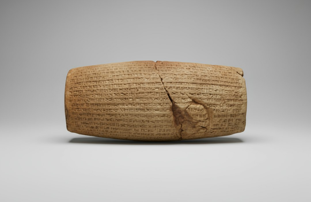
Cuneiform tablets record quantities of land, grain, labor, and silver using Mesopotamian systems of measure. Scribes learned mathematical procedures and worked with reciprocal tables and area problems. A school exercise is not automatically evidence of one exact field method, but it demonstrates a sophisticated culture of numerical administration.
For a land surveyor, the useful lesson is not that this passage supplies a modern procedure. It is that land was already being made durable through named neighbors, remembered markers, measured quantities, witnesses, and public authority. Those are ancestors of ideas that still appear in deeds, plats, monument records, and boundary testimony. The vocabulary changed; the need to connect human rights to physical ground did not. Computation, standardized units, and record keeping form an infrastructure as important as the measuring tool itself.
Tablets, Seals, and Witnesses
Land sales, leases, divisions, and grants could be written on clay tablets and authenticated through seals and witness lists. A document might identify parties, dimensions or areas, adjoining owners, obligations, and penalties. Because clay survives fire and burial unusually well, Mesopotamia preserves an immense but uneven archive.
For a land surveyor, the useful lesson is not that this passage supplies a modern procedure. It is that land was already being made durable through named neighbors, remembered markers, measured quantities, witnesses, and public authority. Those are ancestors of ideas that still appear in deeds, plats, monument records, and boundary testimony. The vocabulary changed; the need to connect human rights to physical ground did not. A durable record preserves more than geometry: it preserves who acted, under what authority, and before whom.
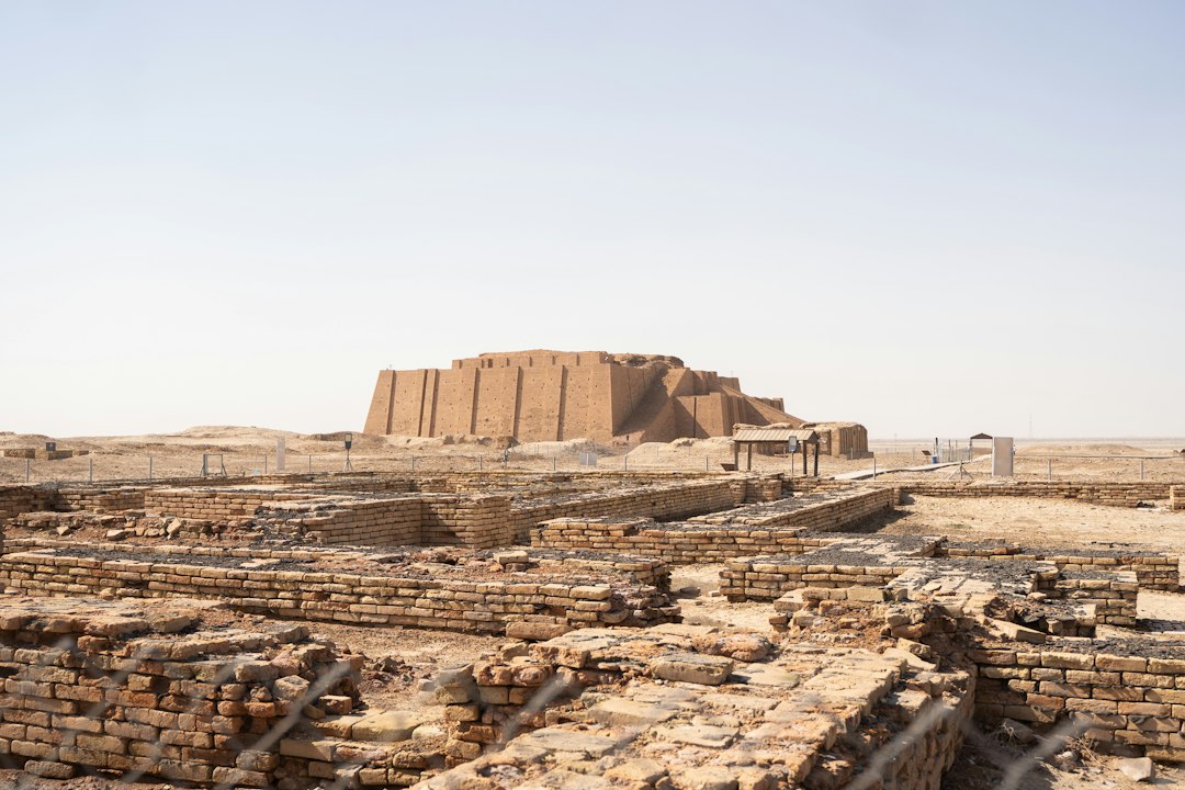
Photo by حسن / Unsplash. Used under the Unsplash License. Source.
Kudurrus and the Problem of the ‘Boundary Stone’
Kassite kudurrus carry inscriptions and divine symbols relating to royal land grants and protections. The familiar English label “boundary stone” can suggest that every object stood at a field corner. Museum scholarship cautions that many were probably official records or copies deposited in temples. Their legal function was real, but their physical role was not identical to a modern monument.
For a land surveyor, the useful lesson is not that this passage supplies a modern procedure. It is that land was already being made durable through named neighbors, remembered markers, measured quantities, witnesses, and public authority. Those are ancestors of ideas that still appear in deeds, plats, monument records, and boundary testimony. The vocabulary changed; the need to connect human rights to physical ground did not. An artifact’s nickname should never substitute for proven use or original location.
Curses as Enforcement
Kudurru inscriptions often invoke gods and curses against anyone who alters the grant or damages the monument. To a modern reader this may sound ornamental, but it belonged to the enforcement language of the time. Political, religious, and legal authority worked together to protect a spatial decision across generations.
For a land surveyor, the useful lesson is not that this passage supplies a modern procedure. It is that land was already being made durable through named neighbors, remembered markers, measured quantities, witnesses, and public authority. Those are ancestors of ideas that still appear in deeds, plats, monument records, and boundary testimony. The vocabulary changed; the need to connect human rights to physical ground did not. Every recording system depends on institutions that make later people respect the record.
When Boundaries Became Disputes
Mesopotamian legal documents preserve disputes over ownership, inheritance, access, and obligations. Resolution could depend on tablets, witnesses, oaths, officials, and local knowledge. The evidence resembles no single modern court file, yet the pattern is recognizable: competing stories are tested against records and people connected to the land.
For a land surveyor, the useful lesson is not that this passage supplies a modern procedure. It is that land was already being made durable through named neighbors, remembered markers, measured quantities, witnesses, and public authority. Those are ancestors of ideas that still appear in deeds, plats, monument records, and boundary testimony. The vocabulary changed; the need to connect human rights to physical ground did not. Measurement helps resolve a dispute only when it is integrated with evidence of the rights being located.
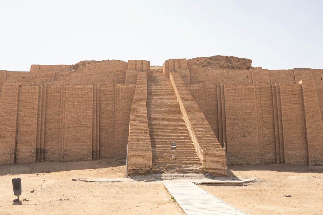
Photo by حسن / Unsplash. Used under the Unsplash License. Source.
The Long View from Babylon
Mesopotamian practices changed across Sumerian, Old Babylonian, Kassite, Assyrian, and later periods. Units, institutions, languages, and political control varied. Treating four thousand years as one system hides the very history that makes the evidence valuable. What endured was the administrative need to count, describe, allocate, irrigate, tax, and defend land.
For a land surveyor, the useful lesson is not that this passage supplies a modern procedure. It is that land was already being made durable through named neighbors, remembered markers, measured quantities, witnesses, and public authority. Those are ancestors of ideas that still appear in deeds, plats, monument records, and boundary testimony. The vocabulary changed; the need to connect human rights to physical ground did not. Good history names its time and place as carefully as a survey names its datum.
Reading the Evidence Carefully
Popular histories sometimes line up Hammurabi, a cuneiform tablet, and a kudurru as if they were parts of one standardized land office. The chronology warns against that shortcut. Hammurabi ruled during the Old Babylonian period; the best-known kudurrus belong to later centuries and different political conditions. Connecting them is useful only at the level of a long regional tradition of documenting land and authority. Collapsing them erases change and can turn a careful historical comparison into a false claim of direct continuity.
From Historical Record to Field Practice
Across this history, precision should not be confused with a large number of decimal places. Precision begins with a stated purpose, a suitable reference, controlled observations, and enough redundancy to reveal a mistake. Earlier practitioners expressed those requirements through cords, sight lines, repeated angles, witnesses, and permanent stones. Later surveyors added calibrated chains, optical circles, leveling rods, electronic measurements, satellites, and adjustment software. Every generation gained reach, yet every generation still had to decide which evidence deserved confidence. That judgment—not the novelty of the tool—is the durable craft at the center of surveying.
Clay, Water, and the Geometry of Responsibility
Hammurabi’s collection is not a field handbook, and the later kudurru is not simply an ancient iron pipe. Their importance lies elsewhere. Together with tablets and canal landscapes, they show a society building durable relationships among land, labor, water, authority, and written proof.
That relationship is the heart of cadastral work. A survey does not float above society as pure geometry. It gives spatial form to obligations and expectations—who may occupy, who must maintain, who bears a loss, and which evidence will be believed after the original participants are gone.
A Worked Example: When the Canal Crosses the Parcel
Imagine two cultivated fields served by the same canal. The upstream holder fails to maintain a bank, water escapes, and the downstream crop is lost. A legal decision needs more than a general rule about negligence. Someone must identify the responsible reach of bank, connect the failure to the flooded ground, establish who held each field, and quantify a remedy. The surviving law does not give us a modern survey plat of that case, but its logic is spatial from beginning to end. It turns location, flow, use, and responsibility into a chain of proof.
A Surveyor’s Reading Checklist
- Date an artifact or text before combining it with evidence from another Mesopotamian period.
- Treat the Code as a royal law collection, not a complete modern codebook.
- Do not assume every kudurru was planted at a parcel corner.
- Separate mathematical school texts from demonstrated field procedures.
- Follow water, labor, authority, and documentation together.
Sources and Further Reading
- Yale Avalon Project: Code of Hammurabi
- Yale Avalon Project: Introduction to the Code
- The Met: Boundary stone (kudurru)
- The Met: Kudurru of Gula-eresh
Image credits appear with each image. Historical claims are framed to distinguish primary texts and surviving artifacts from later interpretation.