

Exploration & Navigation
Surveying Across the Seas, Part 3: Sextants, Almanacs, and the Surveyed Ocean
How sextants, chronometers, astronomical tables, and hydrographic surveys made ocean navigation repeatable.
On This Page
- 01 — Introduction
- 02 — Two Mirrors, One Angle
- 03 — The Horizon Is Not Quite Where It Seems
- 04 — Time and the Almanac Give the Angle a Meaning
- 05 — When the Moon Supplied the Clock
- 06 — Turn the Sextant Toward the Shore
- 07 — A Closer Look: Why Soundings Need a Datum
- 08 — Read the Water, Then Read the Record
- 09 — Sources and Further Reading
Series: Surveying Across the Seas
A sextant does something wonderfully specific: it lets an observer bring two distant objects into the same view and measure the angle between them. Point it toward the Sun and horizon, and it can help locate a ship. Turn it sideways toward known landmarks, and it can help locate a sounding boat. The same small instrument connects the sky above the navigator with the surveyed coast beside the hydrographer.
Neither use produces a finished chart at the turn of a screw. The angle must be corrected and connected to a reference. This final installment follows that connection, from a sight at sea to the depths printed on a nautical chart.
Two Mirrors, One Angle
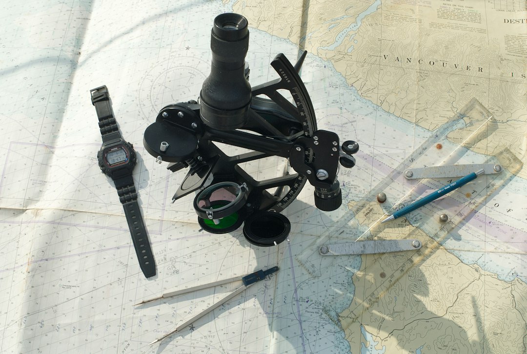
Photo by @maranthi / Unsplash. Used under the Unsplash License. Source.
A sextant combines a direct view through its horizon glass with a reflected view from an adjustable index mirror. The observer moves the index arm until the reflected celestial body meets the horizon. Double reflection makes the measured angle twice the angle through which the index mirror turns, allowing a relatively short arc to cover a large observing range.
The useful feature aboard ship is that both images are seen together. The observer does not have to transfer a direction from one separate sight to another while the deck moves. A rolling sea still makes the work difficult, but the instrument preserves the relationship being measured. It is portable geometry designed around an awkward place to stand.
The Horizon Is Not Quite Where It Seems
Several corrections stand between the reading and the angle used in a calculation. Index error is the instrument’s departure from a correct zero. Dip accounts for the visible sea horizon falling below the observer’s horizontal plane because the eye is above the water. Atmospheric refraction bends the incoming light, making a celestial body appear higher than its geometric position.
The Sun and Moon also have visible disks. A sight of the lower edge must be related to the center. Parallax accounts for the difference between observing from Earth’s surface and from the reference position used in the calculation. These are different physical effects, not interchangeable adjustments. A correctly read angle can still yield a poor answer if the observer applies the wrong correction.
Time and the Almanac Give the Angle a Meaning
The chronometer supplies reference time. An almanac describes where the celestial body should be at that time. A sight then tells the navigator how the body appears from the ship. In traditional time-sight work, an altitude and an assumed or known latitude help determine local hour angle; comparison with the body’s position at Greenwich gives longitude. Other sight-reduction methods produce lines of position that are combined for a fix.
This is why an altitude is not a coordinate by itself. The same body can have the same altitude at many places. Time, the body’s identity, and additional positional information remove that ambiguity. The American Practical Navigator develops the modern calculation in detail; the underlying question remains where an observer must stand to see the measured geometry.
When the Moon Supplied the Clock
Commissioners of Longitude and Nevil Maskelyne. Public domain. Source. Resized by WordPress.

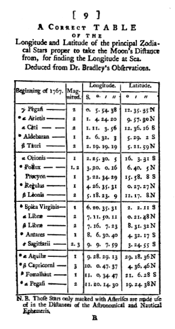
The lunar-distance method reverses part of the process. Instead of trusting a clock, the navigator measures the angle between the Moon and the Sun or a suitable star. After correction, the angle is compared with predicted values to find reference time. “Distance” here means angular separation in the sky, not the number of miles to the Moon.
The first British Nautical Almanac, published in 1766 for 1767, made predicted lunar distances available in a practical form. Its tables depended on observations and astronomical computation ashore. The method was demanding aboard ship because small angular errors could mean appreciable errors in time. Still, it offered a way to determine or check reference time without depending entirely on a timekeeper. Royal Museums Greenwich traces that connection between the observatory and the navigator.
Turn the Sextant Toward the Shore
Hydrographers had a different problem: where was the boat when a depth was measured? NOAA’s account of early surveying describes lead-line soundings positioned by three-point sextant fixes. Observers measured two horizontal angles between three known shore stations. Their common middle station tied the two angles together, allowing the boat’s position to be plotted or calculated.
Those shore stations had to be established first. Triangulation connected measured angles and baselines on land; the boat’s observations then carried that framework offshore. Poor geometry or a misidentified station could spoil the fix even when the sextant reading was careful. The depth and position were separate observations that had to describe the same moment.
A Closer Look: Why Soundings Need a Datum
Suppose a lead line measures 24 feet (7.3 meters) from the water surface to the bottom while the water stands 3 feet (0.9 meter) above the chart’s reference level. In this simplified example, the depth below that datum is 21 feet (6.4 meters). Without the water-level correction, two boats passing at different tides could appear to disagree about an unchanged seabed. Actual surveys require a fuller treatment of the observing system and water levels.
Read the Water, Then Read the Record
James Cook and Michael Lane; Thomas Jefferys / Centre for Newfoundland Studies, Memorial University, via Wikimedia Commons. Public domain. Source.

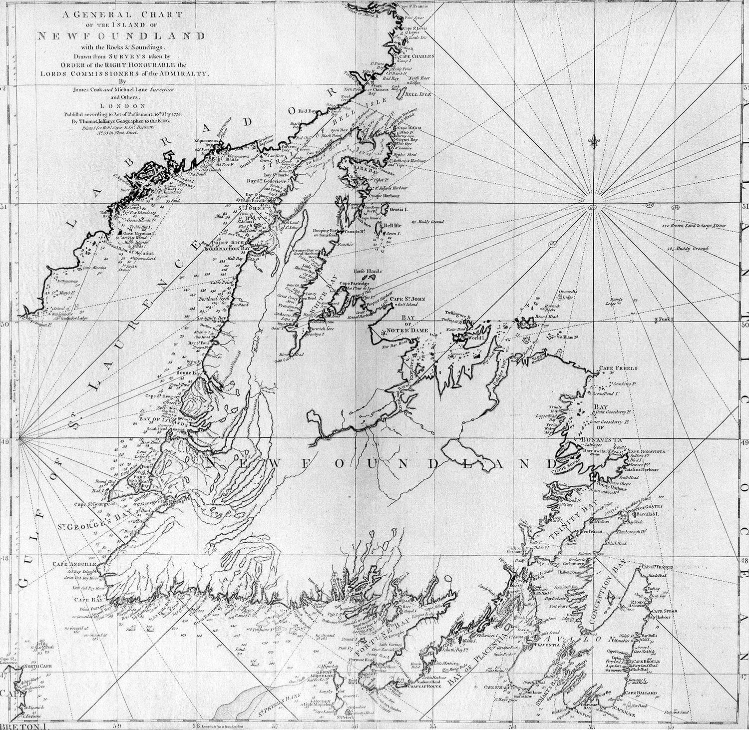
A finished chart can combine surveys from different decades. Dense modern coverage and sparse lead-line observations may sit beside each other under the same tidy typography. NOAA emphasizes that survey age and method matter: accurate individual soundings did not reveal every obstruction between them.
That is the lasting achievement of the measured ocean. A navigator’s sight could locate a ship; a hydrographic survey could leave a record for ships that had not yet sailed. The sextant, clock, almanac, and chart did their best work together, turning a moment’s observation into knowledge another mariner could use.
Sources and Further Reading
NGA: The American Practical Navigator
Royal Museums Greenwich: History of the Royal Observatory
NOAA: History of Hydrographic Surveying
NOAA: Hydrographic Manual, visual positioning and sounding procedures