
The Boundary Is Not the Metal
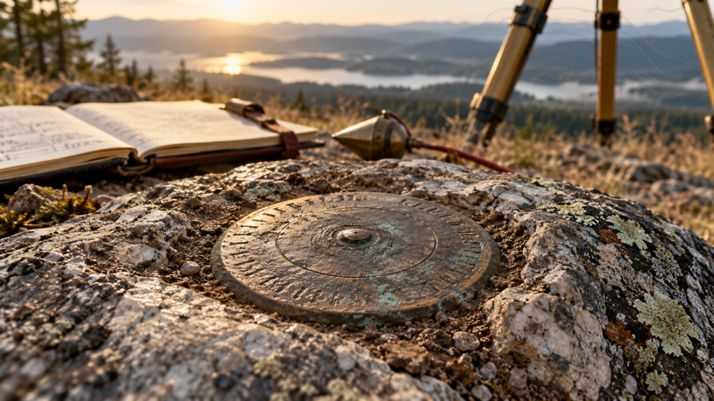
A survey monument may be a brass disk, an iron pipe, a stone, a concrete post, a driven rod, a marked tree, or another durable object. To a passerby it can look insignificant. To a surveyor it may be the physical witness to a legal boundary, a geodetic position, an elevation, or the work of an earlier survey party.
The object is important, but the boundary is not made of brass or iron. A monument matters because of what it represents and how it relates to the record. Its history, original purpose, condition, location, accessories, and relationship to surrounding evidence determine its meaning.
Boundary Monuments and Geodetic Marks
Boundary monuments and geodetic marks are often discussed together, yet they serve different functions. A cadastral monument marks or helps re-establish a property corner or public-land subdivision. A geodetic control mark provides a point with published position, elevation, gravity, or related survey data. A single mark can sometimes participate in more than one system, but the surveyor should never assume that every disk is a property corner or that every property corner has a published geodetic coordinate.
The National Geodetic Survey describes bench marks as long-lasting points whose elevations have been determined for survey control and for monitoring movement of the Earth’s crust. NGS datasheets and mark descriptions help identify the station, the type of monument, its stamping, setting date, condition, and reference measurements.
Cadastral monuments work through the law and record that created the parcel. In the Public Land Survey System, original corners established during the official survey carry special weight. Their positions are perpetuated through monuments, accessories, field notes, plats, subsequent surveys, occupation, and testimony.
Why Descriptions Matter
A coordinate can guide a crew close to a mark, but a description helps confirm that the correct mark has been recovered. NGS emphasizes that mark descriptions are critical to positive identification. They may describe a disk set in concrete, a rod driven below grade, nearby structures, visible stamping, and measured ties to stable features.
The same principle applies to boundary evidence. A field note stating that a corner was a stone of a certain size, accompanied by two bearing trees of identified species and diameter, gives a future surveyor several independent clues. Even if the original stone is missing, the accessory evidence or reliable testimony may perpetuate the corner’s location.
Existing, Obliterated, and Lost
Public-land surveying uses careful distinctions when discussing corners. An existing corner is supported by its monument or other direct evidence. An obliterated corner has lost the visible traces of the original monument or accessories, but its location can still be recovered beyond reasonable doubt from acceptable evidence. A lost corner is one whose position cannot be determined from the available evidence and must be restored by an authorized method, often involving proportionate measurement.
These terms are not casual descriptions of whether a crew found metal. A corner can be obliterated without being lost. Long-standing occupation, credible local knowledge, collateral evidence, historical measurements, or record relationships may preserve its location. Conversely, a shiny new pipe does not automatically prove the original corner.
This is why experienced surveyors resist jumping immediately to coordinates or proportioning. The first task is evidence gathering. Search the record. Study the original notes. Look for accessories. Evaluate occupation. Interview knowledgeable people when appropriate. Compare nearby recoveries. A mathematical solution should not replace evidence that can still identify the created boundary.
The Long Life of a Bench Mark
Geodetic marks have their own biographies. A bench mark may have been established for a leveling line, later included in a national adjustment, recovered repeatedly, and assigned updated elevations as datums changed. The disk may remain in exactly the same concrete structure while the published value changes because the reference system, network adjustment, or understanding of crustal motion has improved.
This distinction is especially important as the National Spatial Reference System is modernized. The physical mark is not the datum. It is a point that has been observed within one or more datums. Coordinates and elevations belong to particular reference frames, epochs, and adjustment histories. A datasheet must be read with the same attention given to a deed or plat.
A Mark Is Also a Story
Survey monuments connect generations of work. A nineteenth-century stone, a Coast and Geodetic Survey disk, a concrete right-of-way monument, and a modern deep-driven rod all reveal something about the needs and technology of their time. Materials changed as surveyors sought greater durability, stability, and recoverability.
The surrounding landscape changes too. Roads are widened, shorelines move, buildings are demolished, roots disturb shallow marks, and development buries once-visible evidence. Recovery notes become valuable because they document each encounter. A clear description and photograph created today may be the best guide available to a crew decades from now.
Field Habits Worth Keeping
When recovering a possible monument, approach it as evidence rather than as a souvenir or obstacle. Record the condition before disturbing anything. Photograph the mark and setting. Note stamping, dimensions, material, depth, and nearby features. Compare the recovery with the authoritative record. Search for reference marks or accessories. If the mark appears disturbed, document why.
Never remove or reset a monument casually. Laws, agency rules, contracts, and professional standards govern how marks are treated. A displaced mark may still provide evidence about its former position, and an unauthorized replacement can create more confusion than the original damage.
Small Object, Large Responsibility
A monument’s physical size has little relationship to its legal or technical importance. A disk a few inches across may support miles of leveling. A stone below the leaves may control hundreds of acres. A small nail may preserve a carefully referenced construction point.
The profession’s responsibility is to understand what the mark was intended to represent, how well the evidence supports its identity, and how to preserve that information for the next surveyor. The best monument is not merely durable. It is recoverable, documented, connected to the record, and treated with respect.
Sources and Further Reading
National Geodetic Survey: Geodetic Bench Marks
National Geodetic Survey: Survey Mark Recovery and Descriptions
Bureau of Land Management: Manual of Surveying Instructions, 2009