

Maps & Mapping
Ortelius’s 1570 World Map
Ortelius’s 1570 world map helped establish the modern atlas—and shows how mapmakers combined geographic knowledge with speculation.
On This Page
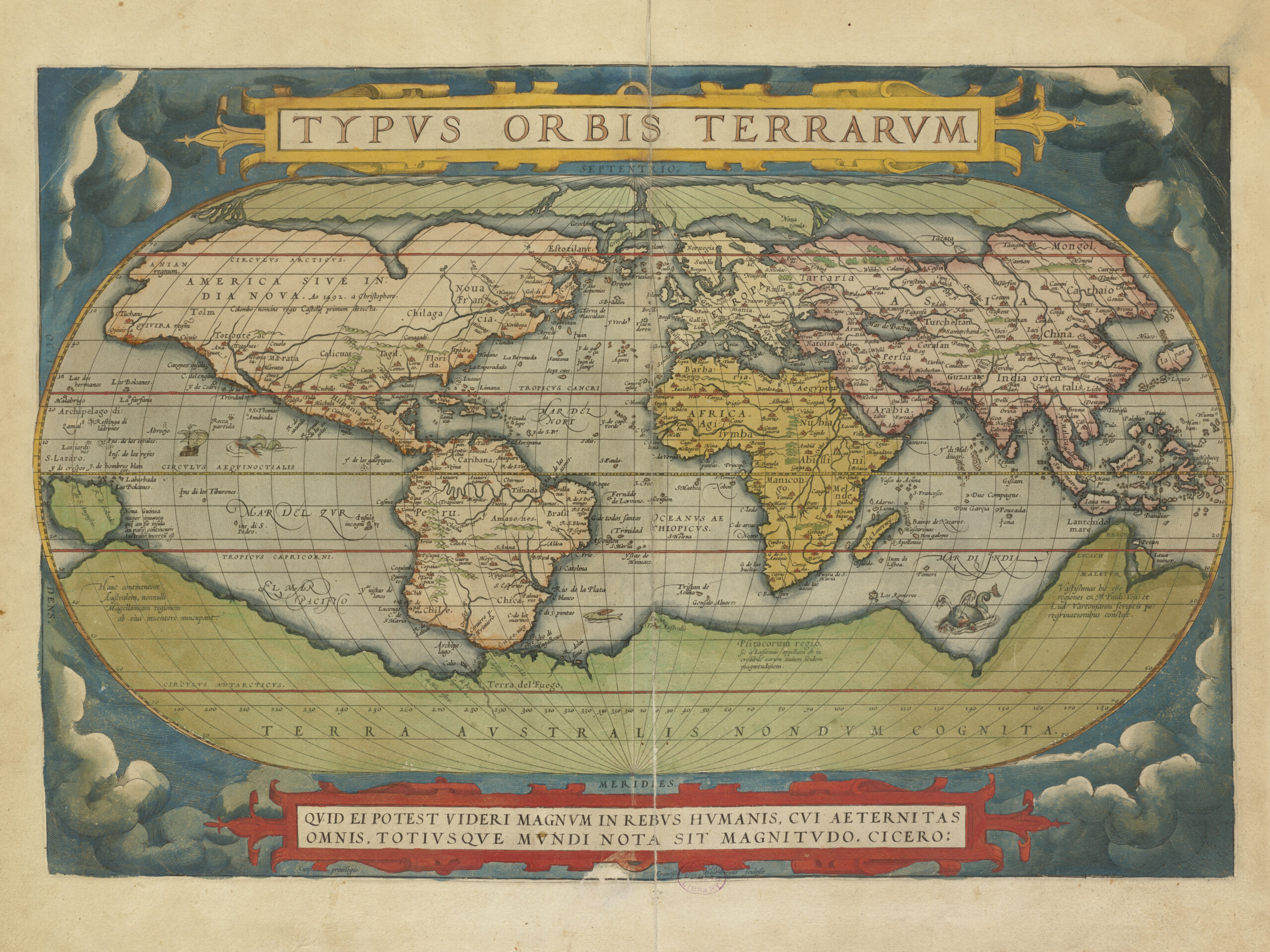
Abraham Ortelius’s Typus Orbis Terrarum (1570) deserves a place in the Lost Surveyor Map Archive because it helped establish the modern atlas. As the opening world map in Theatrum Orbis Terrarum, it was part of a collection of maps prepared in a consistent format and bound together with explanatory text. That approach changed how geographic knowledge was organized, published, and shared.
The map also captures the limits of geographic knowledge in its time. Recognizable coastlines appear alongside speculative geography, reminding us that historical maps record not only what people knew, but also what they believed. Look along the bottom of the map for the vast imagined southern continent labeled Terra Australis Nondum Cognita, or “southern land not yet known.”
Explore the map in our Map Archive. For a closer look at the place names and inscriptions, view the full-resolution scan (10,880 × 8,160 pixels; approximately 26 MB).

Map image: Abraham Ortelius, Typus Orbis Terrarum (1570). Norman B. Leventhal Map & Education Center, Boston Public Library, via Wikimedia Commons (CC BY 2.0). Digitized image resized for display.

Discussion
Questions, field experience, and thoughtful observations are welcome.