
Boundaries & Land Rights
Cooley’s Essay: Why Better Measurements Don’t Automatically Move Boundaries
Thomas Cooley’s enduring essay asks surveyors to recover established boundaries, investigate the evidence, and recognize the limits of a beautifully measured line.
On This Page
A survey can be beautifully measured and still answer the wrong question. When the work is to recover an existing property boundary, the question is where that boundary was established and what evidence supports it. A cleaner rectangle, a more even division, or an extra decimal place may be useful information. None, by itself, explains who owns the ground.
That tension gives Thomas M. Cooley’s The Judicial Functions of Surveyors its staying power. Cooley was writing about vanished stakes, uncertain records, and neighbors who had arranged their lives around lines on the land. The instruments have changed considerably. The temptation to let a tidy calculation settle an untidy question is still recognizable.
Cooley’s essay matters to surveyors because it challenges the assumption that improving a measurement justifies moving a boundary. His central point is that the original corners and lines established on the ground govern, even when their positions do not agree with the recorded measurements. If the monuments have disappeared, the surveyor’s task is to investigate where they stood, giving proper weight to longstanding occupation and other surviving evidence, rather than placing new corners where the originals supposedly should have been. Better measurements can help recover a boundary; they do not, by themselves, justify disturbing established property rights.
Read the paper before borrowing the principle
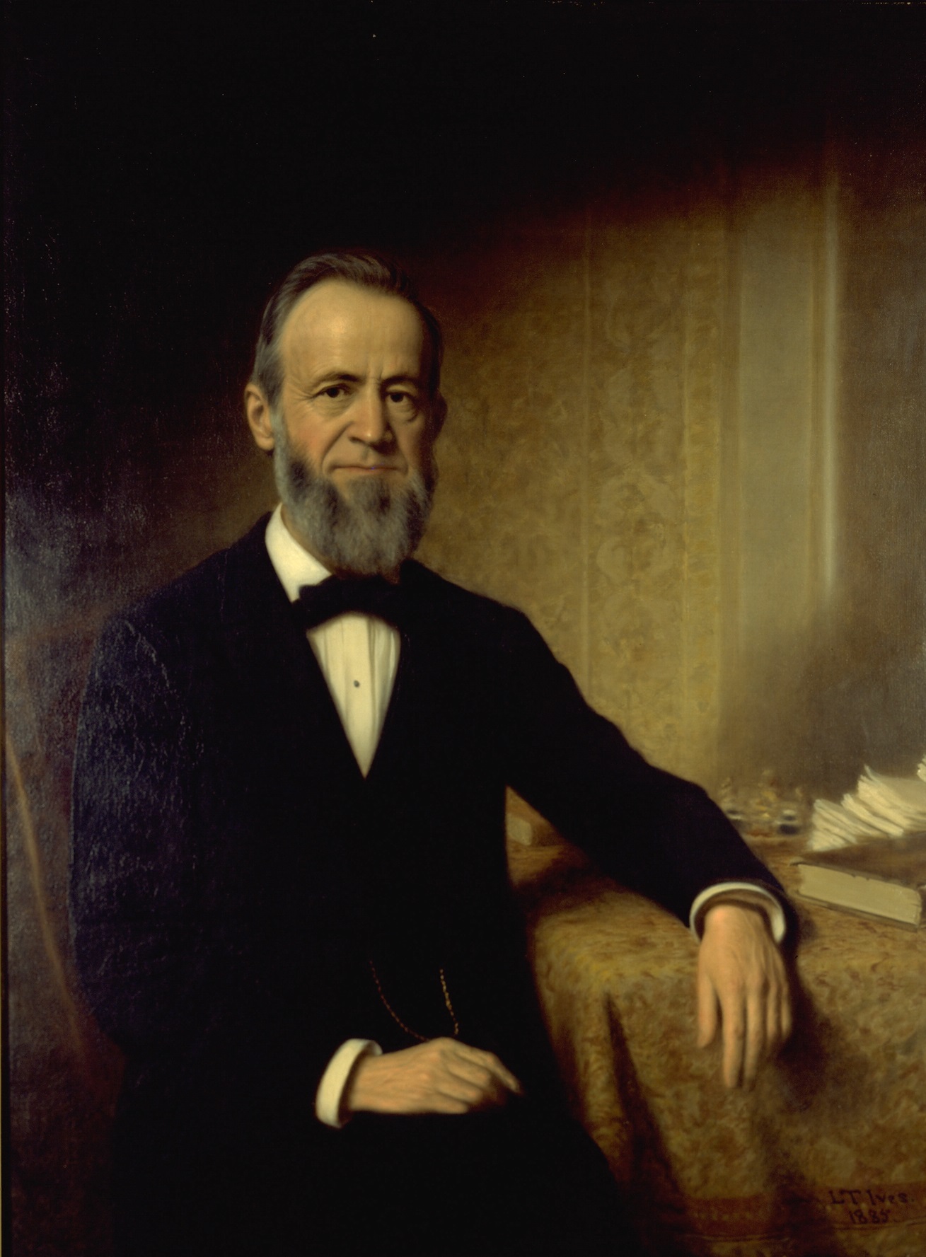
Lewis T. Ives, portrait presented in 1885. Wikimedia Commons; source identified as the Michigan Supreme Court Historical Society. Public domain in the United States.

Cooley served on the Michigan Supreme Court from 1864 to 1885 and was chief justice during several portions of that service. He also taught law at the University of Michigan and wrote influential legal treatises. The court’s historical society records those roles. They explain why surveyors would take his views seriously, but they do not turn everything he wrote into a judicial ruling.
The Judicial Functions of Surveyors is a paper or address, not a judgment resolving a particular lawsuit. Surveyors sometimes use the label “Cooley’s Dictum” for its ideas. That convenient label can obscure the document’s actual character. A passage from this essay is not, simply because Cooley wrote it, binding precedent in Florida or anywhere else.
The readable reproduction used here identifies its source as the printed proceedings of the Michigan association’s January 9–11, 1883 meeting. That identifies the edition being cited; it does not independently establish an exact delivery date. The essay also appears in F. Hodgman’s 1907 A Manual of Land Surveying, printed pages 379–394. Those printed page numbers provide a second way to follow the discussion below.
Its setting matters. Cooley describes Michigan public-land surveys and town plats, then explores how the loss of physical evidence complicates later work. His criticism of early surveying belongs to that historical discussion. It should not become a blanket judgment about every original survey or an excuse to distrust a record before investigating it.
Recovering the established line
The essay’s central example begins with original corner stakes that have disappeared. Cooley objects to replacing them at the positions they would have occupied if the first survey had been performed perfectly. In his account, purchasers acquired land with reference to the original boundaries. A later surveyor’s preferred geometry cannot simply replace that history.
His instruction is concise: “To ascertain by the best lights of which the case admits, where the original lines were.” Hodgman, p. 382; reproduction, p. 2.
That is the essential retracement problem: working backward from the evidence to recover an established boundary. A monument is a physical marker associated with a corner or boundary; its identity and history matter as much as its measured position. An old pipe does not acquire authority merely by being old, and a newly measured coordinate does not explain why a pipe was placed there.
Consider a deliberately simplified example. Original records describe a subdivision whose lots appear regular on paper. Surviving original corner evidence, once authenticated and considered with the governing records, shows that the work on the ground was slightly irregular. Dividing the block into mathematically equal pieces might produce an attractive drawing. It would still leave unanswered the historical question: which lines were actually established, and which rights attach to them?
Cooley’s discussion of unequal areas makes the same point more sharply. He imagines original monuments leaving adjoining government subdivisions with ninety acres and seventy acres rather than equal areas. His concern is the land conveyed with reference to those monuments, rather than a later redistribution to make the acreage look right. The example explains his reasoning; it is not a complete rule for every excess, shortage, subdivision, or deed conflict. Those require their own records and applicable law. Hodgman, pp. 381–382.
A missing marker can leave a long trail
One of the essay’s most useful distinctions concerns disappearance. A wooden stake may have rotted away while reliable evidence of its former position survives. That is a different situation from losing every reliable means of locating the corner.
Cooley examines two meanings of the word extinct: physical disappearance and the loss of reliable location evidence. Confusing the two encourages premature calculation. Before assuming the corner cannot be recovered, the surveyor has to investigate what remains. In Cooley’s narrative, that can include witness trees, earlier occupation, and the circumstances in which lines were recognized. Hodgman, pp. 383–385.
A witness tree is a tree recorded in relation to a surveyed corner so that it can help locate the corner later. More broadly, a replacement marker, a previous survey, a fence history, or testimony may contribute to the evidence. Each raises questions. Who placed the marker? What did the earlier survey recover? Was the fence built on a surveyed line, set back for convenience, or placed without any boundary investigation? How does a witness know what they recall?
These questions also explain why evidence can conflict without being worthless. A fence might be useful evidence of an earlier location even when the fence itself is poorly constructed. Conversely, a straight and carefully maintained fence may have little to say about the original boundary. Its story has to be established. Readers interested in that physical chain of evidence can continue with how survey monuments carry boundaries through time.
Occupation raises two different questions
Here the essay becomes especially easy to oversimplify. Cooley gives substantial weight to long-established occupation and the practical arrangements of adjoining owners. He warns that a reconstruction from courses and distances can disturb an entire neighborhood if the surveyor disregards the evidence of its development.
Two inquiries need to remain separate. First, does the occupation help identify the location of the original boundary? Second, have the owners’ actions acquired a legal effect under an applicable doctrine, such as boundary by agreement or acquiescence? The first concerns historical evidence. The second requires the legal elements of the particular doctrine to be established. They can involve the same fence and still be different questions.
Cooley’s treatment moves between those inquiries. A modern reader should notice when he is explaining evidence of original location and when he is discussing the legal consequences of owners accepting a line. His passages about acquiescence, time periods, and settlement are grounded in his legal setting. They cannot be lifted out as a present-day national timetable or as a rule that every old fence controls. Hodgman, pp. 384–388.
This is why reading the essay alongside an actual Florida decision is worthwhile. A court must address the particular doctrine, required proof, and record before it. The companion discussion of Hearn Properties, Inc. v. Cruce takes up that task. Cooley supplies a valuable question to ask of the evidence; a Florida dispute still has to be evaluated under the law that governs it.
Judgment without a gavel
The title can sound grander than the authority Cooley actually describes. Near the essay’s end, he expressly distinguishes surveyors from judicial officers while describing the judgment they exercise with the acceptance of the parties. Earlier, he emphasizes that a surveyor’s opinion and survey do not conclusively bind the people concerned. Hodgman, pp. 387–388 and 394.
That distinction is important to both clients and practitioners. A surveyor can gather evidence, evaluate it, explain a professional conclusion, and identify a conflict. The act of drawing or staking a line does not itself adjudicate disputed title. Where a legal dispute remains, the parties may need legal advice and an appropriate agreement or judicial resolution. Cooley’s historical discussion of mediation and informal settlements should not be mistaken for current instructions on how to create an enforceable boundary agreement.
Nor does concern for settled occupation justify concealing an inconvenient result. Cooley specifically says the surveyor must not mislead or report facts contrary to their judgment. That passage deserves as much attention as his warnings about disturbing possession. A defensible explanation can distinguish the recovered evidence, the surveyor’s interpretation, competing claims, and the legal questions that remain. Hodgman, pp. 386–387.
My reading is that Cooley’s strongest contribution is a discipline of explanation. A client deserves more than a confident line on a drawing. The reasoning should make it possible to understand what supports that line and what a new measurement has, and has not, resolved.
What is worth carrying forward
The essay ranges beyond vanished corners into meander lines, waterfront rights, and other questions. Its water-boundary discussion is another reminder to respect context: it includes historical Michigan propositions that cannot simply be applied to Florida shores. Reading the complete essay is worthwhile, but using it responsibly means checking each legal proposition against its jurisdiction, subject, and time. This article concentrates on the retracement and professional-judgment portions.
For a modern reader, the enduring method is concrete. Identify the boundary question before choosing the calculation. Trace the records and physical evidence. Investigate how occupation began. Separate a measurement from the legal conclusion someone hopes to draw from it. Explain discrepancies rather than quietly designing them out of the result.
There is room in that method for excellent instruments and demanding measurement work. Better observations can reveal relationships that older work could not resolve. Their value grows when the surveyor can connect those observations to reliable boundary evidence.
The old stake may be gone. The responsibility to explain where it stood, why that matters, and what the surviving evidence can honestly support remains. That is a substantial assignment for any generation of surveyors.
For general information and editorial discussion only; not legal advice. Consult a qualified attorney about your circumstances.
Sources and further reading
- Thomas M. Cooley, The Judicial Functions of Surveyors, in F. Hodgman, A Manual of Land Surveying (1907), printed pp. 379–394. Historical primary text; the principal source for this reading. Specific passages are linked above.
- Lucas & Company reproduction, eight pages. Its heading identifies the January 9–11, 1883 proceedings. Pagination differs from Hodgman’s edition.
- Michigan Supreme Court Historical Society, Thomas Cooley: judicial service, legal writing, teaching, and portrait information.
- LostSurveyor, Reading the Old Plats: A Field Guide to the Stories Hidden in Survey Records, for the record-reading side of the subject.