
Maps & Mapping
Depth from Photographs: The Quiet Geometry of Photogrammetry
Move the camera, and an ordinary photograph gains a new kind of information. Photogrammetry turns those changes of viewpoint into models, maps, and measurements.
On This Page
Hold a thumb in front of you and look past it at something farther away. Close one eye, then the other. The thumb seems to move against the background, although neither your hand nor the background has gone anywhere.
That small change of viewpoint hints at the central pleasure of photogrammetry. A photograph records an appearance. Several well-connected photographs can also reveal spatial relationships. The depth was not printed on the image; it becomes accessible through the geometry between images.
The same detail, seen twice
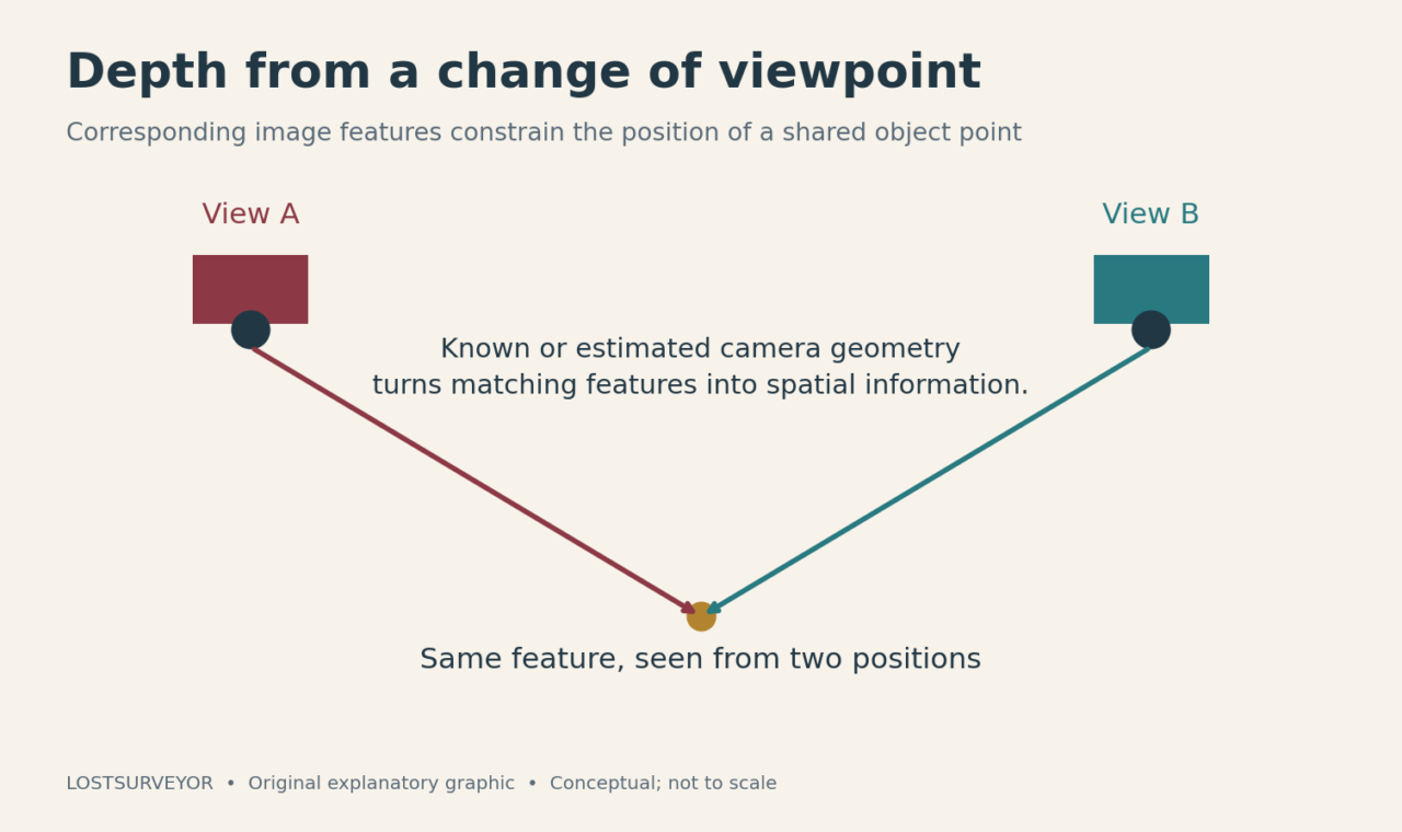
Photogrammetry means obtaining measurements from photographs. In a simplified example, the same recognizable feature appears in views taken from different positions. Each image supplies a direction toward that feature. With the camera geometry understood, those directions constrain where the feature can be in three dimensions.
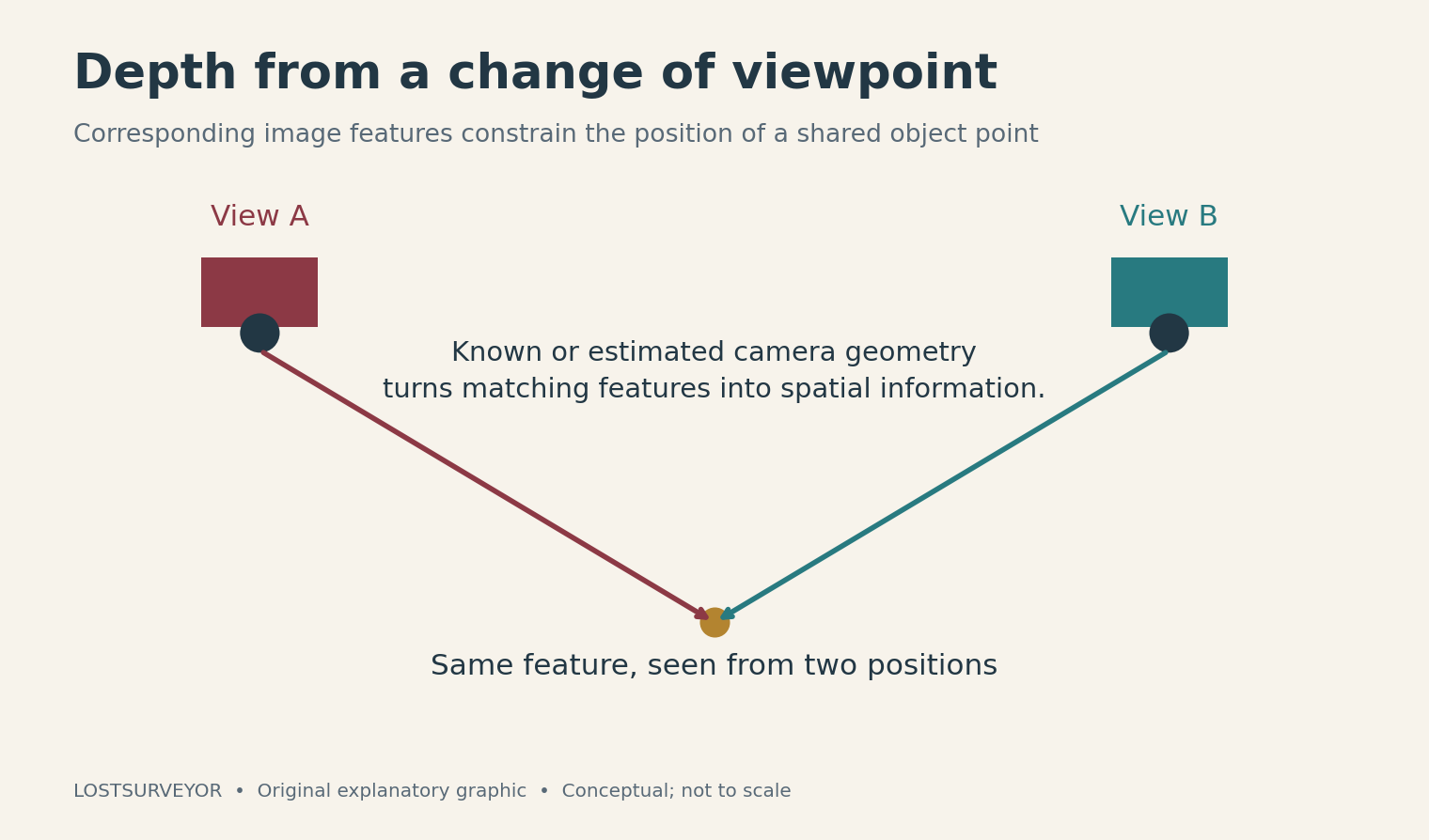
Original explanatory graphic for LostSurveyor. Conceptual; not to scale.
One photograph leaves many possible positions along a viewing direction. Another viewpoint helps narrow them. The exercise becomes much stronger when a project contains many overlapping images and many matching features, rather than relying on a single convenient pair.
This is why a mapping camera keeps photographing places it has already photographed. The repetition is useful evidence. Taking one elegant image of each separate patch of ground would produce a nice collection and a much less connected reconstruction.
How the software builds the relationship
A common modern workflow begins by detecting distinctive image features and finding correspondences in other photographs. It then estimates camera positions and orientations along with a sparse set of three-dimensional points. This stage is usually called structure from motion, or SfM.
The “motion” is the change of camera viewpoint across the collection. The software is not simply watching objects move and guessing what they are. It is solving a network of relationships among images, cameras, and shared features.
Bundle adjustment refines the fit. Think of many viewing rays being adjusted together so that the estimated scene and camera geometry better explain where the features actually appear in the photographs. The name is imposing; the purpose is a consistent explanation of the observations.
Further processing can estimate denser surface information from multiple views. A dense point cloud may then support a mesh, a textured model, or other products. The stages are related, but the first successful alignment of the photographs is not automatically the finished work.
The camera has a personality
A lens does not draw the world with perfect geometric obedience. Distortion and the camera’s internal geometry affect where details appear in an image. Calibration describes these influences so that processing can account for them.
Camera position and orientation are another part of the problem: where the photograph was made and which way the camera was looking. Some information may be known beforehand, and some may be estimated during reconstruction. Either way, the image is being treated as a measurement with geometry, not merely as a picture to be pasted onto a surface.
I like this change of status. A camera is such a familiar object that it is easy to overlook what careful use can extract from it. Photogrammetry takes an everyday way of recording the world and asks it a more ambitious question.
A model needs a place in the world
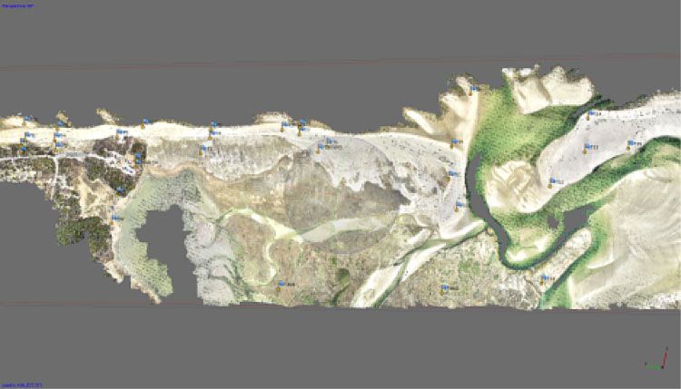
Image: U.S. Geological Survey; public domain. Source and description.
A reconstruction can describe a shape without yet having the correct scale, orientation, or position for the intended project. Known distances, camera-position information, or surveyed ground control can help establish those relationships.
Ground-control points participate in fitting the model to known coordinates. Checkpoints play a different role: they are kept out of that fit and used to assess the result. The distinction is easy to miss on a colorful screenshot, but it separates information used to build the answer from evidence used to examine it.
That is also why photogrammetry belongs comfortably beside conventional surveying. The photographs may supply extensive visible detail while other instruments provide reference observations. The methods are contributing different parts of the same spatial account.
The world does not always cooperate
A richly textured, stable surface offers features that can be recognized again. A blank wall offers fewer. Repeating patterns can be confusing; reflections may change with viewpoint; moving vegetation changes between exposures. Water combines several difficult properties at once.
A polished model can therefore contain holes, distorted patches, or surfaces that deserve closer scrutiny. Adding more photographs helps only when they add useful observations. More files of the same poor view are a very efficient way to make a larger problem.
The method is not confined to drones, either. Photographs taken from the ground can record objects and buildings, and suitable historical aerial photographs can be reprocessed to recover information about past landscapes. The essential ingredient is the connected geometry, not the novelty of the camera platform.
The enjoyable surprise of photogrammetry is that depth emerges from a collection of flat pictures. The professional achievement is making that depth useful. When the views connect, the camera geometry is understood, and the result is properly placed and examined, a photograph becomes more than a memory of a place. It becomes a way to measure it.
Sources and further reading
- Pix4D: Image acquisition and photogrammetry — Viewpoint, overlap, texture, and difficult surfaces.
- COLMAP: Image-based 3D reconstruction — An open-source project’s explanation of feature matching, structure from motion, and dense reconstruction.
- OpenCV: Camera calibration — The role of camera geometry and lens distortion; includes technical examples for interested readers.
- USGS: Coastal structure-from-motion workflow — Background on the processing sequence and bundle adjustment.
- Pix4D: Ground control and checkpoints — Different roles for fitting a project and checking its spatial result.
- USGS: Historical photographs and structure from motion — Why older photographs can also become new spatial evidence.