
Maps & Mapping
Above the Job: What a Surveying Drone Brings Back to Earth
The aircraft gets the attention, but its real contribution is a useful view of the job. Drone mapping depends on the sensor, the observations, and what happens after landing.
On This Page
The memorable moment in a drone survey is often the least informative one: the aircraft lifts off, steadies itself, and heads toward the job. The rotor noise fades. Everyone on the ground gets a small, irresistible urge to look up.
For the mapping work, however, the interesting event is happening under the aircraft. A sensor is gathering observations that need to become a coherent account of a place. The flight is a means of getting a camera or another instrument into a useful position.
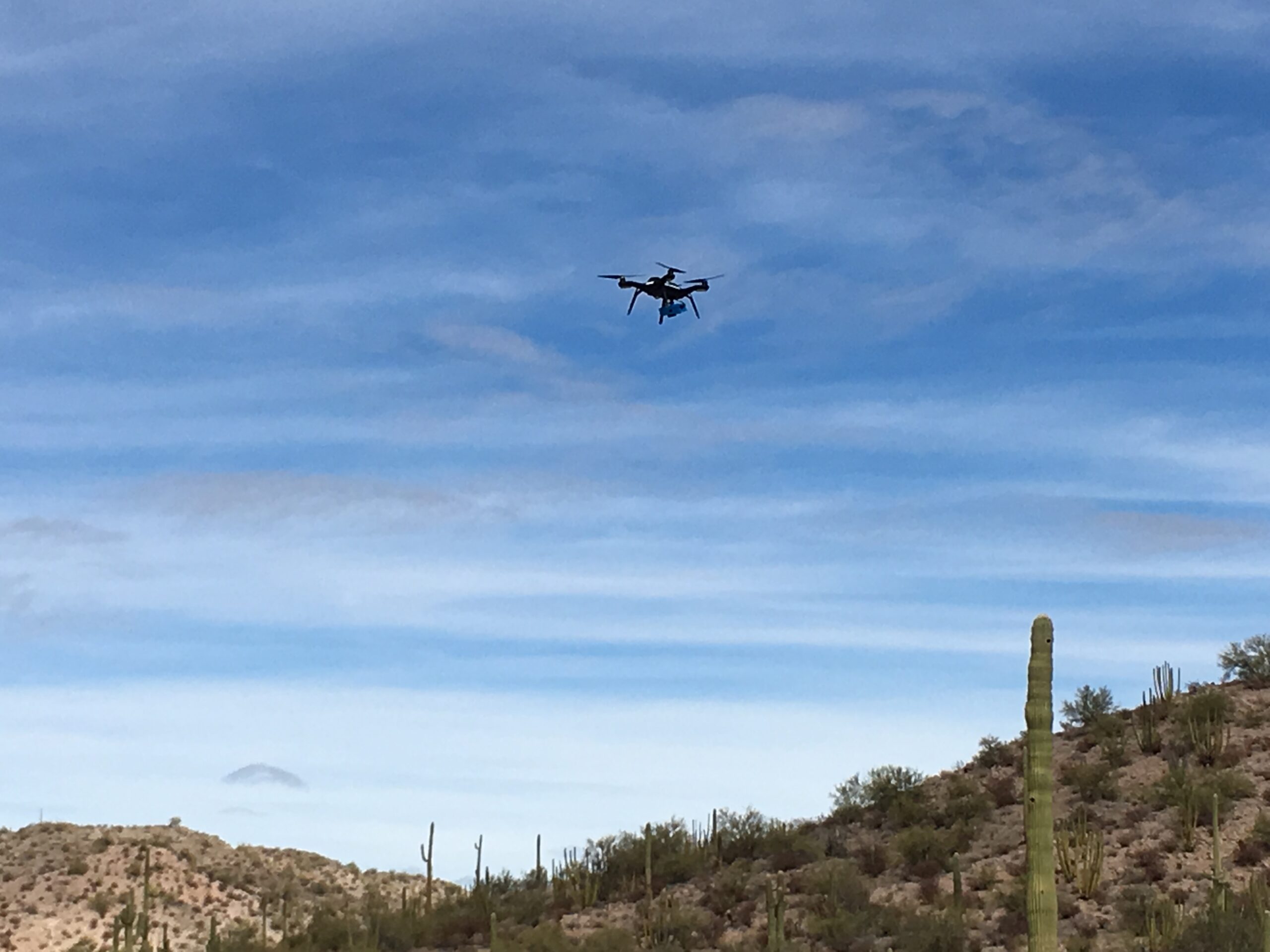
Photo: Geoffrey Debenedetto, U.S. Geological Survey; public domain. Source. WordPress resized the original.
An aircraft is not yet a survey
A drone can provide repeated views of a construction site, a shoreline, or another area where an aerial perspective is valuable. It can also photograph a place beautifully without producing a dependable mapping result. Those are different achievements.
With a conventional camera, overlapping photographs can be processed into three-dimensional information and an orthomosaic: an image assembled and geometrically corrected so that it behaves more like a map than a casual aerial snapshot. Features displaced by camera tilt and terrain must be accounted for during that process.
The resulting image can help readers understand the whole job at once. A haul road, a stockpile, and the edge of a work area appear in their surrounding context. I like that ability to restore the bigger picture. A site can be familiar at walking speed and surprisingly revealing from above.
The location still needs an argument
The aircraft’s GNSS receiver helps it navigate and can supply positions associated with the observations. Mapping systems may use RTK corrections during the flight or post-processed kinematic positioning afterward. These approaches can improve the position information, but their presence on a specification sheet does not establish the quality of the finished map.
Surveyed ground control can connect imagery to a reference system. Separate checkpoints, withheld from that fit, offer evidence about how well the result agrees with independently measured positions. A project can look internally convincing while being poorly placed in the larger world.
Small pixels are similarly easy to overinterpret. They describe image sampling, not a guarantee that every feature has been reconstructed or positioned equally well. The distinction matters whenever an attractive aerial view is expected to support a measurement rather than simply illustrate a progress report.
A short guide to what hangs underneath
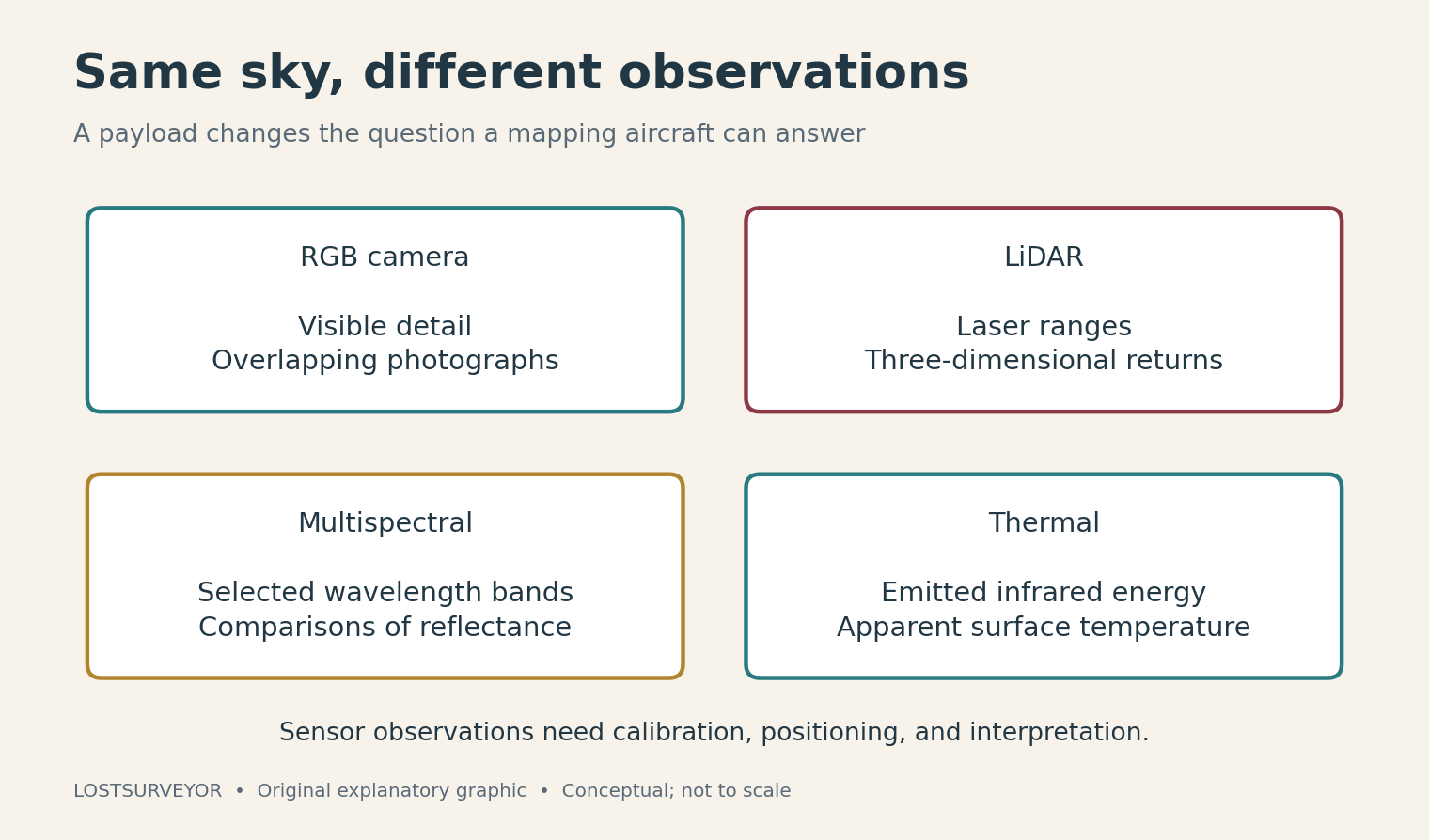
Original explanatory graphic for LostSurveyor.
An RGB camera records ordinary visible-light detail—the red, green, and blue information of a familiar photograph. For photogrammetry, its job is to provide clear, overlapping views with recognizable features.
A LiDAR payload records laser-ranging observations. Combined with suitable position and orientation information, those returns form a point cloud. It offers a different measurement approach from matching features in photographs, with its own calibration and processing demands.
A multispectral sensor separates selected wavelength bands. Some extend beyond visible light, allowing reflectance comparisons useful for studying vegetation and other surfaces. Meaningful comparison requires calibration; a vivid color map is not, by itself, an explanation of plant condition.
A thermal camera observes infrared energy and can provide information about apparent surface temperature. Surface properties, reflections, weather, and viewing conditions affect interpretation. A bright patch deserves investigation before it deserves a diagnosis.
These are short descriptions because the payload should serve the story, not overwhelm it. The useful starting question is what the project needs to observe. Buying more kinds of sensors does not automatically make that question easier to answer.
The unglamorous part of getting airborne
A mapping flight needs coverage that suits the intended product. For photography, the images must connect through overlap and useful visual detail; for laser mapping, the observation geometry and positioning information must support the points being collected. A completed flight can still leave missing or weak data.
The job also exists in shared airspace. In the United States, many commercial small-drone mapping operations are conducted under Part 107, and controlled-airspace flights may require authorization. The FAA’s current guidance belongs in the planning, along with conditions at the site. A programmed route is a flight plan, not permission to fly it.
After landing comes the quieter work: organizing the observations, processing them, checking the spatial result, and producing something another person can use. This is where the aircraft’s brief appearance turns into a lasting contribution.
Bring back an answer
The most satisfying drone product has a purpose you can describe without naming the aircraft. It shows how a site has changed, makes an awkward area legible, or supplies a spatial record for a clearly defined task.
The takeoff is still fun to watch. But the real success arrives later, when someone opens the finished work and sees the ground more clearly than before. That is a good reason to fly—and a better reason to pay attention to everything the flight leaves behind.
Sources and further reading
- USGS: UAS orthoimagery — How aerial photographs become map-like image products.
- Pix4D: Relative and absolute mapping accuracy — Image detail, georeferencing, and independent checkpoints.
- MicaSense: Calibrated reflectance panels — Why multispectral measurements need more than attractive colors.
- DJI: Thermal payload support — A manufacturer example showing the environmental influences on thermal measurements.
- NOAA: LiDAR — Laser mapping from aircraft and other platforms.
- FAA: Part 107 airspace authorizations — Official information for U.S. certificated remote pilots.