
Instruments & Methods
Surveying a Moving Seafloor: How GNSS-Acoustic Geodesy Tracks Tectonic Plates
Satellites cannot reach through seawater, so marine geodesists combine GNSS at the surface with acoustic ranging below to measure tectonic motion on the deep ocean floor.
On This Page
- 01 — Introduction
- 02 — Where Satellite Surveying Stops
- 03 — A Coordinate Passed Through the Sea Surface
- 04 — The Benchmark Is an Array
- 05 — The Ocean Is Part of the Instrument
- 06 — Survey Geometry Still Matters
- 07 — What the 2011 Tohoku Earthquake Revealed
- 08 — Watching the Quiet Part of the Earthquake Cycle
- 09 — Cascadia’s Offshore Blind Spot
- 10 — From Research Ships to Uncrewed Platforms
- 11 — Position Is Not the Same as a Map
- 12 — A Surveying Problem at Planetary Scale
- 13 — Sources and Further Reading
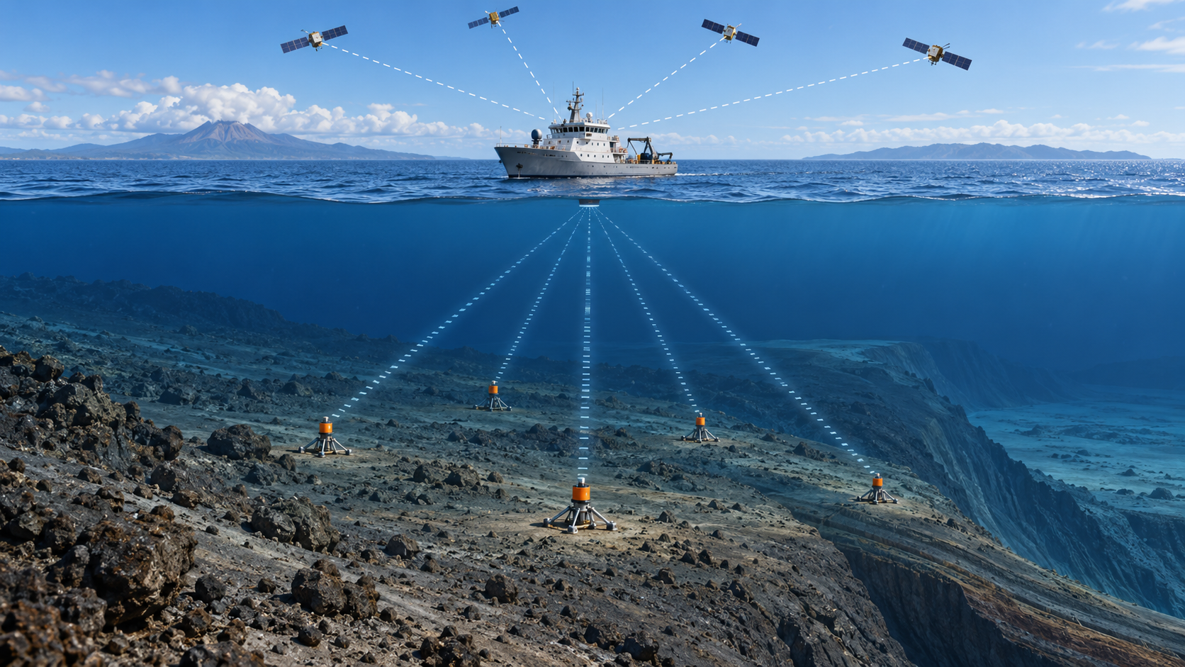
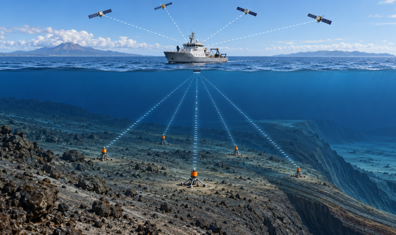
Original conceptual illustration created for The Lost Surveyor; not measured survey data.
Where Satellite Surveying Stops
Global navigation satellite systems have made it possible to watch continents move. A continuously operating receiver anchored to bedrock can reveal a slow regional drift, the accumulation of strain near a fault, or the abrupt displacement caused by an earthquake. The measurements are tied to a global reference frame and repeated often enough to turn position into motion.
That direct connection ends at the ocean surface. The radio signals used by GNSS do not penetrate seawater to useful depths, yet many of the world’s most consequential plate boundaries lie offshore. Subduction zones descend beneath ocean margins, and the sections capable of producing large earthquakes and tsunamis may be tens or hundreds of kilometres from the nearest land station.
Seafloor geodesy was developed to close that observational gap. One of its principal methods, GNSS-acoustic positioning, joins two very different kinds of measurement: satellite positioning above the water and acoustic ranging through it. The result is a survey system capable of tracking benchmarks that cannot see the sky.
A Coordinate Passed Through the Sea Surface
A GNSS-acoustic survey usually begins with an array of acoustic transponders installed on the seabed. A survey vessel, buoy, or uncrewed surface craft moves over the array carrying a GNSS antenna, an acoustic transducer, and instruments that measure the platform’s attitude and motion.
GNSS determines the position of the surface platform in a terrestrial reference frame. The acoustic system then sends a coded signal down to a seafloor transponder, which replies. The measured travel time, combined with an estimate of sound speed through the water, provides the range between the surface transducer and the seabed instrument. Observations made from many positions around the array allow analysts to solve for the transponders’ location.
The technique is sometimes described as extending GNSS to the seafloor, but the phrase can hide the essential handoff. Satellite radio provides the surface position; sound provides the underwater distance. Vessel motion, antenna-to-transducer offsets, timing, attitude, acoustic travel time, and the state of the water column all have to meet in one adjustment.
The Benchmark Is an Array
On land, a geodetic station may be a monument with a receiver fixed directly above it. Offshore, several transponders are commonly arranged across an area of seafloor and treated as a stable array. The survey estimates the array’s position rather than trusting a single instrument to represent a moving piece of crust.
The instruments are built to remain in place for years, listening most of the time and replying when a survey is made. A vessel returns on later campaigns and repeats the observation geometry. The difference between solutions, after accounting for uncertainty, is the measured displacement of the seafloor.
That displacement may be only centimetres per year while tectonic plates converge. During a major earthquake it can be measured in metres. In either case, the task is recognizably geodetic: preserve a monument, occupy it repeatedly, control the reference frame, model systematic effects, and decide whether a coordinate change represents the Earth or the measurement system.
The Ocean Is Part of the Instrument
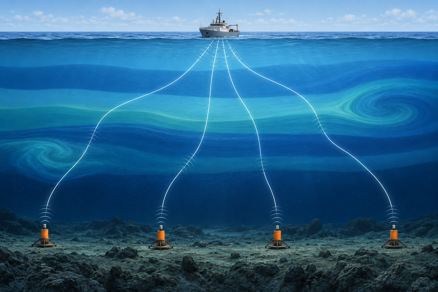
Original conceptual illustration created for The Lost Surveyor; not a measured sound-speed model.
Distance from acoustic travel time depends on the speed of sound, and sound speed in the ocean is not constant. It changes principally with temperature, salinity, and pressure. The water column can be layered, tilted, and disturbed by tides, currents, internal waves, and eddies. Acoustic paths bend as they cross those changing conditions.
A small error in the assumed sound-speed structure can appear as a shift in the calculated transponder position. For that reason, crews collect profiles of temperature and salinity, design tracks that approach the array from different directions, and increasingly estimate aspects of the sound-speed field within the positioning solution itself.
This makes the ocean more than empty space between instrument and benchmark. It is a changing part of the measurement system. Modern research combines seafloor geodesy with physical oceanography because a current or eddy that matters to an ocean model may also matter to a coordinate.
Survey Geometry Still Matters
GNSS surveyors are accustomed to thinking about satellite geometry. GNSS-acoustic work has an underwater counterpart: the distribution of observations at the sea surface affects how well the seafloor position can be resolved. A vessel that samples only one side of an array provides weaker geometry than one that surrounds it with balanced tracks.
The platform is not stationary in the surveying sense. It heaves, rolls, pitches, and moves with wind, current, and steering corrections. The position of the antenna must be transferred to the acoustic transducer while that motion is occurring. Each acoustic exchange is therefore associated with a position, attitude, and time rather than a single idealized setup over a point.
The field procedure may look like a ship travelling a repetitive pattern, but the pattern is part of the observation design. It supplies the changing lines of position needed to separate array coordinates from sound-speed effects and other correlated errors.
What the 2011 Tohoku Earthquake Revealed
The value of measuring offshore became unmistakable after the magnitude 9.0 Tohoku-Oki earthquake struck Japan on March 11, 2011. GNSS-acoustic sites operated by Japanese researchers had been established above the offshore source region before the earthquake, providing rare observations on both sides of the event.
A team led by Mariko Sato reported more than 20 metres of horizontal seafloor displacement across part of the focal region, with the largest measured movement about 24 metres toward the east-southeast. The same study reported nearly three metres of uplift at the seafloor site, even as terrestrial observations recorded subsidence on land.
Related observations closer to the Japan Trench found a horizontal displacement as large as 31 metres at one site. Together, the offshore measurements showed that displacement increased toward the trench and supplied direct evidence that very large rupture extended beneath the ocean. Land stations were indispensable, but they could not sample the region in the same way.
The achievement was not an earthquake prediction. It was something geodesy does especially well: place a measured constraint where models had previously depended on inference. The seafloor coordinates helped researchers reconstruct how the plate boundary moved and better understand the source of the tsunami.
Watching the Quiet Part of the Earthquake Cycle
The most dramatic use of seafloor geodesy comes after an earthquake, but much of its scientific value lies in the quieter years between events. At a subduction zone, one tectonic plate descends beneath another. Where the plate interface is locked, continuing convergence can deform the overriding plate and store elastic strain.
Onshore GNSS networks record part of that deformation. Their ability to distinguish what is happening near an offshore trench decreases with distance, however, and different patterns of fault locking can produce similar motions on land. A seafloor station installed nearer the plate boundary adds information where the competing models differ most.
Repeated offshore measurements have also been used to investigate post-earthquake deformation and slow slip events. Slow slip releases fault displacement over days, months, or longer without producing the strong shaking of an ordinary earthquake. Detecting it requires measurements that are stable enough to separate a transient crustal signal from the shifting ocean above.
Cascadia’s Offshore Blind Spot
The Cascadia subduction zone, extending from northern California to British Columbia, illustrates the practical reason for placing geodetic control offshore. Its megathrust lies largely beneath the Pacific Ocean. A dense network of land stations monitors the continental side, but the near-trench portion of the system remains comparatively distant from those instruments.
United States Geological Survey researchers have studied how a limited number of future GNSS-acoustic stations could be placed to provide the most new information about strain accumulation in Cascadia. The problem is both scientific and logistical. Seafloor instruments, deployment, ship time, maintenance, and repeated occupations are expensive, so a network must be designed around the information each station can contribute.
Such a network would not tell communities the date of the next earthquake. It could improve estimates of where the offshore fault is locked, how strain is distributed, and which rupture scenarios are consistent with observation. Those are important distinctions for understanding earthquake and tsunami hazards without claiming a forecasting ability the measurements do not provide.
From Research Ships to Uncrewed Platforms
Traditional GNSS-acoustic campaigns require a crewed vessel to revisit each array, often for many hours. The expense limits how frequently stations can be observed. Researchers have therefore tested wave-powered surface vehicles, autonomous craft, buoys, and other platforms that can carry GNSS and acoustic equipment without the cost of a full ship.
Uncrewed operation does not remove the geodetic problems. The platform must still produce adequate survey geometry, maintain timing and calibration, and gather enough information about the water column. A smaller craft may also have less freedom to run broad patterns in severe weather or strong currents. Recent work has examined how ocean-physics models can supplement observations when the platform cannot sample the sound-speed field as completely as a research vessel.
The direction of development is clear: more frequent occupations, lower operating costs, and eventually more continuous offshore monitoring. The route is not simply to replace a ship with a robot. It is to redesign the observation system while preserving the quality of the coordinate.
Position Is Not the Same as a Map
GNSS-acoustic positioning is sometimes confused with multibeam sonar because both use sound and appear on ships engaged in seafloor work. They answer different questions. Multibeam sonar sweeps a broad swath and measures the depth and acoustic character of the bottom, producing bathymetry and backscatter. GNSS-acoustic geodesy repeatedly positions a smaller number of seafloor benchmarks with high precision.
One method describes the shape of the seafloor; the other asks whether selected points on it have moved. The techniques can complement each other. Bathymetry supplies regional terrain and evidence of large morphological change, while geodetic stations provide a time series tied to a terrestrial reference frame.
A Surveying Problem at Planetary Scale
Seafloor geodesy is specialized, expensive, and still sparse compared with land-based GNSS. Yet its underlying logic belongs to the wider surveying profession. A remote monument is observed through an indirect chain. Environmental effects must be modeled. Geometry matters. Repetition turns coordinates into velocity and displacement. The final number is meaningful only because the reference frame and uncertainty are understood.
The unusual feature is the environment: the benchmark may sit several kilometres below a moving surface, beyond the reach of radio, on crust that is itself being carried toward a plate boundary. Connecting that point to the global geodetic network requires satellites, acoustics, oceanography, navigation, and patient repetition.
That combination has allowed surveyors and geophysicists to measure motions that were once almost entirely inferred from distant land. It does not make the deep ocean simple. It makes one more part of the moving Earth observable.
Sources and Further Reading
Frontiers in Earth Science: Frontiers in Seafloor Geodesy
Frontiers in Earth Science: History of On-Board Equipment Improvement for GNSS-A Observation
Frontiers in Earth Science: Kilometer-Scale Sound Speed Structure That Affects GNSS-A Observation
Science: Displacement Above the Hypocenter of the 2011 Tohoku-Oki Earthquake
Earth and Space Science: The Applicability of Ocean Physics Models to GNSS-Acoustic Seafloor Geodesy