

Maps & Mapping
Verplanck Colvin: Mapping the Mountains, Protecting the Adirondacks
Verplanck Colvin spent decades surveying the Adirondacks. His maps, mountain journeys, and illustrated reports helped turn a love of wild country into a lasting conservation legacy.
On This Page
Verplanck Colvin’s Adirondack survey sketch is a map that invites you to linger. Mountains rise in carefully drawn relief, their shapes crowding the sheet with the promise of distant views. It belongs to a surveying report, but it also carries the eye of someone who found the landscape worth looking at.
Colvin spent much of his working life trying to understand that country. The effort involved crews, instruments, camps, and repeated journeys through difficult terrain. Along the way, his concern for the Adirondacks helped advance an idea that would change their future: some wild places deserved lasting protection.
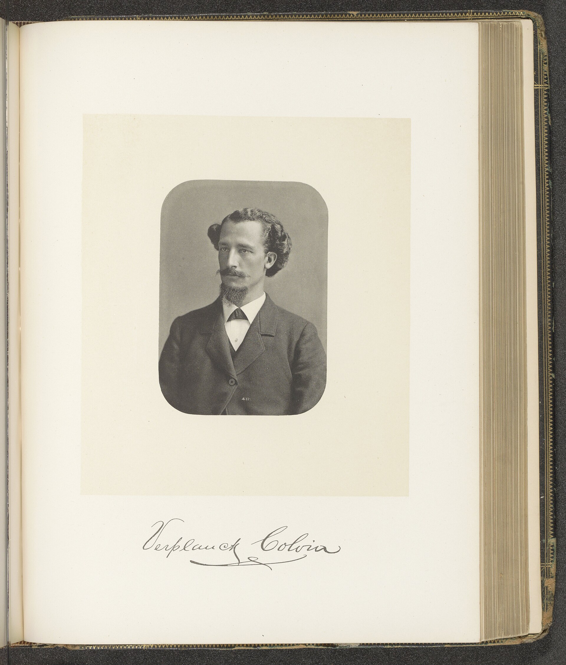
Unknown photographer / Rijksmuseum, RP-F-2001-7-1129-142, via Wikimedia Commons. Public domain; Rijksmuseum release CC0. Source.

A Wilderness Becomes a Life’s Work
Born in 1847, Colvin began surveying in the Adirondacks in 1865, while still a young man. By 1872, he was leading the Adirondack Survey. The undertaking would occupy twenty-eight years, with the landscape providing enough questions to sustain a career.
The region was far from unknown to the people who lived, traveled, hunted, and worked there. What the state lacked was a comprehensive and dependable record of its geography and many of its property boundaries. Earlier surveys and maps offered pieces of the picture, often with considerable gaps between them.
For Colvin, mountain summits offered a way to connect those pieces. Stations on high ground could be seen from other distant points, helping a surveying party establish the positions of features across a broad landscape. The mapmaking plan consequently required a great deal of climbing.
A modern visitor can enjoy a summit as the reward for a day’s walk. Colvin’s parties reached high ground with a further task ahead of them. They needed to position equipment, identify what they could see, make observations, and keep records that would remain useful after the camp had moved.
The Work Behind the View
The surviving photographs at Adirondack Experience show the survey as a shared enterprise. In one, Colvin and his team stand beside their equipment on Blue Mountain around 1880. Another presents Colvin with his longtime associate Mills Blake. A photograph from 1876 records a crew on Hurricane Mountain.
Those images make the official title “Superintendent” feel less distant. A survey had to be carried out by people who could get themselves and their equipment through the woods, manage a camp, and work together on exposed ground. The finished map preserved their observations while tending to leave the daily labor out of sight.
The field books now held by the New York State Archives offer another route back into that labor. They contain the working records behind the reports: observations, calculations, sketches, and the written traces of successive seasons. The books are reminders that a sweeping view on paper begins with many smaller acts of attention.
The details had to survive the journey as well as the people. Notes could become valuable years after an observation was made. Colvin’s papers consequently matter beyond the story of a single expedition; they preserve the accumulated work of a long undertaking.
An Artist in the Survey Party
Colvin drew as well as measured. St. Lawrence University’s gallery holds examples of his Adirondack work, including a view from the crest of the Gothics and a preliminary survey sketch. His reports used illustrations to convey the region’s terrain and natural character.
The drawings give a reader something a list of places cannot quite supply. A ridge becomes a shape against the sky; the foreground suggests the distance to the next mountain. They preserve his response to the country alongside his attempt to record it.
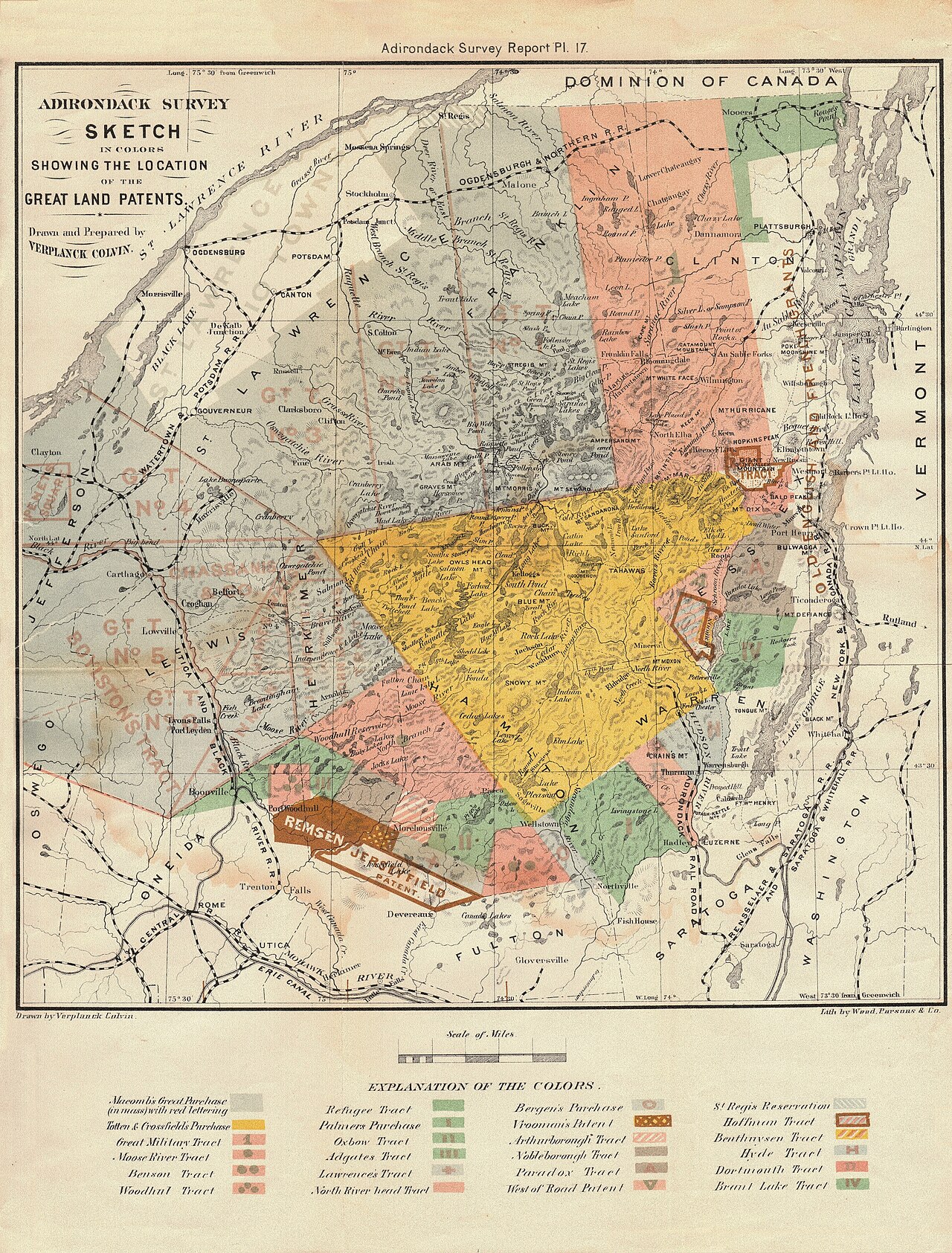
Verplanck Colvin / State of New York survey report, via Old Book Art and Wikimedia Commons. Public domain. Source.

His 1873 survey sketch combines those interests particularly well. Its crowded mountain forms encourage the eye to move through the landscape rather than simply locate a name. Studied today, it is both an old working document and an appealing invitation to imagine a journey through the High Peaks.
Ambition Had Its Costs
Colvin’s enthusiasm did not make every season run smoothly. A retrospective published in the New York State Conservationist in 1954 describes shortages of provisions, uncertain support from Albany, and organizational problems within the parties. Its account credits his contribution while also examining the difficulties people encountered under his leadership.
That assessment is useful because it gives the achievement a human scale. An ambitious superintendent could have a compelling vision and still struggle to organize the work required to achieve it. Crews experienced the consequences in practical matters such as food, shelter, pay, and the protection of delicate instruments.
The Conservationist article also records occasions when Colvin used his own money to help pay the crews. Government backing could be precarious. The survey’s persistence depended on more than the beauty of the country or the ingenuity of a plan.
These complications belong in the story. Mountain work was demanding enough without a shortage of supplies, and a long project placed repeated pressures on both its leaders and its assistants. The surviving maps are more interesting when the people behind them are allowed to be imperfect.
From Survey Reports to Protected Forest
Colvin became an advocate for preserving the Adirondacks, contributing to a broader conservation effort that involved officials, commissions, writers, and concerned citizens. His surveys and reports made the region’s features more visible to people deciding its future.
Protection arrived through several important steps. New York established the Adirondack and Catskill Forest Preserves in 1885. Adirondack Park followed in 1892. In 1894, the state approved constitutional protection for Forest Preserve lands under the principle remembered as “forever wild.”
Those developments should be understood as a collective achievement. Colvin was an influential participant, and his work helped furnish knowledge and arguments for preservation. The legislation and constitutional change also depended on the efforts and decisions of many others.
The resulting landscape includes both public and private land, communities, working forests, and places set aside for wilderness recreation. The Forest Preserve’s protection applies to the state lands within it. That distinction helps a visitor appreciate the Adirondacks as a living region with a complex history.
Reading the Landscape Again
Colvin’s survey leadership ended in 1900, and he died in 1920. His work remained in reports, field books, drawings, photographs, and survey marks. Each preserves a different part of the relationship between a man and the country that held his attention.
For readers who enjoy hiking, photography, or old maps, his story offers a satisfying connection between those interests. A mountain panorama can be beautiful, useful to a surveying crew, and important to a public argument about conservation—all at once.
The best place to begin may be that nineteenth-century sketch. Follow its mountain shapes for a moment, then think about the journeys needed to give them their positions on the page. Colvin’s legacy lives in that act of looking closely, and in the opportunity later generations still have to encounter the landscape for themselves.
Sources and further reading
New York State Archives: Colvin’s Adirondack survey field books
Adirondack Experience: Mapping Mastermind—Verplanck Colvin
St. Lawrence University: Colvin’s preliminary survey sketch
St. Lawrence University: The Crest of the Gothics
New York State Conservationist: Verplanck Colvin, 1954