
People of Surveying
The Surveyors of the Northwest: Measuring the First Public Lands
The Seven Ranges, Thomas Hutchins, and the field crews who turned the Land Ordinance of 1785 into monuments, notes, and a lasting national survey system.
On This Page
- 01 — Introduction
- 02 — Hutchins knew a country organized by rivers
- 03 — A point of beginning and a very short first season
- 04 — What measuring a mile actually required
- 05 — Seven ranges, stepped along the Ohio
- 06 — The first grid was not the later grid
- 07 — What the experiment left behind
- 08 — Sources and further reading
In the autumn of 1785, the new nation’s plan for its western lands encountered a stubborn fact: Congress could prescribe a straight line, but someone still had to carry that line through the woods. Thomas Hutchins and the surveyors assembling near Pittsburgh were about to test an ambitious national policy with compasses, chains, marked trees, and a great deal of walking.
Their assignment became known as the Seven Ranges, the first substantial federal implementation of the Land Ordinance of 1785. The work took place in what is now eastern Ohio. Here, “the Northwest” means the country northwest of the Ohio River, not the Pacific Northwest. The project is worth studying because it reveals how a survey system begins: not as a finished set of perfect rules, but as a series of decisions tested against terrain, limited resources, and political conflict.
Hutchins knew a country organized by rivers
Before directing the federal surveys, Hutchins had accumulated extensive experience in the interior of North America. His 1778 map of the western portions of Virginia, Pennsylvania, Maryland, and North Carolina depicted a much larger region around the Ohio, Mississippi, and Great Lakes. Rivers, settlements, and routes gave the landscape its structure. The future rectangular grid had not yet become the dominant way to describe its land parcels.
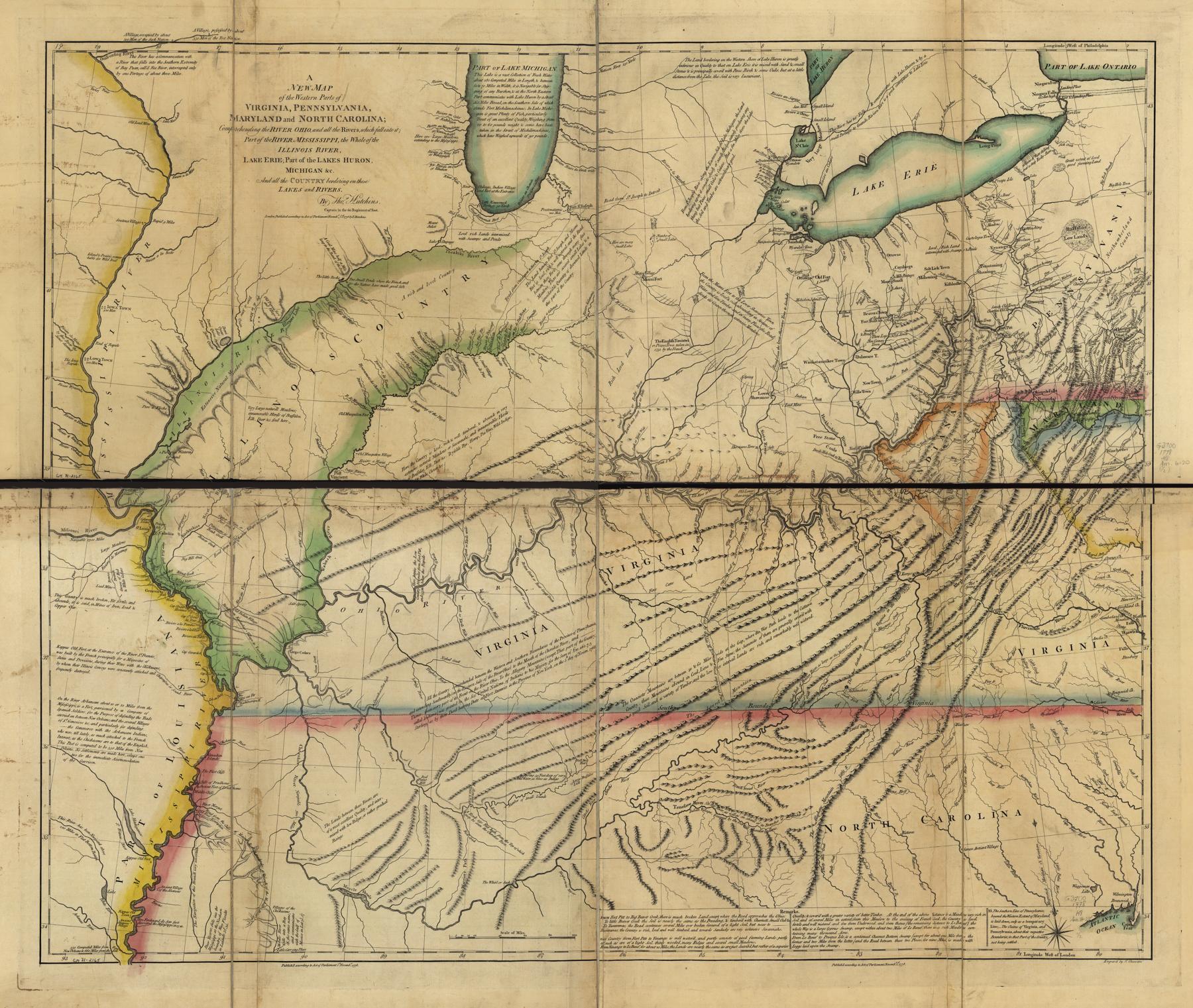
The Land Ordinance of May 20, 1785 proposed a different administrative order. Townships six miles square would provide the framework for describing and selling federal land. Congress assigned a surveyor from each of the thirteen states to work under the geographer of the United States. Hutchins had to turn this legislative outline into an organization capable of supplying reliable measurements and usable records.
The assignment was also inseparable from the struggle over the Ohio country. Indigenous peoples had settlements, political relationships, travel routes, and claims throughout the region. American assertions that land was available for survey did not mean those assertions were universally accepted. The danger reported by the crews belonged to this larger contest over possession and sovereignty; it was not simply another natural obstacle alongside rivers and hills.
A point of beginning and a very short first season
The eastern starting point connected the new work to Pennsylvania’s western boundary and the Ohio River. C. Albert White’s BLM history records that the Pennsylvania boundary party, including Andrew Ellicott, set a wooden post on the river’s north bank in August 1785. The rectangular survey would begin from that established boundary connection rather than from an arbitrary convenient clearing.
Hutchins began the westward line on September 30. Only eight of the thirteen state surveyors had arrived for the 1785 effort. They were assisted by roughly thirty chainmen and axmen. According to White, the party completed only four miles between September 30 and October 8, when reports of danger toward the Tuscarawas brought the work to a halt.
Four miles is a revealing measure of the difference between a congressional scheme and a field operation. The authorized compensation was two dollars for each mile surveyed, intended to cover the surveyor’s field expenses, including assistants. Four completed miles therefore meant only eight dollars under that mileage allowance. This was not simply a matter of taking more careful readings. An inadequate operating arrangement could threaten the entire undertaking.
What measuring a mile actually required
A compass or circumferentor established a direction, while a chain measured distance along the line. A standard Gunter’s chain measured 66 feet, but White describes a two-pole, or 33-foot, chain in this initial work. A nominal mile required 160 such half-chain lengths. Each individual placement was a small opportunity to misalign a chain, miscount a length, or measure a slope instead of the intended horizontal distance.
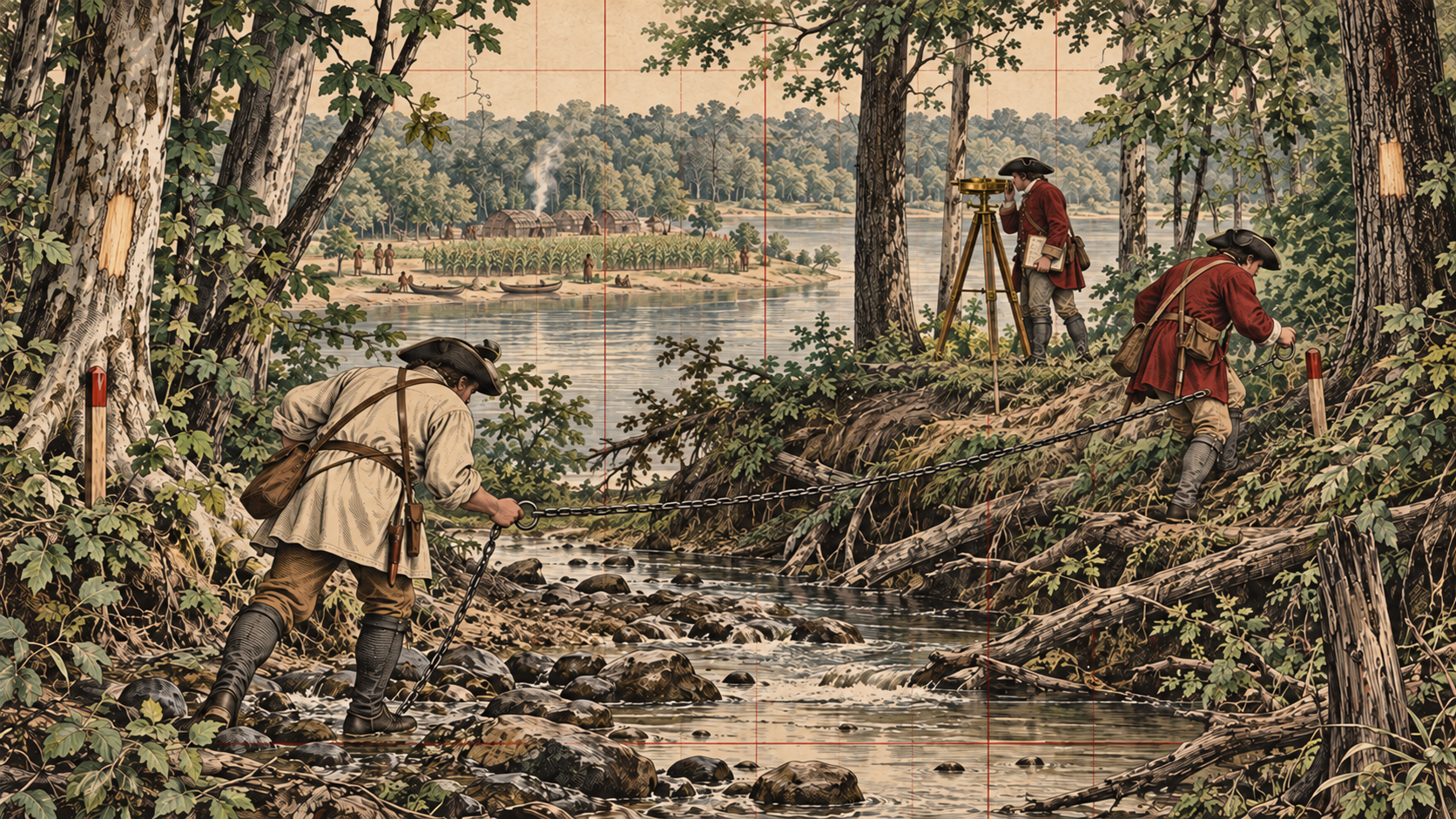
Holding the chain horizontally mattered. If its full length simply followed the surface of a steep hillside, the measured ground path would be longer than the horizontal separation between its ends. Chainmen therefore had to manage height differences, alignment, and the transfer of endpoints. Meanwhile, axmen opened sight lines and marked trees. Direction and distance were products of coordinated labor, not readings made by a solitary man beside a tripod.
At the prescribed mile points, the crews set posts and marked bearing trees. A bearing tree was an accessory whose recorded relationship to a corner could help recover the position if the post disappeared. The field record also described terrain and resources. Congress wanted land that could be identified and evaluated, so the surveyor’s observations about water, soil, timber, and other features had administrative value alongside the measurements.
Seven ranges, stepped along the Ohio
Congress revised the immediate assignment in May 1786, limiting the work to seven ranges south of the initial east–west line and relaxing the strict true-meridian requirement for this operation. Surveying resumed in August. As the westward line advanced, parties worked south along range boundaries at six-mile intervals until they reached the Ohio River.
This is why the first survey does not form a simple rectangular block. Pennsylvania supplied an eastern limit, the initial line supplied a northern reference, and the winding Ohio clipped the project along its eastern and southern margins. The shape of the completed plat records the interaction between an imposed framework and an existing geographic boundary.
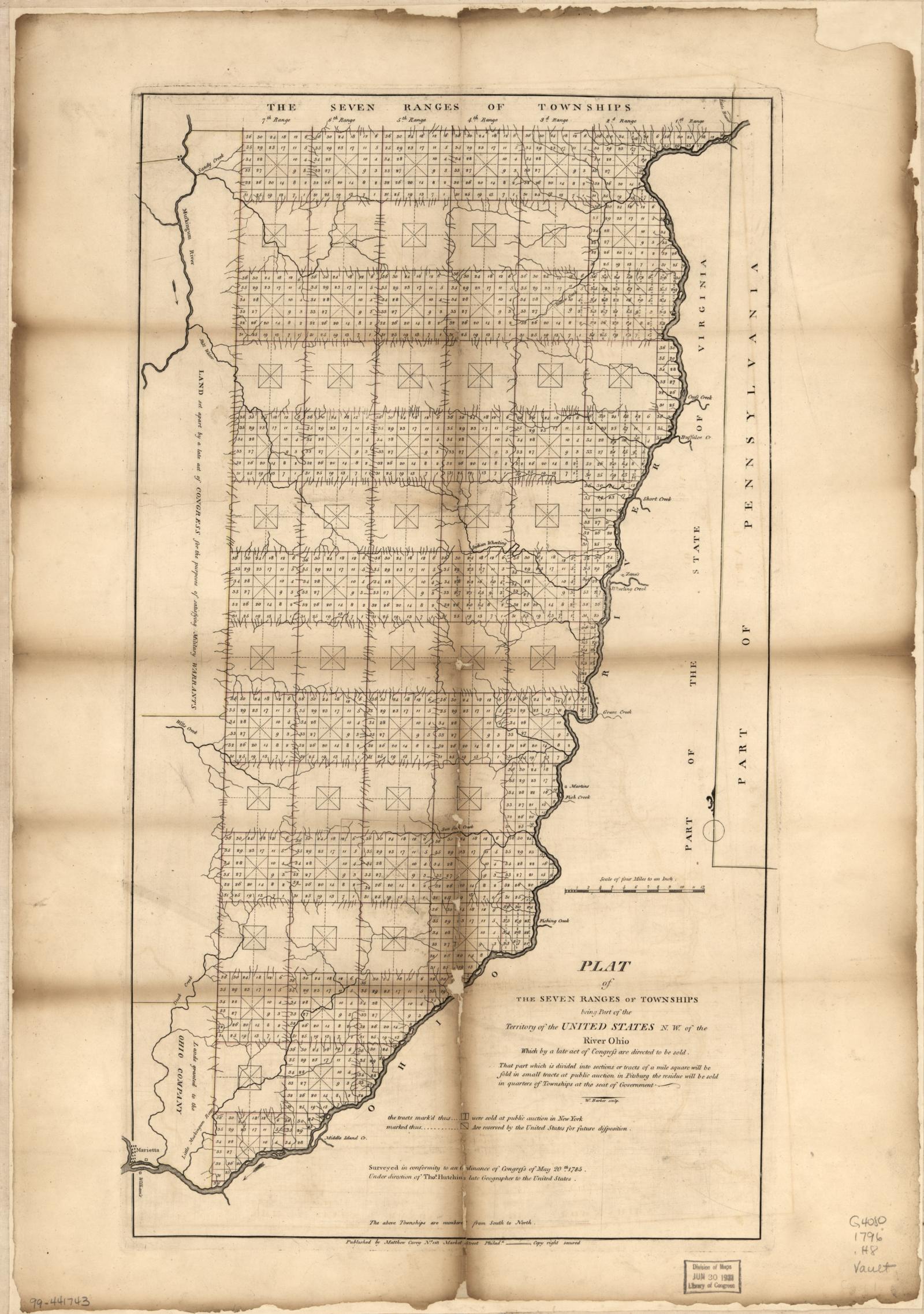
By mid-November 1786, four complete ranges had been finished. The remaining work continued in 1787 under surveyors including Absalom Martin, James Simpson, and Israel Ludlow. White places completion of the fieldwork in June 1787, with records subsequently delivered and the final plats reaching the Board of Treasury in 1788. Those dates should not be confused with 1796, the publication date of the printed map reproduced here.
The administrative work after the field season was substantial. Measurements had to become descriptions, plats, and records suitable for officials and purchasers who had never seen the ground. The first New York sales of this land took place in 1787. A corner cut in the woods had to remain intelligible as its meaning passed through a surveyor’s notes, an office drawing, and a land transaction.
The first grid was not the later grid
A modern surveyor opening a Seven Ranges plat must resist the temptation to read it as an ordinary later township. Under the first ordinance, the thirty-six numbered one-mile squares were initially protracted—that is, drawn—inside the surveyed township outlines. Surveying the exterior and setting its mile corners did not mean every internal section line had been run or every interior section corner monumented.
The numbering is another warning. The original scheme began with section 1 in the southeast, then proceeded northward in successive columns. The later arrangement, established by the 1796 legislation, begins in the northeast and snakes back and forth in rows. A reader who silently substitutes the modern pattern can place a perfectly legible section number in the wrong part of the township.
Procedures for connecting adjacent work also required refinement. White describes difficulties where separately run township boundaries produced different corner positions instead of a single shared corner. This was a practical network problem: several individually plausible lines do not necessarily meet where their planners expected. Later instructions became more explicit about the sequence of work, connections, and the handling of discrepancies.
What the experiment left behind
The Seven Ranges demonstrated both the power and the limitations of a national rectangular plan. The framework made parcels comparable and describable, but it did not remove the need for field judgment, adequate funding, careful recordkeeping, or procedures for joining one survey to another. Nor did orderly land sales settle the underlying conflicts over the country’s occupation and ownership.
For today’s surveyor, the most useful lesson is historical specificity. Before interpreting an old line, ask what the surveyor was actually instructed to do, what was measured rather than merely drawn, and which version of the system was then in use. A later manual can explain the mature practice without necessarily describing an earlier crew’s assignment.
Hutchins and his colleagues did not leave a flawless grid. They left the first working foundation of a survey system that could be extended, corrected in its procedures, and understood by others. Their achievement lay in making a national idea tangible: measured lines, marked corners, and records that allowed someone far from the Ohio River to identify a particular piece of ground. The imperfections belong to that achievement’s history, and understanding them is part of learning to read its surviving evidence.
Sources and further reading
C. Albert White, A History of the Rectangular Survey System (BLM, 1983), especially printed pages 11–21 and the discussion of the 1796 legislation, supplies the chronology, personnel, field methods, and early instructions used here. Primary cartographic sources are Hutchins’s 1778 regional map and the Seven Ranges plat published in 1796, both held by the Library of Congress.
For an explanation of the developed township, range, and section framework, see Lines Across a Young Nation.
[…] with The Surveyors of the Northwest for the story of the first field crews, or Reading the Old Plats for a closer look at the […]