

Measuring the World
Surveying the Highest Peak, Part 3: GPS, Geoids, Snow, and the Modern Height of Everest
Why modern Everest measurements depend on GNSS, gravity, snow depth, reference frames, and a clear definition of height.
On This Page
- 01 — Introduction
- 02 — The 2020 Number Has a Definition
- 03 — What a Summit Receiver Actually Measures
- 04 — The Ellipsoid Is a Useful Shape, Not Sea Level
- 05 — A Closer Look: A Model Matters
- 06 — Snow Makes the Summit a Changing Surface
- 07 — A Moving Mountain on a Moving Earth
- 08 — The Agreement Behind the Digits
- 09 — Sources and Further Reading
Series: Surveying the Highest Peak
Everest’s jointly announced 2020 height is about 29,032 feet (8,848.86 meters), including the snowcap. Nepal and China announced the result on December 8, 2020. The exact published metric value is retained here because it is the scientific figure the two countries adopted; the rounded feet value is an everyday comparison.
Reaching the summit with a satellite receiver does not make the answer automatic. The receiver supplies a geometric position. To turn that position into an elevation, surveyors must establish the height reference, account for gravity, and decide which part of the summit “the top” means.
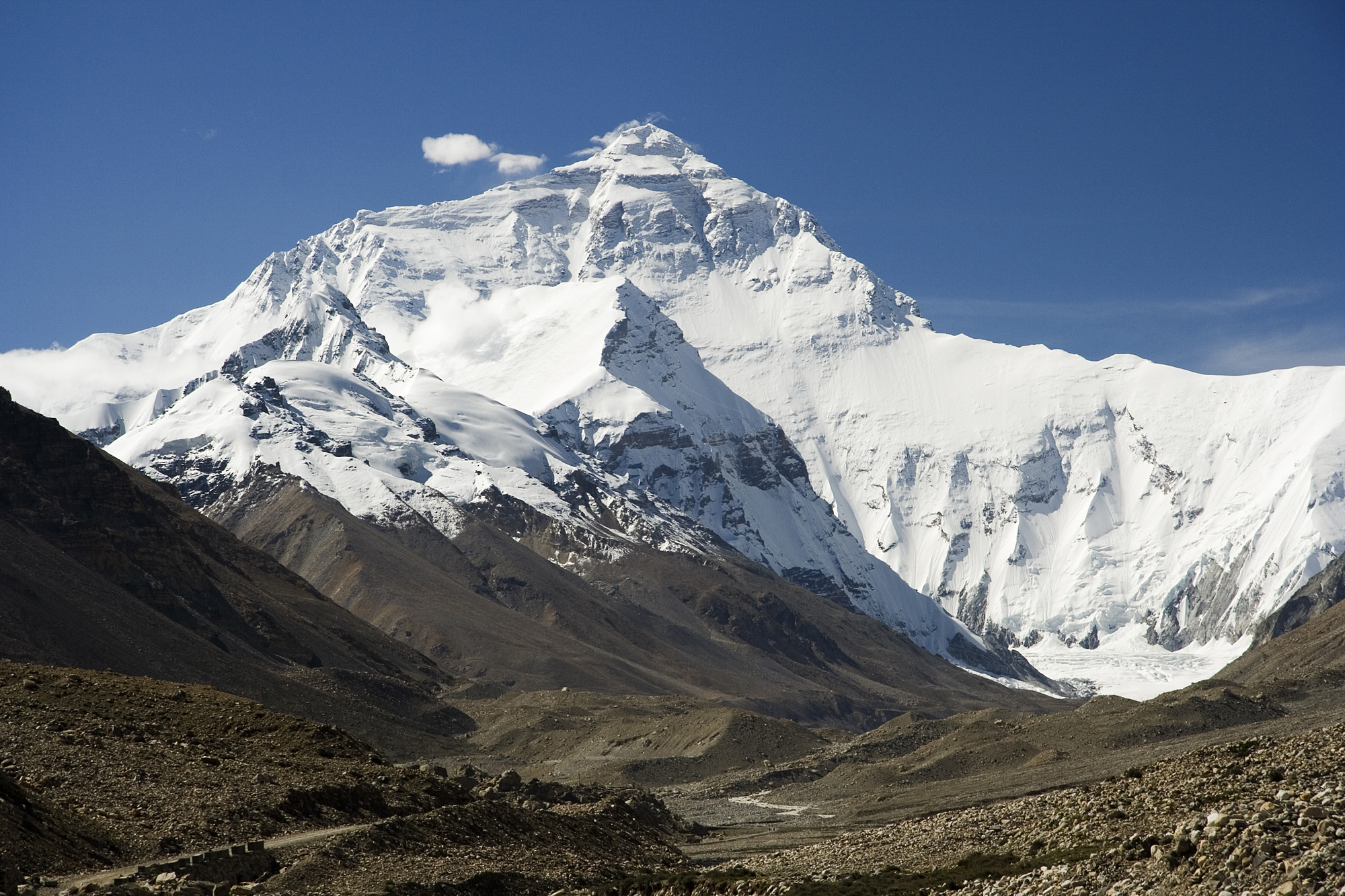
Luca Galuzzi (www.galuzzi.it). CC BY-SA 2.5. Source. Resized by WordPress.

The 2020 Number Has a Definition
China’s official announcement records the joint figure of 8,848.86 meters. The accompanying government-published account explicitly says the snowcap is included. That qualifier is not a footnote to the answer. It identifies the surface to which the answer belongs.
A snow-surface height and a rock-surface height can both be legitimate measurements while giving different values. Subtracting them without examining the definitions can turn a difference in what was measured into a false claim that the mountain grew or shrank by that amount.
What a Summit Receiver Actually Measures
GNSS, the family of satellite navigation systems that includes GPS, estimates the receiver antenna’s position in a reference frame. The antenna is not the ground point. Its height above the chosen surface, the part of the antenna used as the reference, and the observation setup must be known.
A summit occupation also has ordinary surveying problems in an extraordinary setting: power, stable mounting, recording time, visibility of satellites, reflected signals, and safe handling. A sophisticated receiver cannot recover observations it never logged or determine an antenna height nobody recorded. The field procedure connects the instrument to the physical summit.
The Ellipsoid Is a Useful Shape, Not Sea Level
An ellipsoid is a smooth mathematical model of Earth. It makes positions convenient to calculate. A geoid is related to a level surface of the gravity field, broadly corresponding to mean sea level extended beneath the continents. Gravity varies with the distribution of mass, so the two surfaces do not coincide.
The usual relationship for orthometric height is H = h − N: subtract geoid height N from ellipsoid height h. This is a general explanation of the distinction, not a claim that the complete Everest computation can be reproduced with one subtraction. Actual survey results depend on the chosen physical height system, gravity models, and connections to its reference.
A Closer Look: A Model Matters
Consider an imaginary mountain point with an ellipsoid height of 10,000 feet (3,048 meters) and a geoid height of +100 feet (30.48 meters). Its orthometric height in this simplified example is 9,900 feet (3,017.52 meters). If the adopted geoid height changes by 1 foot (0.305 meter) while the geometric position stays fixed, the derived orthometric height changes by 1 foot in the opposite direction. The point did not have to move.
Snow Makes the Summit a Changing Surface
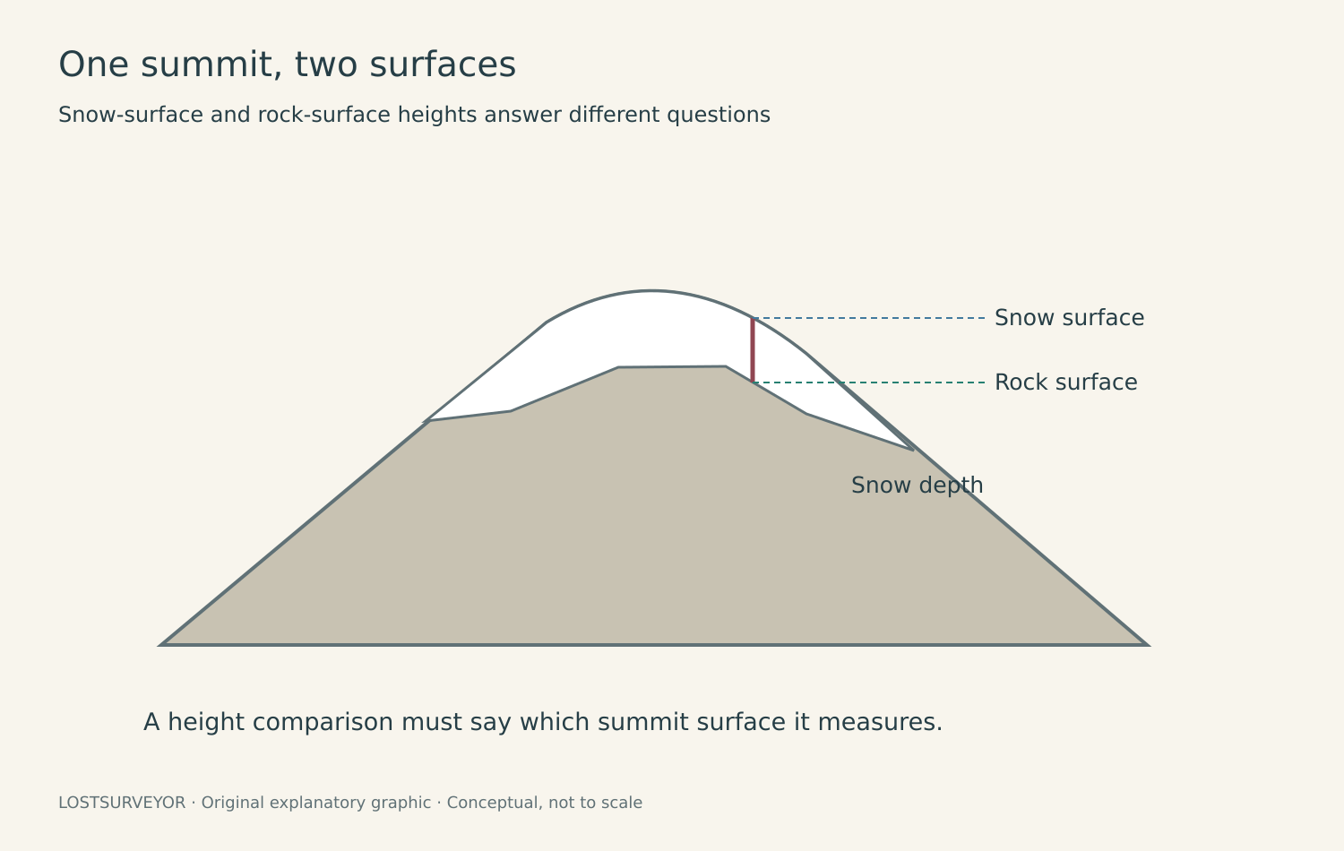
Original LostSurveyor explanatory graphic. CC BY 4.0. Conceptual, not to scale.
The upper snow surface can change with accumulation, wind, and melting. Ground-penetrating radar can help investigate material beneath it, but identifying the rock interface requires interpretation of the returned signal. A bright radar reflector is evidence to evaluate, not a label announcing “bedrock.”
For comparisons, the observation date and the physical surface belong beside the number. A later survey may observe a different snow condition even if the underlying rock remains at the same height in the selected system. The 2020 agreement’s snowcap definition prevents one important source of confusion.
A Moving Mountain on a Moving Earth
The Himalayas are part of an active collision zone. Tectonic deformation and earthquakes can change positions, while erosion and ice processes change the surface. A precise coordinate consequently belongs to a reference frame and a time as well as a named place.
It is tempting to compare two published heights and call their difference a growth rate. That works only after their references, methods, dates, and summit definitions have been made comparable. Otherwise, physical change and measurement change remain mixed together.
The Agreement Behind the Digits
The first surveyors observed a remote summit from controlled stations. Modern crews can stand on it. In both cases, the mountain’s height reaches all the way back to a reference somewhere else. Standing on the highest point does not remove the need to explain what “high” means.
Sources and Further Reading
The Cryosphere: Everest summit snow depth and radar observations, 2023
China Ministry of Foreign Affairs: joint height announcement, December 8, 2020 (Chinese)
State Council Information Office: 2020 height includes the snowcap