
Instruments & Methods
Finding Level: From Water Levels and Spirit Bubbles to Digital Heights
Establishing height has always required a definition of level, a reliable sight line, and a path of observations strong enough to reveal accumulated error.
On This Page
- 01 — Introduction
- 02 — Water as an Early Reference
- 03 — The Roman Chorobates
- 04 — The Spirit Level
- 05 — Telescope Levels and the Line of Collimation
- 06 — Differential Leveling
- 07 — Bench Marks and a National Vertical Network
- 08 — Curvature, Refraction, and Sight Length
- 09 — Automatic and Digital Levels
- 10 — Orthometric Height, Ellipsoid Height, and the Geoid
- 11 — Modern Vertical Datums and Time
- 12 — Reading the Evidence Carefully
- 13 — From Historical Record to Field Practice
- 14 — Level Is a Physical Idea and a Surveying System
- 15 — A Short Level-Loop Example
- 16 — A Surveyor’s Reading Checklist
- 17 — Sources and Further Reading
Establishing height has always required a definition of level, a reliable sight line, and a path of observations strong enough to reveal accumulated error.
A builder can see when water runs downhill, but precise height is subtler. “Level” is tied to gravity, while the surfaces used in maps and coordinate systems are mathematical or modeled. Surveyors developed instruments that create a horizontal line of sight, then carried differences in elevation from point to point through leveling. Modern digital levels automate rod reading, and GNSS produces ellipsoid heights, yet the old questions about reference and closure remain.
This history travels from water surfaces and Roman construction descriptions through the spirit bubble, the wye and dumpy level, precise geodetic leveling, automatic compensators, bar-coded rods, and geoid models. The sequence is not a claim that every invention had one birthplace or that older methods vanished instantly. It is a story of progressively controlling a vertical reference.
To measure height is to choose a reference surface, follow gravity or model it, and keep small errors from accumulating along the way.
Water as an Early Reference
A calm water surface offers an intuitive indication of equal potential over short distances. Builders in many cultures used channels, troughs, or water-filled devices to transfer level. Range and accuracy were limited by meniscus reading, wind, temperature, container shape, and the practical difficulty of extending the reference.
The instrument matters, but the observation system matters more. A reading becomes defensible only when the observer controls setup, centering, calibration, temperature or refraction where relevant, note keeping, repetition, closure, and an independent check. A natural reference becomes a measurement only through a controlled apparatus and repeatable reading. That continuity is one reason an old field book can still feel familiar to a surveyor carrying equipment its author could scarcely imagine.
The Roman Chorobates
Vitruvius described the chorobates, a long beam with plumb lines and a water channel, in connection with aqueduct work. The account is a valuable literary source, but reconstructions vary and it should not be treated as a universal instrument specification for every Roman project. It reflects close attention to very small gradients.
The instrument matters, but the observation system matters more. A reading becomes defensible only when the observer controls setup, centering, calibration, temperature or refraction where relevant, note keeping, repetition, closure, and an independent check. Engineering descriptions must be interpreted alongside archaeology and the performance the work required. That continuity is one reason an old field book can still feel familiar to a surveyor carrying equipment its author could scarcely imagine.
The Spirit Level
The curved, liquid-filled vial associated with the spirit level emerged in early modern Europe and is often linked to Melchisédech Thévenot in the seventeenth century. A centered bubble indicates the vial is tangent to level at its midpoint. Sensitivity depends on curvature, graduation, mounting, and temperature.
The instrument matters, but the observation system matters more. A reading becomes defensible only when the observer controls setup, centering, calibration, temperature or refraction where relevant, note keeping, repetition, closure, and an independent check. A bubble does not create level; it reports the relationship between an instrument axis and gravity. That continuity is one reason an old field book can still feel familiar to a surveyor carrying equipment its author could scarcely imagine.
Photo by Jensens, public domain, via Wikimedia Commons.

Telescope Levels and the Line of Collimation
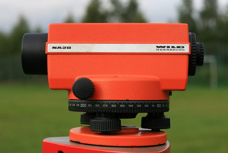
Attaching a telescope and bubble to a stable support created a horizontal line of sight that could be read against a graduated rod. Wye levels allowed the telescope to be lifted and reversed for adjustment. Dumpy levels made the telescope more rigidly attached, improving stability and simplifying routine use.
The instrument matters, but the observation system matters more. A reading becomes defensible only when the observer controls setup, centering, calibration, temperature or refraction where relevant, note keeping, repetition, closure, and an independent check. A reliable sight line depends on known relationships among bubble, telescope, and mechanical axes. That continuity is one reason an old field book can still feel familiar to a surveyor carrying equipment its author could scarcely imagine.
Differential Leveling
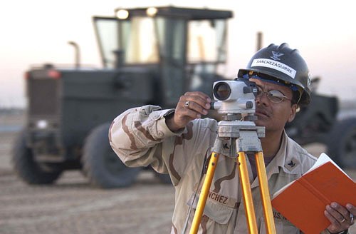
Differential leveling obtains an elevation difference by subtracting a foresight from a backsight. Repeated setups carry height around obstacles and over long routes. Balanced sight lengths help cancel collimation effects, while firm turning points and clear booking protect the chain of elevations.
The instrument matters, but the observation system matters more. A reading becomes defensible only when the observer controls setup, centering, calibration, temperature or refraction where relevant, note keeping, repetition, closure, and an independent check. Each setup is small, but an error can travel through every elevation that follows. That continuity is one reason an old field book can still feel familiar to a surveyor carrying equipment its author could scarcely imagine.
Bench Marks and a National Vertical Network
Geodetic agencies established durable bench marks and ran precise leveling lines across the United States. Published elevations supported mapping, engineering, flood studies, and local control. Marks could be disturbed, and elevations changed as networks were readjusted and datums replaced. A stamped number is not necessarily the current published elevation.
The instrument matters, but the observation system matters more. A reading becomes defensible only when the observer controls setup, centering, calibration, temperature or refraction where relevant, note keeping, repetition, closure, and an independent check. A monument and its coordinate or elevation are related records, not the same thing. That continuity is one reason an old field book can still feel familiar to a surveyor carrying equipment its author could scarcely imagine.
U.S. Navy photo by Brien Aho, public domain, via Wikimedia Commons.

Curvature, Refraction, and Sight Length
Over distance, Earth curvature makes a level surface depart from a straight sight line, while atmospheric refraction bends light. In ordinary differential leveling, balancing backsight and foresight distances cancels much of their combined effect. Precise work also controls rod calibration, temperature, settlement, and observation timing.
The instrument matters, but the observation system matters more. A reading becomes defensible only when the observer controls setup, centering, calibration, temperature or refraction where relevant, note keeping, repetition, closure, and an independent check. Symmetrical observing geometry is a powerful way to reduce errors that are hard to model perfectly. That continuity is one reason an old field book can still feel familiar to a surveyor carrying equipment its author could scarcely imagine.
Automatic and Digital Levels
Automatic levels use a compensator to establish a horizontal line after rough leveling. Digital levels read a coded rod electronically and can store observations. They reduce some reading and transcription mistakes, but compensator checks, rod condition, turning-point stability, and proper sequence remain essential.
The instrument matters, but the observation system matters more. A reading becomes defensible only when the observer controls setup, centering, calibration, temperature or refraction where relevant, note keeping, repetition, closure, and an independent check. Automation changes the failure modes and therefore changes the checklist. That continuity is one reason an old field book can still feel familiar to a surveyor carrying equipment its author could scarcely imagine.
Orthometric Height, Ellipsoid Height, and the Geoid
Traditional elevations are commonly intended to relate to gravity and mean sea level through a vertical datum, producing orthometric heights. GNSS produces ellipsoid heights in a geometric reference frame. A geoid model connects them approximately through the familiar relationship H = h − N, subject to conventions and model accuracy.
The instrument matters, but the observation system matters more. A reading becomes defensible only when the observer controls setup, centering, calibration, temperature or refraction where relevant, note keeping, repetition, closure, and an independent check. Calling both results “elevation” without naming the height type invites costly confusion. That continuity is one reason an old field book can still feel familiar to a surveyor carrying equipment its author could scarcely imagine.
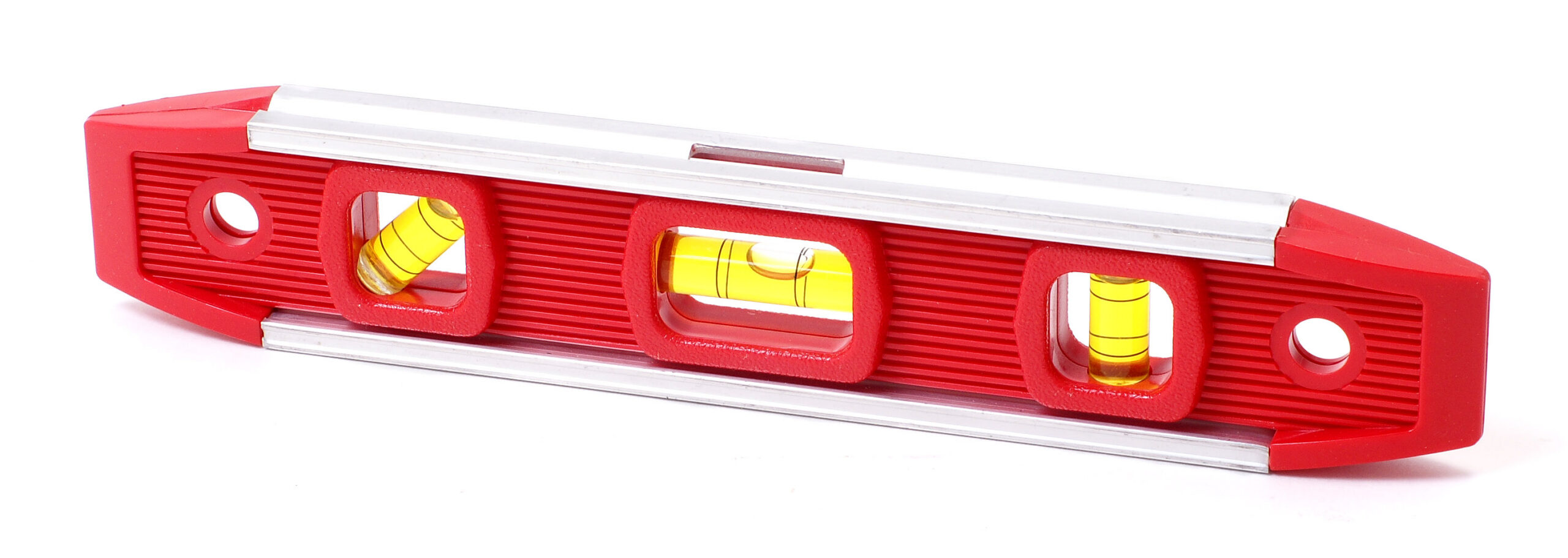
Photo by Evan-Amos, public domain, via Wikimedia Commons.

Modern Vertical Datums and Time
Vertical reference systems evolve as observations improve and the land itself moves through subsidence, uplift, groundwater withdrawal, tectonics, and other processes. NOAA’s modernization of the National Spatial Reference System emphasizes a geocentric frame and gravimetric geoid rather than perpetuating every elevation through long leveling chains.
The instrument matters, but the observation system matters more. A reading becomes defensible only when the observer controls setup, centering, calibration, temperature or refraction where relevant, note keeping, repetition, closure, and an independent check. A height needs a datum and, increasingly, an epoch or observation date. That continuity is one reason an old field book can still feel familiar to a surveyor carrying equipment its author could scarcely imagine.
Reading the Evidence Carefully
A common classroom equation, H = h − N, is useful only after its symbols are understood. The GNSS-derived ellipsoid height h belongs to a specified geometric reference frame. Orthometric height H is intended to represent height above the geoid along the gravity field. Geoid height N comes from a model with its own realization and uncertainty. Mixing coordinate epochs, datums, antenna measurements, or model versions can overwhelm the precision of the observations. The formula is short; the metadata behind each term is the real work.
From Historical Record to Field Practice
Across this history, precision should not be confused with a large number of decimal places. Precision begins with a stated purpose, a suitable reference, controlled observations, and enough redundancy to reveal a mistake. Earlier practitioners expressed those requirements through cords, sight lines, repeated angles, witnesses, and permanent stones. Later surveyors added calibrated chains, optical circles, leveling rods, electronic measurements, satellites, and adjustment software. Every generation gained reach, yet every generation still had to decide which evidence deserved confidence. That judgment—not the novelty of the tool—is the durable craft at the center of surveying.
Level Is a Physical Idea and a Surveying System
The instrument on the tripod is only one part of vertical measurement. The rod, turning point, gravity field, sight balance, benchmark history, datum, and adjustment all participate in the result. That is why a short leveling note can carry so much professional meaning.
For entry-level surveyors, the practical habit is simple: never write or import an elevation without asking what kind it is, where it came from, and how it was checked. The difference between ellipsoid and orthometric height can be many meters; the difference between a stable and disturbed benchmark can be the success of an entire project.
A Short Level-Loop Example
A crew begins on a published bench mark, runs through a series of turning points, and closes on another mark. The observed elevation difference disagrees with the value computed from the published elevations by 0.018 foot. That number is the loop misclosure, but it is not yet a verdict. The crew compares it with the project’s allowable closure, often expressed as a constant times the square root of distance, and reviews sight balance, rod handling, turning points, and booking. If acceptable, the misclosure may be distributed by the chosen adjustment method; if not, the line is rerun.
Now add a datum complication. One bench mark’s datasheet elevation comes from a different adjustment or vertical datum. The arithmetic may close poorly even though the field observations are excellent. Conversely, using two disturbed marks with mutually agreeable published values can produce a neat closure and a wrong project. Before observing, verify mark identity, stability, datum, units, and adjustment history. After observing, inspect both mathematical closure and physical plausibility.
A Surveyor’s Reading Checklist
- Name the vertical datum and height type in notes and deliverables.
- Balance backsight and foresight distances where the method depends on cancellation.
- Close a level loop or connect to independent control.
- Check the instrument’s collimation or compensator according to procedure.
- Verify benchmark recovery notes and current published values instead of trusting a stamp.
Sources and Further Reading
- NOAA NGS: Geodetic Leveling
- NOAA NGS: What Is the Geoid?
- NOAA NGS: Bench Marks
- NOAA: The History of the Geodetic Survey in the United States
Image credits appear with each image. Historical claims are framed to distinguish primary texts and surviving artifacts from later interpretation.