
Land & Society
Why Cities Have Grids, Squares, and Crooked Streets
Savannah's squares and Manhattan's grid show how street plans organize more than traffic. They shape property, shared space, expansion, and the experience of city life.
On This Page
- 01 — Introduction
- 02 — A plan on a river bluff
- 03 — The neighborhood as a repeatable unit
- 04 — Streets organize property as well as travel
- 05 — Manhattan’s different kind of order
- 06 — What a crooked street can tell us
- 07 — The plan and the society were not the same
- 08 — Reading a city while walking it
- 09 — Sources and further reading
A city begins to tell its history before anyone reads a plaque. A straight avenue offers a long view. A narrow lane changes direction at an old property corner. A public square interrupts the blocks and gives the neighborhood a center. These shapes record decisions about land, movement, defense, commerce, and the people expected to live there.
Savannah, Georgia, offers an especially clear example. Its famous squares are part of a repeating system of streets and building lots that began with the colonial settlement in 1733. The pattern is easy to admire as scenery. It becomes more interesting when read as a method for organizing a society—and when compared with a grid built for a different city.
A plan on a river bluff
James Oglethorpe led the establishment of Savannah on a bluff beside the Savannah River. The location combined access to water transport with elevated ground for settlement. British colonial ambitions also mattered: Georgia was intended to strengthen Britain’s position between South Carolina and Spanish Florida. It was neither an empty landscape nor a project concerned only with attractive streets.
The National Park Service’s historical account places the town within that colonial setting. Relations with Tomochichi and the Yamacraw people were important to the settlement’s establishment. A city plan describes arrangements within a settlement; it cannot, alone, explain the relationships and competing territorial claims surrounding it.
The design is usually associated with Oglethorpe, although the Georgia Historical Society cautions that its precise authorship and inspiration remain debated. William Bull and surveyor Noble Jones also helped turn the plan into a place on the ground. The streets were a collective undertaking, even if one name became their shorthand.
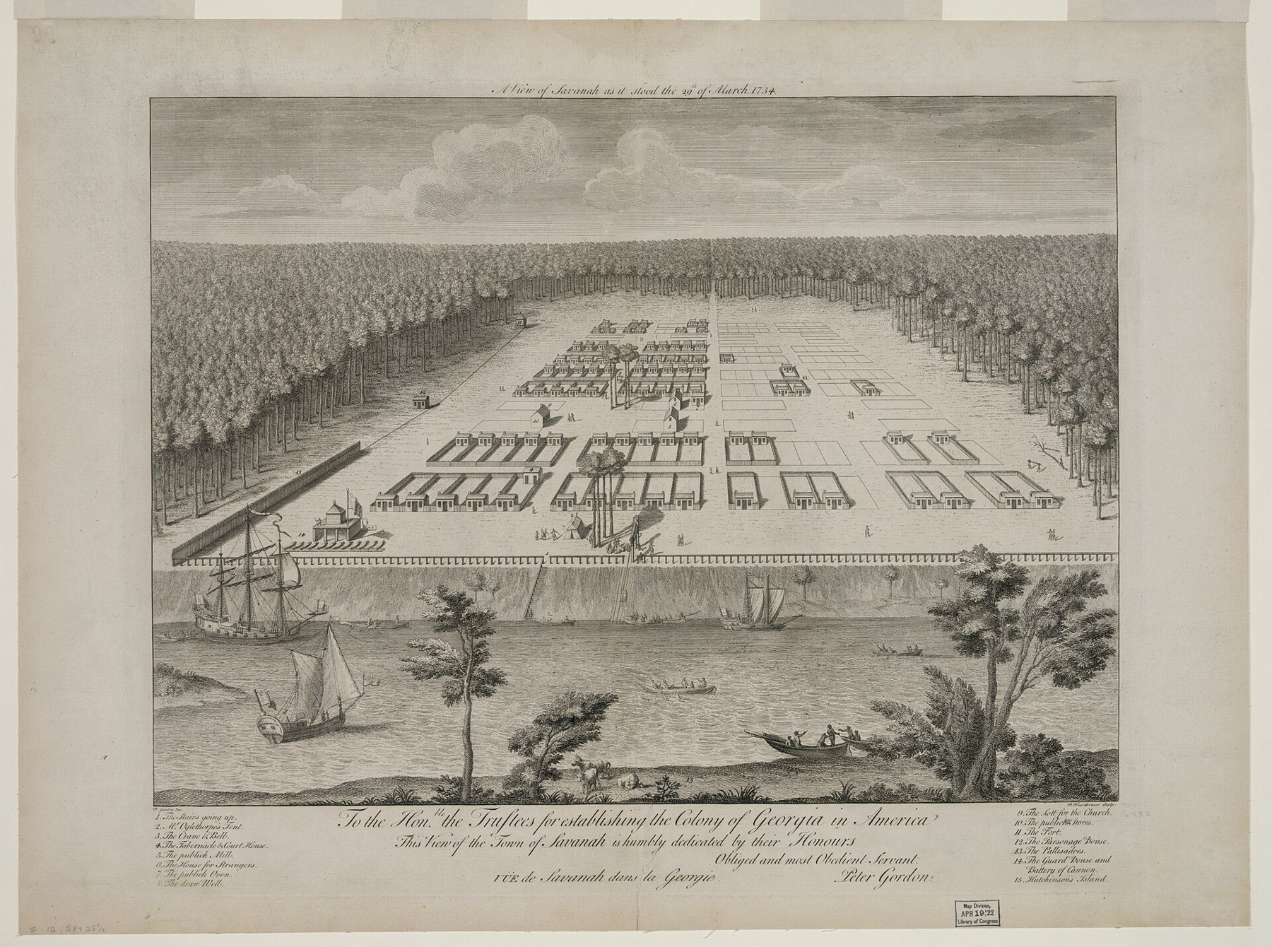
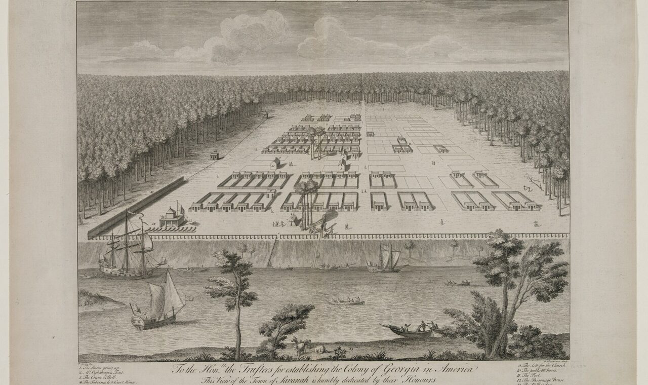
P. Fourdrinier, engraver, after Peter Gordon; Library of Congress. Public domain. Source and rights record. Resized for web display; no content alteration.
_as_it_stood_the_29th_of_March,_1734_-_P._Gordon_inv._;_P._Fourdrinier_sculp._LCCN96514600.jpg)
Peter Gordon’s view of Savannah as it stood on March 29, 1734, engraved by P. Fourdrinier, makes the early order visible. Rows of buildings and open spaces sit behind the riverfront. As an engraving, it is a selected representation rather than a modern aerial survey. Nevertheless, its arrangement gives readers a useful way to see how the town was meant to work.
The neighborhood as a repeatable unit
Savannah’s organizing unit was the ward. A ward contained a central square, groups of house lots, and larger lots reserved for community buildings. The residential groups were called tythings, a historical term that can seem more mysterious than the physical arrangement it describes. Their houses stood in regular groups around the shared center.
The distinction between a square and a ward is important. The square was the open space. The ward included that space and the surrounding development. Calling the entire system simply a collection of parks misses the relationship between public ground and private lots.
This arrangement made expansion possible by repetition. A new ward could extend the city while retaining the basic relationship among streets, homes, civic buildings, and open space. Instead of requiring every part of the growing town to look toward one distant central plaza, the plan supplied a series of neighborhood centers.
That is an interpretation of the plan’s geometry, rather than a claim that every resident experienced community in the same way. A square provides the possibility of gathering. Who feels welcome, who controls nearby property, and how the space is maintained depend on decisions beyond the drawing.
Streets organize property as well as travel
A grid supplies addresses, routes, and parcels that are comparatively easy to describe. Cross streets create repeated intersections. Blocks give buildings a recognizable relationship to public space. Surveying translates proposed lines into positions that can guide construction and distinguish land intended for streets from adjoining lots.
The economic effect can be substantial. Dividing a tract into regular blocks creates units that can be sold and developed separately. Public streets give those units access. Once buildings, utilities, and ownership accumulate along the lines, changing the arrangement becomes expensive. A plan can therefore survive long after the conditions that produced it have changed.
Yet a street line on a map is not necessarily a street already built. Plans may show future routes across undeveloped land or existing properties. A reader needs to distinguish a proposal, a legally established street, and a physically opened route. The three can have different dates. This is one reason an old city map rewards careful attention to its title, legend, and purpose.
Manhattan’s different kind of order
The Commissioners’ Plan of 1811 supplied a major framework for Manhattan’s northward growth. The New York Public Library’s archival description identifies surveyor John Randel Jr.’s work and the plan’s network of 155 numbered streets and 12 avenues. It was a projection of urban development across the island’s terrain, not a record of an already completed city.
Savannah’s repeated squares and Manhattan’s long avenues demonstrate why “grid” is a broad description. One emphasizes a succession of neighborhood open spaces. The other supplies an extensive, numbered framework for metropolitan expansion. Both organize parcels and circulation, but their arrangements produce different experiences of distance, orientation, and public space.
The New York City Landmarks Preservation Commission’s Upper West Side history documents the gap between the 1811 plan and later street construction. Surveying and planning established a framework; opening streets and developing neighborhoods unfolded over subsequent decades. Urban order could be proposed quickly on paper and realized unevenly in time.
What a crooked street can tell us
An irregular street is not necessarily evidence of poor planning. A road may preserve an earlier route, follow a riverbank, skirt difficult ground, or reflect development along separate properties. A later plan may connect these inherited pieces rather than replace them. Different explanations can coexist within one neighborhood.
It is tempting to look at a bend and invent a charming origin. The better approach is to compare dated maps and records. Does the route predate the adjoining subdivision? Did a shoreline once run nearby? Was a proposed extension ever opened? Geometry provides a question; documentary evidence supplies the answer.
Straight streets also adapt. A diagonal road crossing a grid can create triangular parcels. A large institution can close or interrupt a route. A railway, park, or floodplain can force a change in direction. A city’s pattern is usually a conversation between the original design and later needs, rather than a single idea preserved without alteration.
The plan and the society were not the same
Savannah’s founding scheme included ideals about modest holdings and industrious settlers. The society that developed around its squares changed profoundly. Georgia’s early prohibition of slavery was reversed in 1750, and the port became part of an economy dependent on enslaved labor. The Park Service’s account of Savannah’s commercial and colonial history connects the city to that wider transformation.
An orderly layout could persist while wealth and power became deeply unequal. Similar lot sizes did not prevent slavery, erase differences in status, or guarantee equal access to opportunity. Treating a pleasing plan as proof of a harmonious past leaves out the people whose labor sustained the city.
A 1904 postcard of Chippewa Square offers another kind of evidence. Trees, benches, a fountain, and a monument show an open space with its own accumulated history. It is a later view, not an illustration of what the founding settlers saw. The square’s geometry survived while its furnishings and meanings changed.
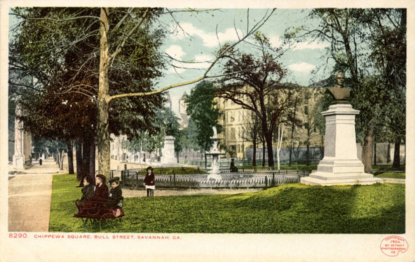
Unknown creator; Newberry Library postcard collection. Public domain. Source and rights record. Resized for web display; no content alteration.
.jpg)
Reading a city while walking it
The reward for noticing street patterns is a richer experience of an ordinary walk. A block becomes a unit of property and development. A square becomes a deliberate reservation of shared space. A crooked lane becomes a possible trace of an earlier landscape. Each suggests a story worth testing against a map.
Cities endure by combining inherited arrangements with new uses. Savannah’s squares and Manhattan’s grid show how long a framework can remain influential, but neither framework tells everything about the people living within it. The lines explain where movement and development were directed. The history explains what those directions made possible, and what they failed to resolve.
Sources and further reading
- National Park Service: Savannah and colonial city planning.
- Georgia Historical Society: Oglethorpe and Savannah’s city plan.
- New York Public Library: the 1811 Commissioners’ Plan and related records.
- New York City Landmarks Preservation Commission: Upper West Side/Central Park West extension report.
- National Park Service: Savannah’s colonial and commercial history.