
Land & Boundaries
When Common Land Became Enclosed: A Changing English Countryside
Enclosure changed more than the shape of English fields. It reorganized overlapping rights, farm management, and the resources on which rural households depended.
On This Page
- 01 — Introduction
- 02 — What was common about the land?
- 03 — Enclosure before the parliamentary era
- 04 — Turning rights into a new arrangement
- 05 — Improvement—and the question of who benefited
- 06 — Laxton: an open-field landscape that adapted
- 07 — Reading beyond the hedge
- 08 — Sources and further reading
A hedge can look like an ancient, unremarkable part of the English countryside. Yet the boundary it marks may belong to a major rearrangement of land, livelihoods, and authority. Fields that now appear to be separate farms could once have formed a shared agricultural system, with households cultivating scattered strips and exercising rights over pasture or other resources.
Enclosure changed those arrangements. It consolidated holdings, altered or extinguished common rights, and gave many landscapes a new pattern of boundaries. The process extended over centuries and differed among places. It was a transformation of both agriculture and society, rather than a single national event in which someone suddenly put fences around every field.
What was common about the land?
“Common” describes rights, not an absence of ownership. A common could have an owner while other people held recognized rights to use particular resources. Depending on local arrangements, these might include grazing animals, gathering fuel, or taking other products of the land. Rights could be associated with particular properties or people; they were not necessarily available to anyone who arrived.
The National Archives’ guide to common lands emphasizes this relationship between ownership and use. The distinction prevents a familiar misunderstanding: land used in common was not simply vacant, unowned ground awaiting a productive purpose.
Open-field farming was related to, but not identical with, common land. In an open-field system, a household’s cultivated strips could be dispersed through large fields. Shared decisions helped coordinate crop rotations and the times when animals could enter land after harvest. A farmer might control the crop grown on a strip while remaining subject to collective arrangements affecting the larger field.
The Open Spaces Society’s explanation notes that common rights could historically apply to arable or meadow land, including grazing after the harvest. A landscape could therefore contain several overlapping relationships: ownership of the soil, cultivation of a strip, and seasonal rights of use.
Enclosure before the parliamentary era
Enclosure did not begin with the Industrial Revolution. The UK Parliament’s historical overview traces it back to medieval times and describes an increasing use of parliamentary authorization in later centuries. Some changes were negotiated locally; others proceeded through statutory processes.
Parliamentary enclosure became especially important from the mid-eighteenth century. Parliament’s overview records more than 5,200 enclosure measures between 1604 and 1914, affecting about 6.8 million acres in England. These figures describe parliamentary activity, not every enclosure that ever occurred. The total history includes earlier and other forms of consolidation.
The distinction matters because a national narrative can disguise local variation. One parish might undergo a concentrated reorganization recorded in a single award. Another might change gradually through agreements and transactions. A straight hedge alone cannot identify the legal route or date of the change.
Turning rights into a new arrangement
In a statutory enclosure, commissioners and surveyors had to identify land, assess claims, and create a new distribution. The resulting award set out decisions about allotments and rights. Its map showed how those decisions related to the ground. An award was a legal instrument; the map was its spatial companion.
The National Archives’ enclosure research guide explains how to find acts, awards, and maps and how numbered plots relate to schedules of ownership and area. Reading only the map can conceal the terms under which a parcel was assigned. Reading only the written schedule makes it difficult to understand the new pattern.
The diagram below illustrates the difference between scattered strips and consolidated holdings. It depicts no real village. Its equal-sized colored areas explain arrangement, not the fairness of any historical settlement. Actual awards need to be studied on their own terms.
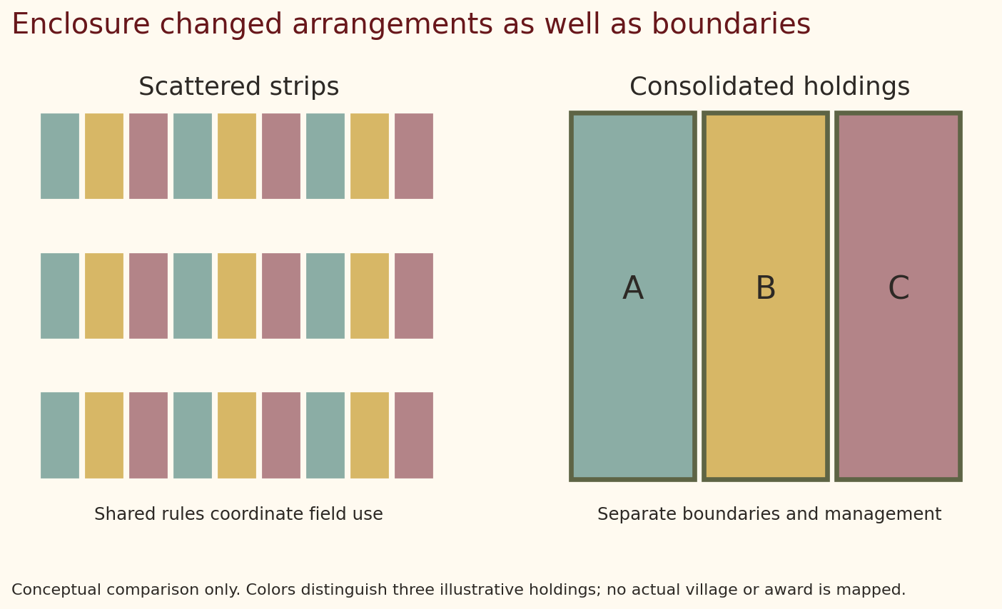
LostSurveyor. CC BY 4.0. Original explanatory diagram. Schematic, not to scale.
Surveying made the reorganization workable by connecting recognized claims to measured parcels. New boundaries, roads, and drainage arrangements could alter how farms functioned. Once a holding was consolidated, its management no longer depended in the same way on coordination across scattered strips. However, the administrative clarity of the new plan did not guarantee that everyone benefited equally.
Improvement—and the question of who benefited
Advocates saw enclosure as a means to improve agricultural management. Consolidated land could make some decisions about planting, livestock, drainage, and investment easier. A tenant or owner could pursue changes that were difficult within a system requiring collective agreement.
For households relying on common resources, the calculation could be different. The ability to graze an animal or obtain fuel might supplement a small income. Replacing that arrangement with a formal allotment changed both the resource and the obligations attached to it. Its practical value depended on such matters as location, size, access, and the household’s ability to meet new expenses.
The distinction between a recognized legal claim and a person’s economic dependence is particularly important. An award records rights accepted by the process. It may not fully reveal informal practices, unequal influence, or the experience of people whose access was not successfully recognized. A tidy schedule should be read alongside evidence about the community.
Contemporary disagreement appears clearly in the House of Commons debate of July 23, 1875. Speakers discussed food production, commoners, provision for poorer residents, and land for public recreation. Their arguments demonstrate that enclosure’s public benefit was contested at the time. Statements made in a debate are evidence of those arguments, not automatically verified descriptions of every common.
Historians likewise disagree about the extent to which enclosure drove rural people into industrial towns. Agricultural change was part of a larger set of economic and demographic changes. It would be too simple to attribute every migration, or every improvement in output, to enclosure alone.
Laxton: an open-field landscape that adapted
Laxton in Nottinghamshire preserves an exceptional surviving open-field system. The Nottinghamshire Heritage Gateway’s account describes its continuing shared arrangements and working manor court. It also explains that the system changed: strips were widened and consolidated to accommodate machinery.
Laxton is therefore valuable precisely because it is not an untouched medieval exhibit. Farmers continued to work within an inherited framework while adapting it to new equipment and circumstances. Its survival challenges the idea that agricultural history was a single, inevitable march from open fields to enclosed farms.
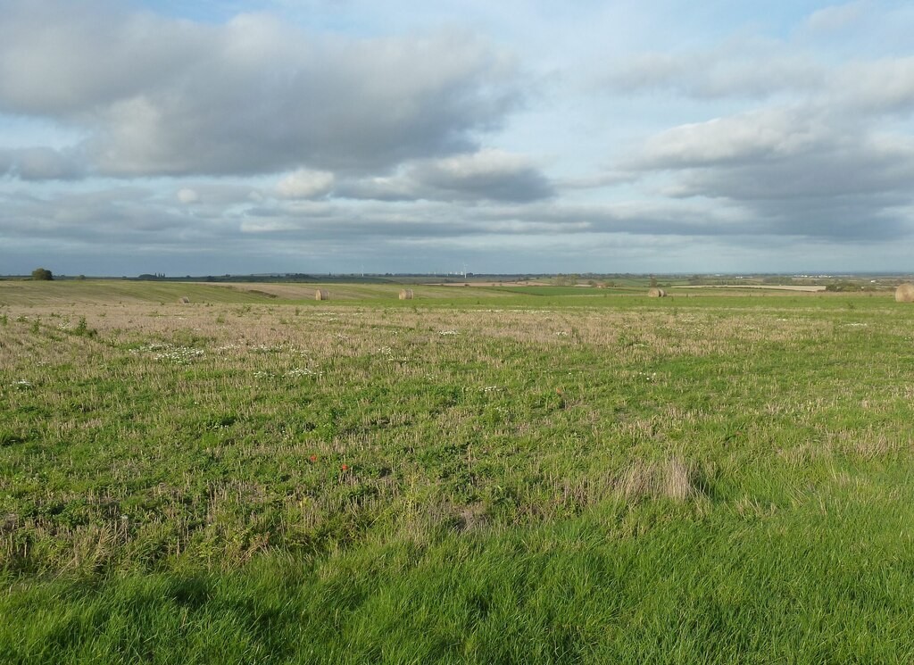
Jonathan Thacker’s photograph of West Field, taken in October 2025, shows the broad working landscape. The file’s location is identified as Laxton and Moorhouse in Nottinghamshire. It is a modern photograph, not a reconstruction of medieval cultivation, and individual historical strip rights cannot be read directly from it.
Jonathan Thacker. CC BY-SA 2.0. Source and rights record. Resized for web display; no content alteration.

Reading beyond the hedge
Enclosure’s visible legacy is a pattern of fields, but its deeper legacy concerns the relationship between property and subsistence. Land could support a household through ownership, tenancy, or a right to use a resource belonging to someone else. Changing one relationship could alter a life without moving a house.
A local enclosure map becomes more revealing when joined to its award, earlier maps, manorial records, and accounts of residents. Which rights were recognized? Where were new holdings placed? What happened to access and shared resources? Those questions recover the social world beneath the boundary lines. The countryside then appears as an inhabited history of decisions, rather than scenery that has always looked the same.
Sources and further reading
- UK Parliament: Enclosing the land.
- The National Archives: enclosure acts, awards, and maps and common-land records.
- Open Spaces Society: common-land questions.
- Hansard: enclosure debate, July 23, 1875.
- Nottinghamshire Heritage Gateway: Laxton and Nottinghamshire County Council: historic landscape character, including the surviving open fields.