
Land & Boundaries
Who Owns the Beach? Property, Public Access, and a Changing Shoreline
Florida's shoreline brings together tidal measurements, private ownership, public use, and a changing landscape. Understanding the beach begins with separating those relationships.
On This Page
- 01 — Introduction
- 02 — A public trust at the water’s edge
- 03 — What mean high water actually measures
- 04 — A boundary on land that moves
- 05 — When restoration establishes a different line
- 06 — Using land and owning land are different relationships
- 07 — The route from the road matters too
- 08 — Reading the shore with greater understanding
- 09 — Sources and Further Reading
A beach looks continuous. Sand runs past a hotel, a public park, a condominium, and a quiet residential street without displaying the distinctions recorded in their deeds. The surf moves across all of them. People arrive expecting a place to swim or walk, while the owners of adjoining land may see the seaward edge of a valuable property. Much of the argument begins with a deceptively simple question: where does one holding end and another begin?
Florida offers a useful introduction because its beaches combine extensive public use, private waterfront ownership, and a shoreline that changes continually. Understanding that combination requires separating three questions. Who owns the ground? What rights do other people have to use it? How can they lawfully reach it? A survey helps answer the first question, but documents, statutes, court decisions, and established rights also matter. The same stretch of sand can involve more than one of these relationships.
A public trust at the water’s edge
Article X, section 11 of the Florida Constitution places lands under navigable waters that have not been alienated, including beaches below mean high-water lines, in state ownership held in trust for the people. That constitutional qualification matters: the provision describes a legal framework, rather than supplying a ready-made ownership map for every waterfront parcel. Its central idea is nevertheless straightforward. Certain coastal lands are held for a public purpose rather than treated simply as an extension of the nearest private lot. The constitutional text is the starting point for understanding the relationship.
An upland owner may possess land adjoining that public shoreline. Deeds and other records identify the holding, while the applicable boundary rules determine its relationship to the water. The owner can also have associated rights, including access to the water. Those rights are significant, but owning a waterfront residence does not mean owning the sea beyond it.
The difficulty for a visitor is that this arrangement rarely appears as an obvious division on the ground. A fence might mark an inland side line without marking the seaward boundary. A sign communicates a claim or an instruction; it does not, by itself, prove the extent of the title. Conversely, an absence of signs does not establish a right to cross someone else’s property.
What mean high water actually measures
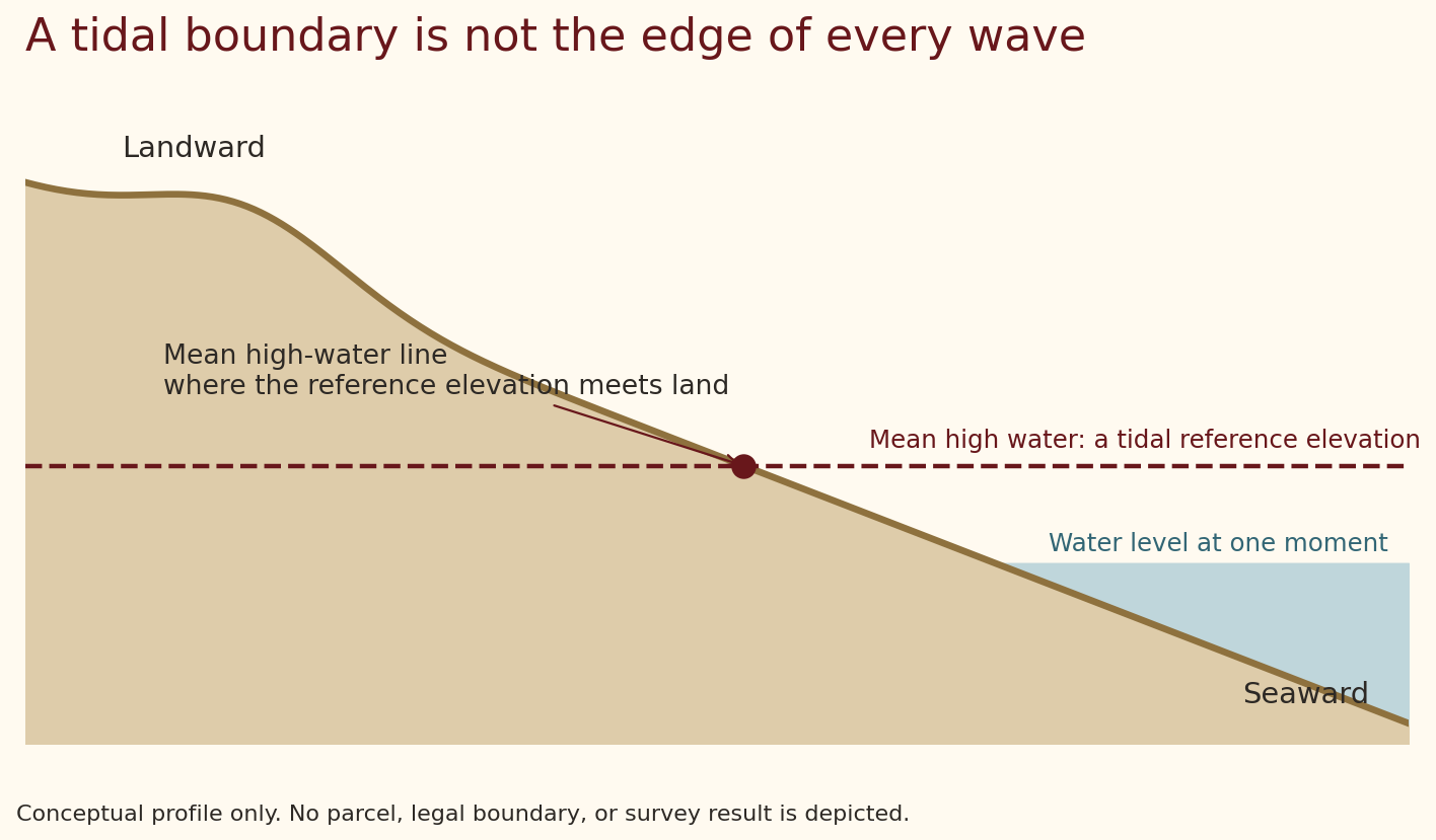
Mean high water is a tidal reference elevation: the average of the high waters over an established observation period. NOAA ordinarily calculates tidal datums using a nineteen-year National Tidal Datum Epoch, accounting for recurring variations in the tides. These datums are local relationships, not one universal height that can be applied unchanged around Florida. A shoreline survey may use shorter observations linked to an established control station; it does not require a survey crew to remain on one beach for nineteen years. NOAA’s datum definitions explain the measurement behind the terminology.
The mean high-water line is where that reference elevation intersects the land. This distinction between an elevation and its intersection with the beach explains why the line can be difficult to recognize. On a gently sloping beach, a small vertical difference can correspond to a considerable horizontal distance. A steep profile produces a different result.
LostSurveyor. CC BY 4.0. Original explanatory diagram. Schematic, not to scale.
The water’s edge at a particular moment reflects that day’s tide and conditions. Waves run up the beach; wind and atmospheric pressure influence water levels; a recent storm may leave a conspicuous debris line. None of those observations automatically identifies the legally relevant mean high-water line. Describing the public shore as the “wet sand” is therefore a useful conversational shortcut only when its limitations are understood.
Surveyors connect tidal information to measurements of the beach and to the records applicable to the property. Florida’s coastal mapping provisions define the terminology and establish procedures for determining these lines. The work translates an abstract reference into a location on changing terrain. It does not turn every visible tide mark into a property monument.
A boundary on land that moves
Beaches exchange sand with the nearshore seabed, dunes, and neighboring stretches of coast. Their shape can change after a storm and again during subsequent recovery. The legal history of a waterfront parcel consequently includes the history of the physical shore.
Two useful terms are accretion and avulsion. Accretion describes gradual additions of land; avulsion involves a sudden change. Florida law treats gradual and sudden changes differently, and the distinction can affect whether a boundary moves. Erosion introduces the corresponding problem of land being removed. The result cannot be determined from the size of a single storm or the apparent position of the surf in one photograph.
For a family that has occupied a coastal property for generations, these changes may have practical and emotional significance. A familiar path can disappear, a dune can migrate, or a former building site can become exposed shore. For the public, the same changes may narrow a walking route or alter a park entrance. Physical change affects several interests at once, which helps explain why a shoreline dispute can become more complicated than its initial description suggests.
When restoration establishes a different line
Beach restoration adds another layer. In qualifying projects governed by Florida’s Beach and Shore Preservation Act, an established and recorded erosion control line replaces the moving mean high-water boundary for the relevant ownership relationship. Section 161.191 addresses the vesting of title on either side of that line and the effect on subsequent changes. An erosion control line is thus a specific legal and surveying feature; it should not be confused with the location of today’s waves.
This distinction became central in Stop the Beach Renourishment, Inc. v. Florida Department of Environmental Protection. Owners challenged the legal consequences of a project involving Destin and Walton County. On June 17, 2010, the United States Supreme Court affirmed the Florida Supreme Court’s judgment, concluding that the decision before it had not taken the owners’ property without compensation. The justices did not agree on every broader constitutional theory discussed in the case. The Court’s syllabus separates the outcome from those additional debates.
For the general reader, the important geographical lesson is that an engineered beach may have an ownership boundary established through a recorded legal process. Newly dry sand does not automatically acquire the same ownership status as adjacent upland. The history of the restoration project can be as important as the current beach profile.
Using land and owning land are different relationships
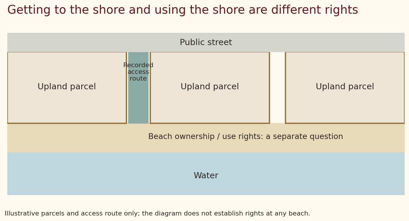
Land ownership is not the only basis for public use. A government may own a beach parcel outright. An easement—a defined right to use land held by someone else—may provide a route or permit particular activities. Florida also recognizes a doctrine of recreational customary use under which qualifying historical public use can support rights on certain privately owned dry-sand beaches.
Customary use depends on evidence and legal findings. It is not established merely by a visitor’s assumption that every beach has always been available to everyone. Nor does a recognized public use necessarily transfer ownership of the underlying land. The scope of the use and the title are separate questions.
The statutory procedure has changed recently. In 2018, section 163.035 imposed a judicial procedure on local governments seeking to establish recreational customary use. Chapter 2025-178, effective June 24, 2025, repealed that section. The Florida Senate’s explanation describes a return to local customary-use ordinances without the repealed procedure, with disputes still subject to the common-law doctrine and judicial review. Older accounts of the 2018 law can therefore misdescribe the current framework. The repeal did not declare every privately owned dry-sand beach public. The enacted bill record and Senate summary document the change.
The route from the road matters too
A public shoreline is of limited practical value if people cannot reach it. Access may come through a publicly owned park, a dedicated street end, or a recorded easement across upland. Those routes have their own locations and conditions. The right to use shoreward land does not automatically establish a right to walk through an adjoining private yard.
LostSurveyor. CC BY 4.0. Original explanatory diagram. Schematic, not to scale.
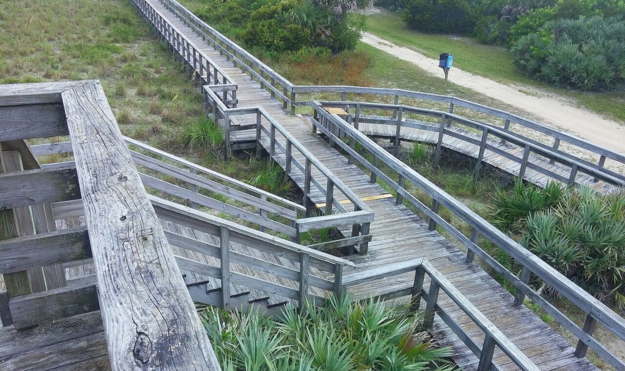
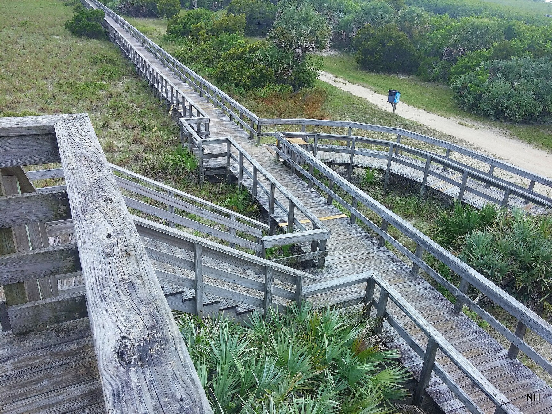
Boardwalks show how access can be organized physically. A defined approach can guide pedestrians over vulnerable dunes and connect an inland entrance to the beach. It also gives visitors a recognizable route, reducing uncertainty about where to go. The boardwalk at Smyrna Dunes provides a real example of this kind of coastal approach; its photograph illustrates the physical infrastructure, not an adjudication of property rights.
nick hoke. CC BY 3.0. Source and rights record. Resized for web display; no content alteration.

Parking, accessibility, maintenance, dune protection, and the placement of entrances also influence who can enjoy a public shore. A legal right and a convenient opportunity to exercise it are closely related, but they are not identical. That distinction places beach access within a larger discussion about how communities organize shared places.
Reading the shore with greater understanding
The apparent simplicity of a beach conceals several histories: tidal observations, deeds, natural changes, restoration projects, and patterns of public use. A sound explanation keeps those histories together without pretending that one photograph or one general rule settles every parcel.
Surveying gives this discussion a physical foundation. It helps locate relevant lines, connect records to terrain, and describe changes clearly. Public institutions and legal processes determine the rights attached to that geography. The resulting shore is both a landscape and a meeting place for private interests, shared recreation, and the enduring movement of water and sand.
Sources and Further Reading
- Florida Constitution, Article X, section 11: sovereignty lands.
- Florida Statutes, chapter 177, Part II: coastal mapping.
- NOAA: tidal datum definitions and observation periods.
- Florida Statutes, section 161.191: erosion control lines and title.
- United States Supreme Court: Stop the Beach Renourishment syllabus.
- Florida Senate: enacted CS/SB 1622 and its 2025 summary.
Legal framework and source links checked October 8, 2026. The diagrams explain general relationships and do not locate boundaries or determine access rights at a particular property.