

Measuring the World
A History of Datums in America, Part 1: From Colonial Surveys to NAD 27 and NGVD 29
From colonial metes-and-bounds surveys and Mason and Dixon to the Coast Survey, U.S. Standard Datum, NAD 27, State Plane coordinates, and NGVD 29.
On This Page
- 01 — Introduction
- 02 — A necessary distinction
- 03 — Before national datums: every survey began somewhere
- 04 — Mason and Dixon: astronomy meets a colonial boundary
- 05 — George Washington and the surveyor-statesmen
- 06 — Lewis and Clark connect observations across the West
- 07 — 1807: the federal government enters geodesy
- 08 — Local and regional datums were the rule
- 09 — The New England Datum and the first regional unification
- 10 — A transcontinental arc ties the nation together
- 11 — 1901: the United States Standard Datum
- 12 — 1927: the North American Datum receives a great readjustment
- 13 — Why old NAD 27 coordinates cannot simply be relabeled
- 14 — State Plane gives the states usable grids
- 15 — The vertical problem: what does “elevation” mean?
- 16 — 1929: a national Sea Level Datum
- 17 — American datums beyond the lower forty-eight
- 18 — A century summarized
- 19 — The achievement—and the limit—of the classical era
- 20 — Sources and further reading
An old survey can give you a perfectly legible coordinate and still leave you with a puzzle: where was its zero? A courthouse, a tide gauge, a triangulation station in Kansas, and Earth’s center of mass have all played different roles in the way Americans describe position. Following those reference points explains how thousands of separate surveys gradually became a connected national framework.
A necessary distinction
A datum is a reference framework used to give coordinates or elevations meaning. A projected coordinate system, such as State Plane, uses a map projection to represent positions from a curved Earth on a flat grid. A property boundary is a legal location established from evidence. These ideas interact, but they are not interchangeable. When a datum changes, the coordinate numbers assigned to a corner may change even though the corner and the boundary remain in the same place.
Before national datums: every survey began somewhere
In colonial America there was no national geodetic network and no continent-wide datum. A survey ordinarily began from something local: a marked tree, a stone, a road, a riverbank, a known corner, an astronomical observation, or a magnetic bearing. The surveyor’s immediate task was to describe a parcel well enough that neighbors and future surveyors could find it again.
Most eastern colonies inherited a metes-and-bounds tradition. A deed might begin at a white oak, continue “north forty-five degrees east” for a stated number of poles, follow a creek, and return along a neighbor’s line. Distance could be measured with Gunter’s chain, while direction came from a compass. The work was practical, local, and often surprisingly durable. It was not, however, referenced to a single mathematical model of the Earth.
Magnetic bearings introduced a special difficulty. Magnetic north changes by place and time, and early surveyors did not always document the declination they used. Trees died, streams shifted, roads moved, and chains differed in length or calibration. Colonial plats can therefore be internally useful while resisting any simple conversion into modern latitude and longitude.
Mason and Dixon: astronomy meets a colonial boundary
One of the most famous surveys in American history began as a dispute between the proprietors of Pennsylvania and Maryland. Between 1763 and 1767, Charles Mason and Jeremiah Dixon used astronomical observations and careful ground measurement to establish much of the boundary that now bears their names.
The Mason–Dixon survey was not a national datum. It was a particular boundary survey, created decades before the United States existed. Yet it demonstrated a principle that would become central to geodesy: a line could be carried over great distance by combining precise instruments, astronomical reference, measured baselines, and repeated checks. The work also shows why a datum is never merely an office convention. It is made real through observations, monuments, instruments, calculations, and people in the field.
George Washington and the surveyor-statesmen
Surveying was woven into early American leadership. George Washington began professional surveying as a teenager and received a commission in 1749 to serve as surveyor of Culpeper County, Virginia. His surviving plats and field work reveal a young man learning land, distance, recordkeeping, and the practical consequences of uncertain boundaries. Those experiences preceded his military and political careers.
Thomas Jefferson was not a career field surveyor in the same sense, but he understood surveying as an instrument of government. The Land Ordinance of 1785 helped establish the rectangular survey system for public lands. Townships, ranges, sections, and aliquot parts imposed a repeatable framework on western land disposal. The Public Land Survey System was not itself a geodetic datum; it was a cadastral system. Its lines and corners nevertheless became one of the most influential geographic frameworks in the nation.
Abraham Lincoln later worked as a deputy surveyor in Sangamon County, Illinois, beginning in 1833. Like Washington, he practiced surveying before becoming president. Lincoln’s work belonged to the world of local land division rather than national geodesy, but it illustrates how important surveyors were to growing communities. Roads, towns, farms, taxation, and ownership all required someone who could measure, calculate, and leave an understandable record.
Lewis and Clark connect observations across the West
The Lewis and Clark Expedition of 1804–1806 was neither a cadastral survey nor the creation of a datum. It was exploration, science, diplomacy, and mapping on a continental scale. Meriwether Lewis and William Clark used compasses, dead reckoning, time, latitude observations, celestial observations, river courses, and information supplied by Indigenous peoples and traders.
Clark repeatedly turned field notes and measurements into maps. Those maps gave the young United States a far better picture of the Missouri and Columbia river systems and the geography between them. Their work belongs in the history of datums because it demonstrates the problem that datums eventually solved: observations made at many places must be tied into a coherent framework before they can form a dependable map.
1807: the federal government enters geodesy
In 1807, President Jefferson signed legislation creating the Survey of the Coast, the ancestor of today’s National Geodetic Survey. The immediate purpose was nautical safety and accurate coastal charts, but a chart could not be better than the geographic framework beneath it.
Ferdinand Rudolph Hassler, a Swiss-born scientist, became the first superintendent. Hassler proposed a geodetic triangulation network as the skeleton for shoreline topography and offshore hydrography. Surveyors would measure a baseline with extraordinary care, observe angles from prominent stations, and extend a connected fabric of triangles across the landscape.
Hassler’s method was slow, expensive, and scientifically demanding. It was also fundamentally sound. Once a network was established, many local surveys and maps could share the same control rather than beginning from unrelated origins.
Alexander Dallas Bache, Benjamin Franklin’s great-grandson and the second superintendent of the Coast Survey, greatly expanded the organization during the nineteenth century. Under Bache, the agency advanced hydrography, topography, tides, geomagnetism, and the mathematical adjustment of triangulation networks. The Coast Survey was becoming not only a charting office, but one of the federal government’s major scientific institutions.
Local and regional datums were the rule
Even as federal triangulation spread, the country remained a patchwork. A city might establish coordinates from an observatory, courthouse, city-hall monument, or convenient baseline. A railroad could adopt its own alignment and elevation system. A canal, harbor, drainage district, highway department, or state survey could define another. Vertical work was often referred to a nearby tide gauge, river gauge, assumed bench mark, or an arbitrary elevation such as 100 feet (30.48 meters).
These systems are sometimes loosely called local datums. Some were rigorous regional networks; others were simply project coordinate or elevation systems. Their value depended on purpose. An assumed elevation could serve a construction project perfectly well, yet it could not automatically be compared with a harbor datum fifty miles (about 80 kilometers) away.
This history still appears in modern records. Surveyors encounter “city datum,” “county datum,” “railroad datum,” “drainage district datum,” and elevations tied to marks whose origin has been forgotten. The label is not enough. One must find the defining monument, adjustment, benchmark description, conversion, or surviving common points.
The New England Datum and the first regional unification
By 1879, Coast Survey triangulation connected enough of the eastern United States to support a common datum. NGS identifies the New England Datum as the country’s first official geodetic datum. Its name describes the early network’s regional reach, rather than a separate modern state system. The datum used the Clarke 1866 ellipsoid; station PRINCIPIO in Maryland supplied its initial point, with orientation toward TURKEY POINT.
The word “ellipsoid” is important. Surveyors needed a smooth mathematical surface that approximated the size and shape of Earth. Latitude and longitude could then be calculated on that surface. The Clarke 1866 ellipsoid fit North American observations reasonably well for its time, but it was not Earth-centered in the modern satellite sense.
A transcontinental arc ties the nation together
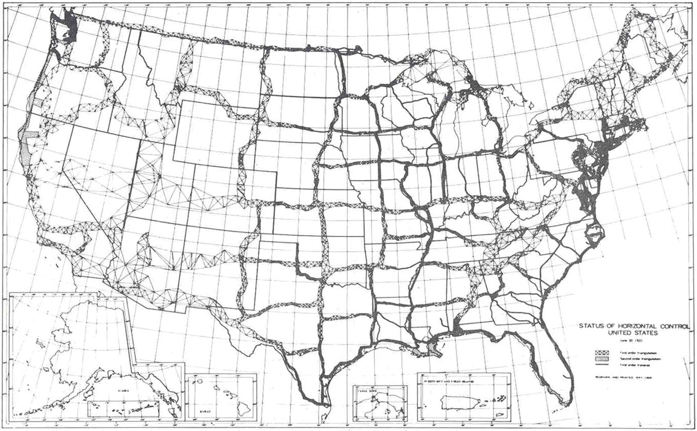
During the late nineteenth century, surveyors pushed a great arc of triangulation westward, largely along the 39th parallel. It was a monumental field and computational undertaking. Towers had to be built so distant stations could see one another. Angles were repeated. Baselines were measured. Astronomical observations controlled orientation. Observations made at different times and by different parties had to be reconciled mathematically.
This transcontinental work connected the eastern network with surveys along the Gulf and Pacific coasts. The nation was finally approaching a horizontal reference system broad enough to deserve the word “national.”
1901: the United States Standard Datum
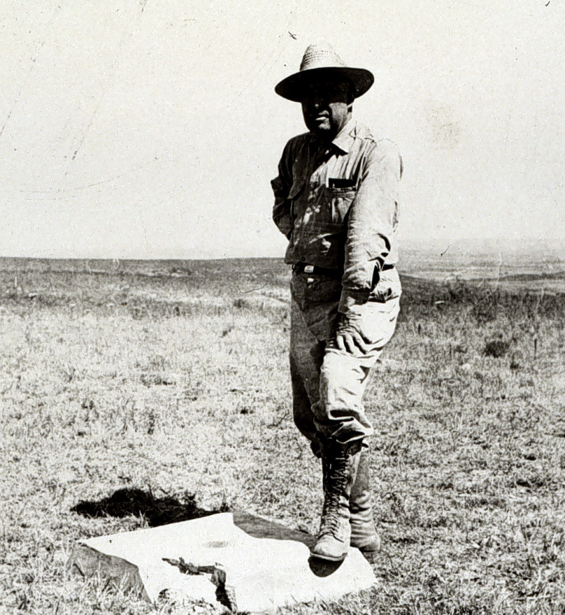
In 1901, the United States adopted the United States Standard Datum, commonly abbreviated USSD. The adjustment drew together the transcontinental arc and other regional surveys. Its fundamental station was MEADES RANCH in Kansas, near the geographic center of the conterminous United States. The network continued to use the Clarke 1866 ellipsoid.
U.S. Coast and Geodetic Survey / NOAA. Public domain. Source. Resized by WordPress.

Putting the origin near the middle of the connected network helped distribute the fit across the continent. MEADES RANCH was a physical station in the triangulation, not a measurement of Earth’s center. That distinction would become important once satellites made a global view practical.
When Canada and Mexico agreed in 1913 to base their triangulation on the same system, the United States Standard Datum was renamed the North American Datum. The underlying framework did not suddenly move because the name changed. The new name acknowledged its continental reach.
1927: the North American Datum receives a great readjustment
Networks accumulate inconsistency. New observations are added, old observations improve, and previously separate arcs are connected. By the 1920s, the existing North American Datum could no longer absorb the expanding network gracefully. The solution was a major continent-wide least-squares adjustment.
U.S. Coast and Geodetic Survey / NOAA. Public domain. Source. Resized by WordPress.

The result was the North American Datum of 1927, or NAD 27. The name marks the beginning of the great readjustment, not an overnight replacement of every coordinate. It retained MEADES RANCH as the fundamental station and the Clarke 1866 ellipsoid, while bringing the observations into a more consistent mathematical relationship. NGS’s historical account places the adjustment work in 1927–1932.
For much of the twentieth century, NAD 27 was the horizontal foundation beneath federal maps, highway plans, boundary work, and State Plane coordinates. A coordinate labeled “NAD 27” therefore carries a particular history: a surface-based continental triangulation network, a locally fitted ellipsoid, and a fixed origin in Kansas.
Why old NAD 27 coordinates cannot simply be relabeled
NAD 27 and modern NAD 83 realizations use different origins, ellipsoids, observations, and adjustments. The numerical difference varies geographically. Adding one constant northing and easting shift is usually not a defensible regional transformation. NGS developed NADCON grids because the historical network distortions vary from place to place.
State Plane gives the states usable grids
Latitude and longitude are excellent for describing position on an ellipsoid, but they are inconvenient for ordinary engineering calculations. During the 1930s, the Coast and Geodetic Survey worked with states to develop the State Plane Coordinate System. Each zone used a map projection selected to keep distortion acceptably small within that zone.
State Plane Coordinate System of 1927, or SPCS 27, was referenced to NAD 27. The system supplied surveyors and engineers with rectangular coordinates—northings and eastings—while preserving a defined relationship to the national datum.
Florida’s familiar East, West, and North zones reflect the practical reason for multiple zones: the state is too large and differently oriented for one traditional projection to minimize distortion everywhere. State Plane is not the datum itself. “Florida East” without “NAD 27,” “NAD 83,” the realization, and the unit is incomplete information.
The vertical problem: what does “elevation” mean?
Horizontal position was only half the national problem. Engineers also needed elevations that agreed across cities, watersheds, railroads, canals, and state lines. Early elevations often came from local mean sea level observations or assumed bench marks. Two nearby systems could both call their zero “sea level” and still disagree.
The Survey of the Coast began determining coastal elevations by trigonometric methods as early as 1817. More precise spirit leveling followed. NGS identifies an 1856 line along the Hudson River as the first geodetic leveling in the United States. Over subsequent decades, long leveling lines crossed the country and were connected into a national network.
1929: a national Sea Level Datum
The general adjustment completed in 1929 produced what was originally called the Sea Level Datum of 1929. It held mean sea level values fixed at 26 tide gauges in the United States and Canada and adjusted a vast network of leveling among them.
The name encouraged a misunderstanding. Mean sea level is not the same everywhere at the same moment, and holding many tide gauges fixed forced sea-surface differences and leveling errors into the adjustment. In 1973 the datum was renamed the National Geodetic Vertical Datum of 1929—NGVD 29—to make clear that it was a national reference surface, not a claim that zero elevation exactly equaled local mean sea level everywhere.
NGVD 29 became embedded in public works, flood studies, highway plans, municipal records, subdivisions, and countless bench-mark systems. Its long use explains why “29 datum” still appears in records today. It also explains why a transformation to a newer datum must be treated as a modeled, location-dependent operation rather than a universal constant.
American datums beyond the lower forty-eight
The national story was never confined to one network. Alaska, Hawaii, Puerto Rico, the Virgin Islands, Guam, American Samoa, and other islands and territories had their own observational histories and practical constraints. Regional systems such as the Old Hawaiian Datum, Puerto Rico Datum, Guam Datum of 1963, and American Samoa Datum of 1962 served places that could not initially be connected to the continental network by conventional triangulation.
There were also numerous local island, military, harbor, city, and state systems. Their existence was not evidence of carelessness. Before satellites, oceans were genuine barriers to high-accuracy geodetic connection. A datum could be excellent within its intended region while remaining incompatible with a datum on another island or continent.
A century summarized
| Period | Development | Why it mattered |
|---|---|---|
| Colonial era | Local metes-and-bounds surveys, magnetic bearings, astronomical observations, and colony-specific boundary work | Land could be conveyed locally, but no national coordinate framework existed. |
| 1763–1767 | Mason and Dixon survey the Pennsylvania–Maryland boundary | Precise astronomy and measurement carried a major line across difficult terrain. |
| 1785 | Land Ordinance advances the rectangular public-land system | A repeatable cadastral framework shapes settlement of the public domain. |
| 1804–1806 | Lewis and Clark observe, measure, and map western geography | Field observations are assembled into a coherent continental picture. |
| 1807 | Jefferson establishes the Survey of the Coast | The federal government begins building a scientific geodetic framework. |
| 1879 | New England Datum | The first official U.S. geodetic datum connects eastern surveys. |
| 1901 | United States Standard Datum | A connected national horizontal datum is adopted. |
| 1913 | Renamed North American Datum | Canada and Mexico participate in the continental system. |
| 1927 | NAD 27 | A major adjustment becomes the horizontal standard for much of the twentieth century. |
| 1929 | Sea Level Datum of 1929, later NGVD 29 | A national vertical network replaces many disconnected elevation systems. |
| 1930s | State Plane Coordinate System | States receive practical rectangular grid coordinates tied to NAD 27. |
The achievement—and the limit—of the classical era
By the middle of the twentieth century, the United States possessed something colonial surveyors could scarcely have imagined: continent-spanning horizontal and vertical networks, standardized marks, national adjustment methods, State Plane grids, and published control available to local surveyors.
Yet the system remained rooted in physical marks, optical lines of sight, spirit-level routes, and Earth models selected before spaceflight. Network distortions accumulated. Bench marks moved. Canada, Mexico, islands, and distant territories were not equally served. Most importantly, satellites would soon allow surveyors to measure position relative to Earth’s center of mass rather than extend coordinates from monument to monument.
That technological change did not merely produce better instruments. It forced geodesists to rethink what a national datum should be.
Sources and further reading
- NOAA National Geodetic Survey: NGS History
- NOAA NGS: Ferdinand Rudolph Hassler
- NOAA NGS: Alexander Dallas Bache
- NOAA NGS: Leveling and Vertical Networks
- NOAA NGS: U.S. Standard Datum
- NOAA NGS: North American Datum
- Library of Congress: Washington as Public Land Surveyor
- National Park Service: William Clark, A Master Cartographer