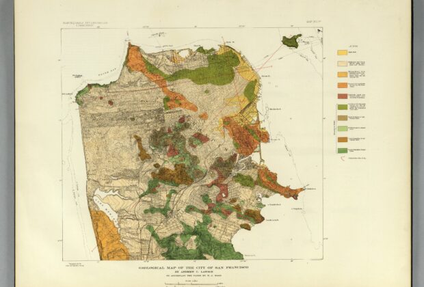
Published with the investigation of the 1906 California earthquake, this map places San Francisco’s streets over ten geological units and identifies the original shoreline. Contours and spot heights…
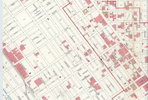
Published before San Francisco’s 1906 earthquake and fire, this block-line map records streets, selected buildings, fire limits and waterfront facilities in the central city. Its key distinguishes construction…
Property lines and business names make this a detailed record of San Francisco’s Chinatown, but its racial and occupancy categories also reveal the viewpoint of the officials who…
This map measures recovery through buildings. The burned district provides the outline, while new and ongoing construction records the city’s progress two years after the 1906 earthquake and…