
Measuring the World
Painting the Seafloor with Sound: The Multibeam Survey
A boat can cross a complicated landscape without anyone on deck seeing it. Multibeam sonar turns returning echoes into a picture of that hidden terrain.
On This Page
A boat can pass over ridges, channels, and a wreck while the people aboard see only water. The landscape below may be as complicated as anything on land, but its familiar clues are missing. There is no distant hill to sight and no surface to walk across.
Hydrographic surveying gives that hidden landscape a description. Multibeam sonar does it with sound, turning echoes into observations of the bottom and, in some systems, features in the water above it.
A strip of terrain with each pass
An echo sounder transmits an acoustic pulse and listens for returning energy. The time out and back, interpreted with the speed of sound in the water, provides range information. The position and direction of that observation allow it to be placed in a spatial model.
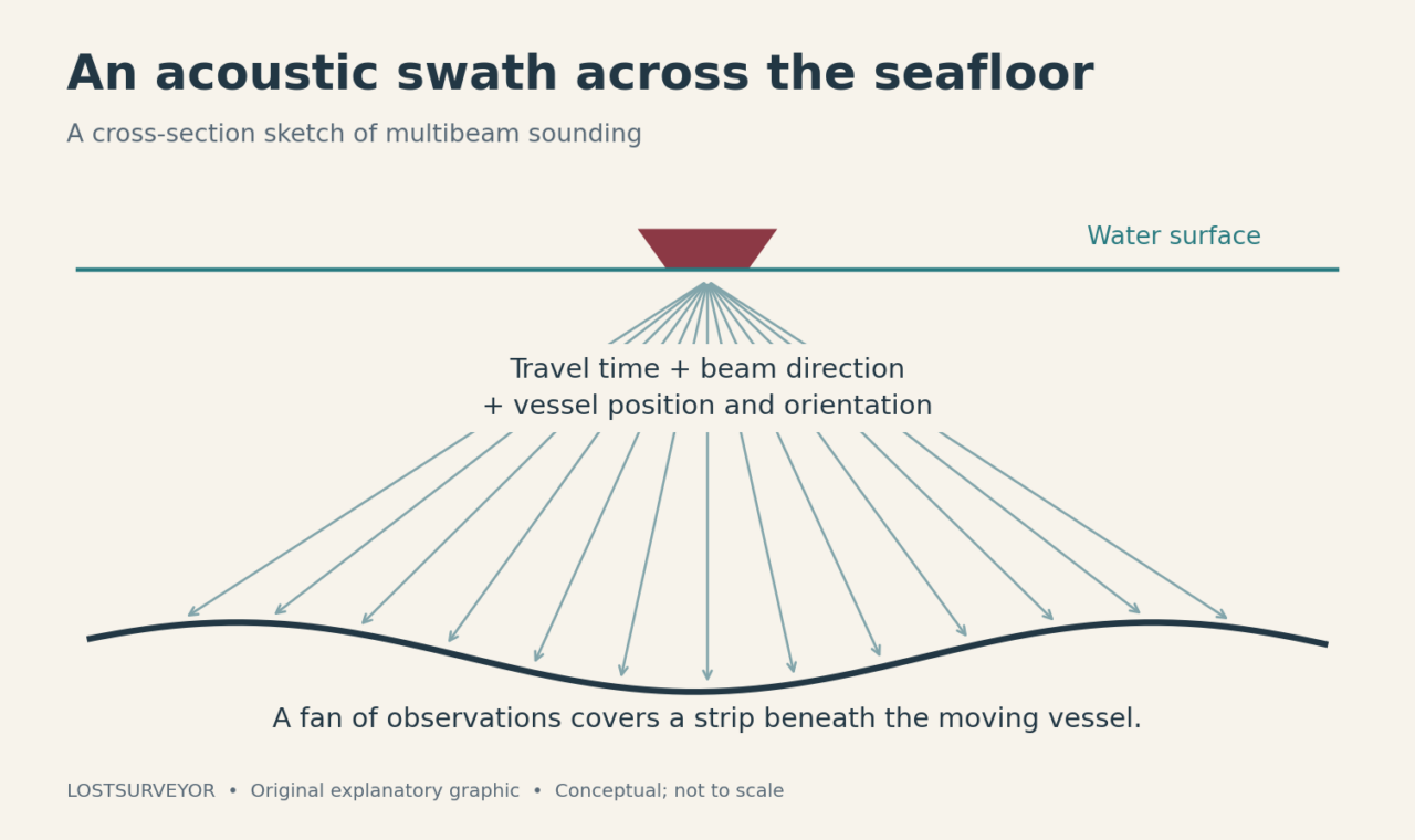
A multibeam system resolves many observations across a fan-shaped swath. Instead of following only a narrow track directly beneath the vessel, it records a strip extending to either side. As the boat moves along planned lines, those strips build coverage of the survey area.
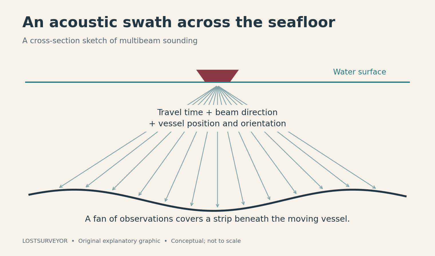
Original explanatory graphic for LostSurveyor. Conceptual cross-section; not to scale.
The result is bathymetry: measurements and representations of underwater depth and terrain. A colorful bathymetric model can look like a landscape after the sea has been politely removed. That is an irresistible way to see a place, but the picture rests on much less theatrical information about travel times, directions, and the moving platform.
The water changes the journey
Sound speed is not a single unchanging number throughout the ocean. Temperature, salinity, and pressure influence it. A hydrographer needs to understand the water column because an error in sound speed changes the interpretation of the returning echo.
Variation with depth also bends acoustic paths through refraction. For an angled observation, that affects where the sounding belongs as well as its depth. Sound-speed profiles help the processing describe the journey more realistically than a simple straight-line sketch.
It is a useful reminder that the medium is part of the instrument’s working environment. The sonar does not merely measure across water. Its measurement is shaped by the water it crosses.
The tripod is moving
The vessel’s motion adds another layer. Roll and pitch change its orientation; heave moves it vertically; heading changes the direction of the swath. Position, motion, sensor relationships, and timing have to work together so an echo is associated with the platform’s state when it was observed.
The bottom should not inherit the boat’s wobble. Corrections and calibration are what separate the two. A calm-looking display on the computer is the result of accounting for movement, not evidence that the movement never happened.
Depth also needs an agreed reference. The instantaneous water surface is not a fixed zero for every visit. Hydrographic data may be related to water-level datums or collected in an ellipsoidal reference system and transformed for a particular product. The reference relationship matters when different observations are compared.
The bottom has an appearance, too
Multibeam systems can record backscatter, the strength of returning acoustic energy. Bathymetry describes shape; backscatter adds clues about what is reflecting the sound. Different seabed materials and surface characteristics can return energy differently.
Those clues are valuable, but they are not a laboratory sample in disguise. Interpreting bottom type can involve other evidence, including imagery or physical sampling. A strong return is an observation to explain, rather than a complete identification of what lies there.
Water-column backscatter can also reveal features such as bubble plumes or aggregations of organisms. A mapping pass may therefore raise questions about the space above the bottom as well as the bottom itself.
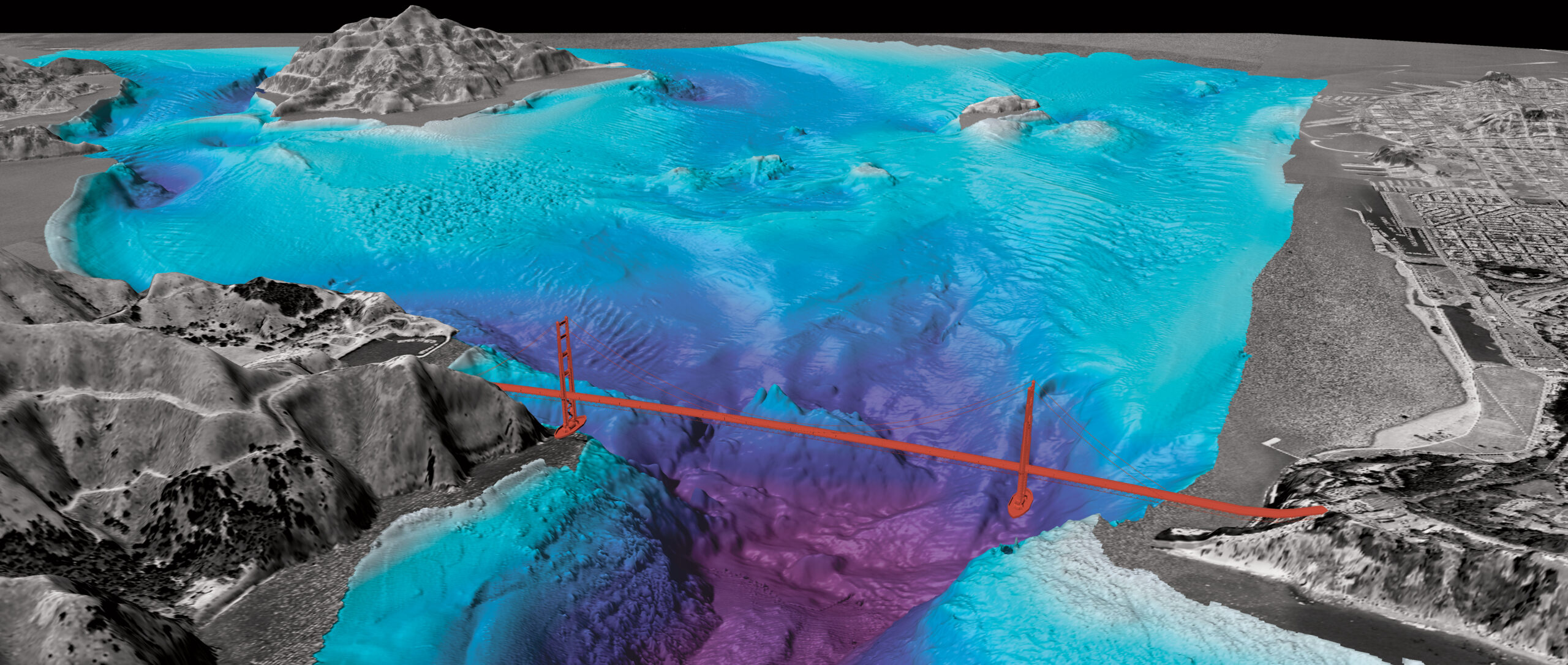
Image: U.S. Geological Survey; public domain. Source and project description. WordPress resized the original.
Not every sonar tells the same story
Side-scan sonar is especially useful for searching and imaging objects and seabed patterns. Conventional side-scan imagery should not be treated as interchangeable with a multibeam depth model. Some specialized systems combine capabilities, but “sonar” is a family of approaches, not one uniform product.
The same distinction applies to a survey’s purpose. A view intended to reveal large landforms, a search for an obstruction, and a detailed charting survey may use related tools while asking different questions of the data.
I find the underwater part of surveying especially appealing because it makes our dependence on instruments so visible. On land, the scenery can tempt us to think we already understand a place. Offshore, the water surface offers almost no such reassurance. The observations have to introduce the landscape.
A hidden place becomes a place
Multibeam surveys support navigation, investigation of seabed features, and planning further exploration. They give people a spatial basis for deciding where to look more closely and how to understand what they find.
The beauty of a seafloor model is not merely its color. It is the sudden recognition that the apparently blank water was covering terrain all along. A boat crossed it, the sound returned, and careful surveying made the invisible landscape legible.
Sources and further reading
- NOAA Ocean Exploration: Multibeam sonar — Acoustic sounding and the fan-shaped view of the bottom.
- NOAA Office of Coast Survey: Hydrographic equipment — The complementary instruments aboard a hydrographic survey platform.
- NOAA: Hydrographic Survey Specifications, 2021 — Technical background on sound speed and vessel-motion corrections; cited for principles, not as a current compliance checklist.
- NOAA: Ellipsoidally referenced surveys — Connecting hydrographic measurements to vertical reference systems.
- NOAA Ocean Exploration: Backscatter — What echo strength can reveal beyond depth.
- USGS: Multibeam bathymetry of San Francisco Bay — The public-domain perspective view and its vertical exaggeration.