
Measuring the World
When Coordinates Expire: Surveying on a Moving Continent
Precise coordinates are tied to both a reference frame and a date because tectonic plates, earthquakes, subsidence, and other deformation keep the ground in motion.
On This Page
- 01 — Introduction
- 02 — The Missing Date in a Coordinate
- 03 — A Monument Is Not Its Coordinate
- 04 — How a Reference Frame Holds a Moving Earth
- 05 — What an Epoch Actually Does
- 06 — Global Frames and Plate-Fixed Frames
- 07 — Earthquakes Break the Simple Velocity Model
- 08 — The United States Moves Toward Time-Dependent Control
- 09 — Coordinates Can Age Without Becoming Bad Observations
- 10 — A Coordinate Change Does Not Move a Boundary
- 11 — Surveying in Four Dimensions
- 12 — Sources and Further Reading

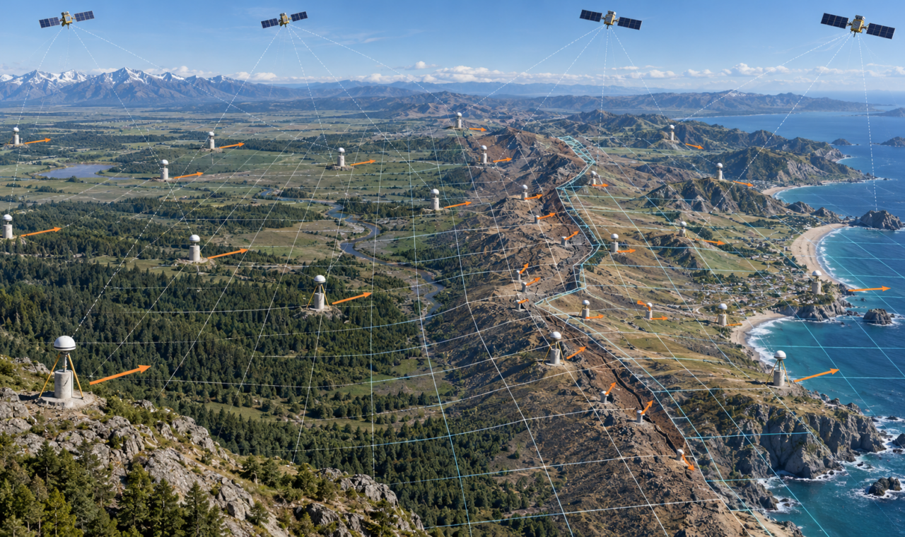
Original conceptual illustration created for The Lost Surveyor; motion vectors and grids are explanatory rather than measured data.
The Missing Date in a Coordinate
A coordinate often looks permanent. Northing, easting, latitude, longitude, and ellipsoid height are written with fixed numbers, sometimes carried to more decimal places than any field mark could justify. The form suggests that the point has one correct position waiting to be recovered.
At high precision, the Earth does not cooperate. Tectonic plates move, faults strain and rupture, aquifers compact, volcanoes inflate, coastlines subside, and the crust relaxes after earthquakes. A monument can remain physically intact while its coordinates in an Earth-centred reference frame change year after year.
The date associated with a coordinate is its epoch. Without the reference frame and epoch, a precise coordinate is incomplete. It may still be useful for a local project, but it cannot be compared reliably with another precise position until both observations are brought to a common system and time.
A Monument Is Not Its Coordinate
A survey monument is a physical object. Its coordinate is a numerical description of that object within a defined reference frame. The distinction is easy to overlook when an older control sheet presents a single published position.
If a tectonic plate carries the monument several centimetres west, the mark has not failed. A fresh GNSS observation may give a different Earth-centred coordinate because the mark actually moved with the crust. Conversely, a coordinate held fixed by convention may conceal that physical motion.
Neither description is automatically wrong. A global scientific frame may be designed to show plate motion. A plate-fixed frame may rotate with the stable interior of the plate so ordinary coordinates change as little as possible. Each serves a purpose, provided the frame and epoch are stated.
How a Reference Frame Holds a Moving Earth
A terrestrial reference system defines the origin, scale, orientation, and time evolution needed to describe positions on Earth. A terrestrial reference frame realizes that system through observed stations and their coordinates, velocities, and other motion models.
The International Terrestrial Reference Frame combines several space-geodetic techniques. Global Navigation Satellite System stations provide continuous positioning. Very Long Baseline Interferometry observes distant radio sources and contributes to orientation and scale. Satellite Laser Ranging measures the distance to orbiting reflectors and helps establish the centre of mass. DORIS uses Doppler observations from satellite signals transmitted by ground beacons.
The current ITRF2020 solution includes station positions at a reference epoch, velocities, discontinuities, seasonal signals, and models for post-seismic deformation at stations affected by major earthquakes. A coordinate can therefore be propagated through time instead of treated as a value that never changes.
What an Epoch Actually Does
An epoch identifies the time at which a coordinate applies. If a station has a known velocity, its position at another time can be estimated by applying that motion over the interval. The calculation is straightforward when motion is steady and far more difficult when the station experiences an earthquake, subsidence, equipment change, or nonlinear post-seismic movement.
Suppose a point moves three centimetres per year relative to a global frame. Coordinates separated by ten years would differ by roughly thirty centimetres even if both observations were excellent. Combining the numbers without accounting for time could create an apparent survey discrepancy where none exists.
The epoch is not simply the date printed on the field notes. A survey epoch usually describes when an observation applies. A reference epoch is a common date to which coordinates have been projected for publication or adjustment. Confusing those concepts can mix actual present-day position with a standardized coordinate representation.
Global Frames and Plate-Fixed Frames
A global frame such as the ITRF is designed to describe Earth as a whole. It does not rotate with one tectonic plate. Stations on stable North America, for example, have nonzero velocities because the plate moves relative to the global system.
A plate-fixed frame removes much of that broad rotation. Coordinates within the stable plate interior remain comparatively steady, which is convenient for mapping, engineering, land administration, and infrastructure. Local deformation does not disappear; a station near a fault, subsiding basin, or volcanic centre can still move within the plate-fixed frame.
The choice resembles selecting a moving platform from which to describe motion. A plate-fixed frame is stable for work on that plate but is not globally motionless. A global frame supports worldwide comparison but allows familiar local coordinates to change.
Earthquakes Break the Simple Velocity Model
Steady velocity is only the first approximation. An earthquake can shift a station abruptly. The crust may then continue moving through afterslip and viscoelastic relaxation, with the rate decaying over months or years. A single straight-line velocity cannot represent the entire record.
Reference-frame solutions handle these events through coordinate discontinuities and post-seismic models. The physical monument may remain usable, but its time series must be divided or modelled so observations before and after the event are not forced into one misleading trend.
For a project survey, an earthquake can create a more immediate problem. Existing control may no longer agree internally, and deformation may vary across the project rather than occur as a rigid shift. Reoccupation and local analysis are needed before old coordinates are accepted as present-day control.
The United States Moves Toward Time-Dependent Control
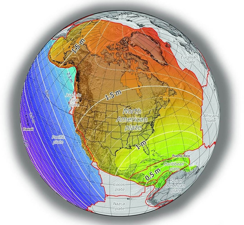
Credit: NOAA National Geodetic Survey; U.S. government work.
NOAA’s National Geodetic Survey is modernizing the National Spatial Reference System. The design replaces the North American Datum of 1983 with four terrestrial reference frames associated with the North American, Pacific, Caribbean, and Mariana plates. Each is aligned with ITRF2020 at epoch 2020.00 and rotates at the average rate of its named plate.
The system is intended to reduce routine coordinate change across stable parts of each plate while preserving tools for motion that remains. Reference epoch coordinates will provide standardized values at selected dates, and deformation models will project positions through time.
As of 2026, the modernized system is still moving through public testing and federal approval. NAD 83 and NAVD 88 remain the official horizontal and vertical datums until the transition is completed. That distinction matters when writing contracts, certifications, metadata, or deliverables: a beta frame can be studied without being treated as the current legal standard.
Coordinates Can Age Without Becoming Bad Observations
An older coordinate may have been correct for its frame and epoch. Its usefulness today depends on how the point moved, whether the monument survived, whether the frame was updated, and how accurately the motion can be modelled. “Old” and “wrong” are not synonyms, but neither are “published” and “current.”
This is particularly important when combining datasets. A lidar project, parcel layer, engineering design, aerial control network, and GNSS survey may each carry a datum name while omitting the realization or epoch. The files can appear compatible and still be separated by decimetres or metres.
Metadata should therefore record the full reference frame, realization, coordinate epoch where applicable, units, transformation method, and source of control. Extra decimal places cannot repair a missing datum or date.
A Coordinate Change Does Not Move a Boundary
Dynamic coordinates can sound as though property lines or constructed features drift whenever a reference frame is updated. A numerical coordinate change does not by itself alter the physical or legal evidence that defines a boundary. Monuments, records, occupation, law, and professional judgment retain their roles.
The coordinate is one description of that evidence. If the reference frame changes or the land moves, the numbers used to describe a corner may change while the corner’s legal identity remains a separate question. Surveyors must avoid substituting coordinate precision for boundary authority.
Engineering and monitoring projects face a related distinction. A frame transformation changes the description of every point according to a model. Real deformation changes spatial relationships on the ground. Determining which occurred is part of the analysis.
Surveying in Four Dimensions
Modern positioning is often called four-dimensional because time joins latitude, longitude, and height. The phrase does not mean every project needs a complex velocity solution. It means high-accuracy work must recognize when motion over the project’s lifetime is large enough to matter.
A construction layout completed within a stable local network may use one practical epoch. A regional control survey, deformation study, autonomous navigation system, or long-lived infrastructure model may require coordinates to be transformed continually. The necessary sophistication depends on accuracy, location, and duration.
The central lesson is simple: Earth is not the rigid drawing surface implied by a coordinate table. A modern reference frame does not defeat that motion. It describes it well enough that measurements made at different times can still refer to the same moving planet.
Sources and Further Reading
International Terrestrial Reference Frame: ITRF2020 Position and Motion Model
NOAA National Geodetic Survey: Replacing NAD 83 and NAVD 88
NOAA National Geodetic Survey: The Four Plate-Fixed Terrestrial Reference Frames
NOAA Technical Report: Working in the Modernized National Spatial Reference System
NOAA National Geodetic Survey: Modernized NSRS Frequently Asked Questions