
Land & Boundaries
The Homestead Promise: How a Land Claim Became a Home
A homestead began with a land description and a promise. Following the paperwork, homes, and communities reveals what the opportunity required—and whose homeland it changed.
On This Page
A homestead application can look surprisingly modest for a document that helped reshape a continent. Daniel Freeman’s handwritten application, dated January 1, 1863, identifies a tract in Nebraska Territory through fractions of sections, a township, and a range. The language is compact. What followed was anything but: years of residence, work, uncertainty, and an attempt to turn a government land description into a home.
Homesteading is often remembered as a story of free land and individual determination. Both belong to its history, but neither tells the whole story. The land had to be legally available, the claimant had to qualify, and the household had to survive long enough to secure title. Beyond the claim itself lay a larger question: how had land inhabited and used by Native peoples become land the federal government offered to newcomers?
A promise with conditions
President Abraham Lincoln signed the Homestead Act on May 20, 1862. It took effect on January 1, 1863. Under the original framework, eligible applicants could claim up to 160 acres of surveyed public land. They generally had to reside on and improve the tract for five years before receiving a patent, the federal document conveying title. The National Archives’ collection includes Freeman’s application and later proof of improvements, making it possible to follow a claim through its paperwork.
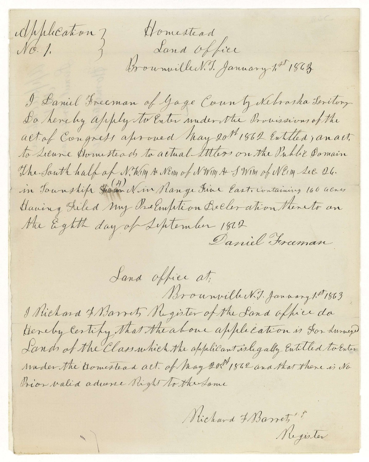
Daniel Freeman. Public domain. Source and rights record. Resized for web display; no content alteration.

The application was a beginning, rather than an immediate deed to a finished farm. A claimant had to be at least 21 or the head of a household, a citizen or someone who had declared an intention to become one, and meet the law’s loyalty requirements. Filing fees were part of the process. Tools, transport, livestock, food, and shelter added costs that the phrase “free land” does little to convey.
The National Park Service’s overview describes the variety of people who pursued the opportunity: immigrants, landless farmers, single women, and formerly enslaved people. Yet access to an application did not create equal access to money, legal assistance, or safe treatment. The same promise reached households with markedly different resources.
What the survey supplied
The rectangular public-land survey system gave the program an administrative language. In its familiar ideal arrangement, a township measures six miles on a side and contains 36 sections. A section nominally contains 640 acres; a quarter section nominally contains 160. Real surveys include irregularities and adjustments, so those textbook quantities should not be mistaken for guaranteed measurements of every parcel.
This structure allowed officials to distinguish one tract from another in applications, plats, and patents. A legal description could be carried from the local land office into the federal record without depending entirely on a claimant’s account of a hill, tree, or creek. Survey monuments and the original records provided evidence for locating the described land on the ground.
That achievement had limits. A survey organized property; it did not certify that a quarter section had adequate water, fertile soil, or a viable route to market. Two tracts with similar descriptions and acreages could offer very different lives. Reading the grid as a promise of agricultural equality confuses an orderly method of identification with the uneven character of the landscape.
The Bureau of Land Management’s land-records resources preserve patents, survey plats, and field notes. These documents let a reader connect a family’s story to a particular tract, while keeping the distinction between describing land and making it productive in view.
Building with what the prairie offered
On parts of the Great Plains, a shortage of nearby timber made sod a practical building material. Blocks of rooted prairie soil could form thick walls. Such houses were adaptations to available resources, not merely symbols of poverty or a single standard pioneer experience.
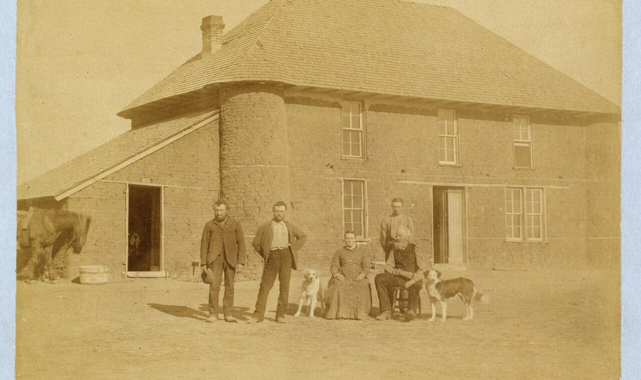
Solomon D. Butcher’s 1886 photograph of Isadore Haumont and his family shows a substantial two-story sod house north of Broken Bow, Nebraska. Its roof, windows, people, and animals make an arresting contrast with the abstraction of a land-office form. The Library of Congress catalog record identifies the Haumont household and anchors this view of prairie life in a particular place and year.
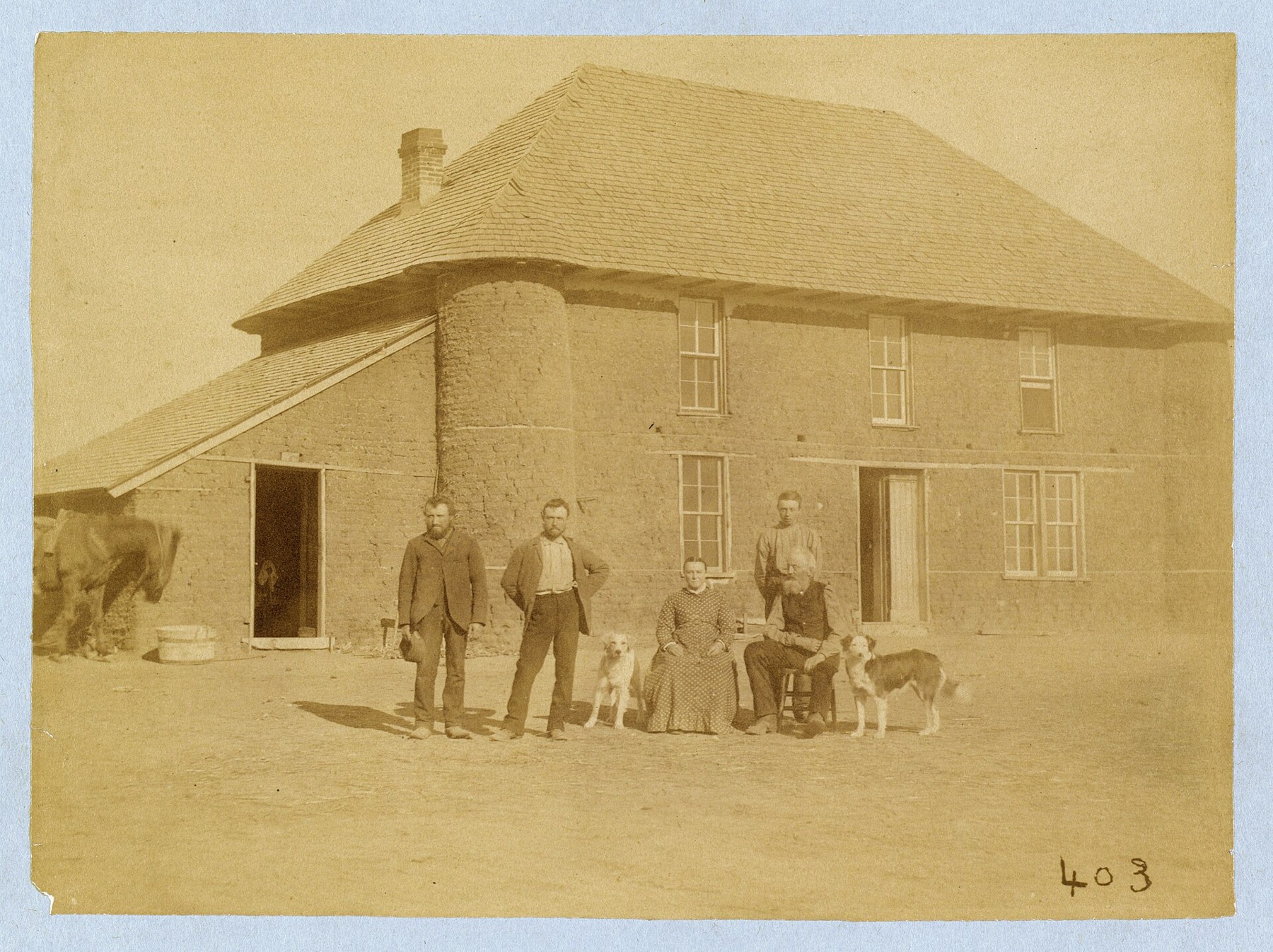
Butcher, Solomon D. (Solomon Devore), 1856-1927, photographer. Public domain. Source and rights record. Resized for web display; no content alteration.

The household standing before that building suggests how much “improvement” could contain. Shelter required materials and labor. Crops required suitable weather as well as planting. Cooking, keeping animals, maintaining clothing, and caring for children belonged to the same undertaking, even when official records emphasized buildings and cultivated acreage.
Conditions varied sharply by region. The Park Service’s history of homesteading in the Badlands explains how unreliable rainfall and marginal soils challenged farming. Later measures addressed some of those difficulties: the Enlarged Homestead Act of 1909 provided larger claims on qualifying land, and the Stock-Raising Homestead Act of 1916 allowed 640-acre claims for qualifying grazing land. The original 160-acre model was not a timeless prescription for every western environment.
Whose name appeared on the claim?
Women were central to homesteading both as applicants and as members of claimant households. Single, widowed, divorced, and deserted women could acquire land in their own names when eligible. A married woman’s separate eligibility depended on whether she qualified as the household head. The Park Service’s account of women homesteaders distinguishes ownership recorded on paper from the labor of women whose names did not appear on the claim.
Some women combined work on a homestead with paid employment as teachers, nurses, seamstresses, or domestic workers. Land could offer independence, a way to support children, or an asset eventually sold to finance a different life. Remaining on the same farm for generations was one outcome, rather than the only measure of success.
Black settlement also belongs at the center of this history. Nicodemus, Kansas, founded in 1877, became an important African American community on the plains. Its town development and surrounding homesteading were related but distinct processes; a town lot should not automatically be described as a federal homestead claim.
The Nicodemus history maintained by the Park Service describes Black entrepreneurs and settlers building institutions as well as seeking land. A church, school, shop, and local government supplied relationships that an isolated acreage could not. Their experience broadens the familiar picture of westward settlement from a lone wagon to a community seeking economic opportunity and greater freedom.
The land was already a homeland
Federal public land was a legal category, not evidence that a landscape had been empty. Native nations had homes, travel routes, food systems, political relationships, and sacred places across lands later offered for settlement. Treaties, coercion, warfare, removal, and reservation policies formed the wider history within which homesteading operated. The circumstances differed among places and peoples, but the consequences cannot be removed from the story.
The Dawes Act of 1887 was a separate law that divided tribal lands into individual allotments and opened land labeled surplus to non-Native acquisition. It should not be collapsed into the Homestead Act, even though both helped transform landholding in the West. The Park Service’s explanation of allotment describes the loss of tribal land and the government’s assimilation objectives.
For a settler, a boundary might mark the beginning of security. For a Native community, new boundaries could mark a profound loss of territory and authority. Recognizing both experiences makes the history more precise. A family’s courage and labor do not erase the policies that made its opportunity possible; those policies do not make the family’s daily hardships imaginary.
Reading the promise in the landscape
Homesteading left more than surviving houses. It left land descriptions, property lines, family records, road patterns, and expectations about ownership. Some claims became enduring farms. Others were abandoned, sold, or absorbed into larger holdings. A patent records a successful legal transition, but it does not, by itself, tell the whole subsequent story of a household.
The most revealing way to read a homestead is to move among its different records. The application explains what was sought. A plat helps locate it. Testimony and improvements show what officials required. A photograph puts people and buildings back into the acreage. Tribal histories reveal a landscape beyond the federal file. Together, these sources turn “free land” from a slogan into a complicated, recognizably human history.
Sources and further reading
- National Archives: Homestead Act and Daniel Freeman documents.
- National Park Service: About the Homestead Act, women homesteaders, and homesteading in the Badlands.
- Bureau of Land Management: General Land Office records.
- National Park Service: Nicodemus and the Dawes Act.
- Library of Congress: Butcher’s Haumont family photograph, 1886.