
Field Notes
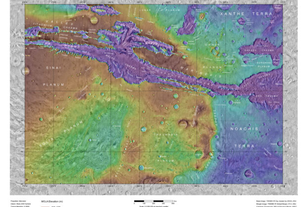
Coprates, MC-18: THEMIS Imagery and MOLA Topography
This named terrain map brings the Valles Marineris canyon system into a single regional view. Color-coded laser-altimeter elevations are combined with thermal-infrared imagery, allowing the deep chasms, intervening…