
Measuring the World
Clocks as Surveying Instruments: Relativistic Geodesy and the Shape of Earth
Optical atomic clocks can sense differences in gravitational potential, opening a path toward measuring physical height through the rate at which time passes.
On This Page
- 01 — Introduction
- 02 — When Time Becomes a Height Measurement
- 03 — Gravity Does More Than Pull Downward
- 04 — Relativity Is Already Built Into Satellite Surveying
- 05 — The Clocks That Left Home
- 06 — Why Optical Clocks Changed the Possibility
- 07 — The Measured Quantity Is Gravitational Potential
- 08 — The Link Between Clocks Is Part of the Instrument
- 09 — What Clock Geodesy Could Observe
- 10 — Why Survey Crews Are Not Carrying Optical Clocks Yet
- 11 — A New Instrument in an Old Geodetic System
- 12 — Sources and Further Reading
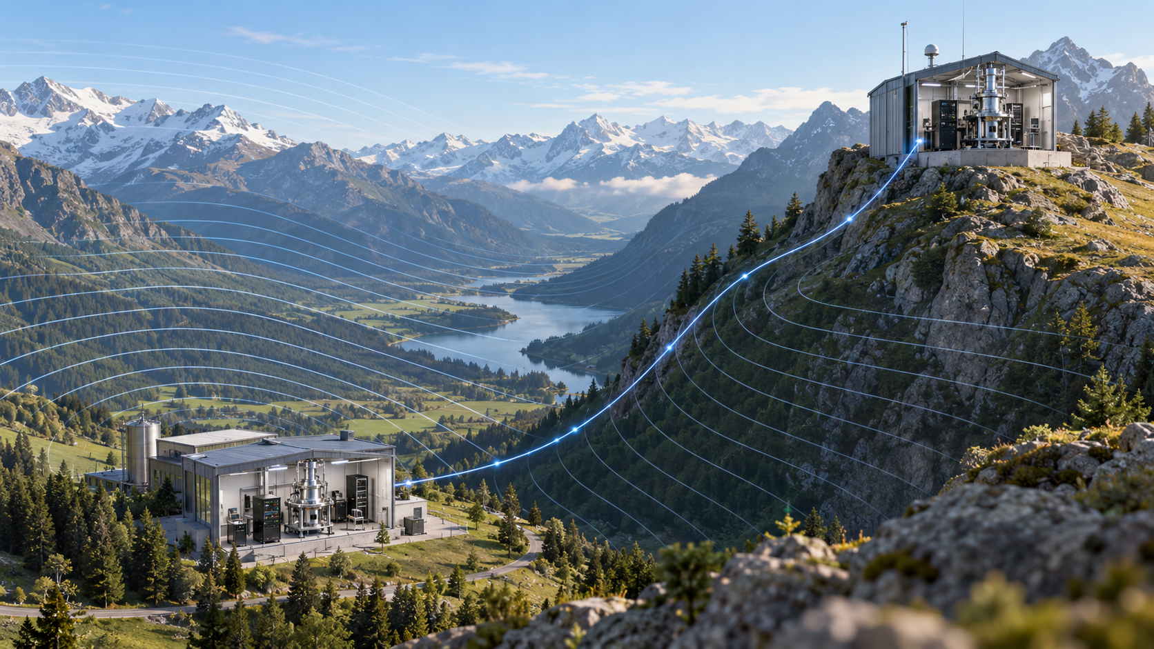
Original conceptual illustration created for The Lost Surveyor; not a photograph of an operating clock network.
When Time Becomes a Height Measurement
A surveyor looking for the height of a hillside would usually reach for a level or a satellite receiver. An atomic clock seems an unlikely addition to the equipment list. Yet raise a sufficiently precise clock and it ticks a little faster. That small change offers a new way to investigate height.
Einstein’s general relativity explains why. A clock’s rate depends partly on its place in Earth’s gravity field. Scientists describe that place using gravitational potential: the energy per unit mass associated with a location in the field. Near Earth’s surface, moving upward generally increases that potential and speeds up the clock. Ordinary watches cannot reveal the difference; optical atomic clocks can.
Using clock comparisons to study Earth is called relativistic geodesy. Two linked clocks can reveal a difference in gravitational potential without a crew running a level line between them. Turning that observation into a conventional elevation still requires gravity information and a height reference, but the possibility is remarkable: timekeeping can contribute to a survey.
Gravity Does More Than Pull Downward
Surveyors already work with gravity when they level an instrument or establish a vertical with a plumb line. Heights referred to the geoid, the gravity-based surface that approximates mean sea level, also depend on it. A clock adds another observation of that same physical world.
The change in clock rate is known as gravitational redshift. It is a real physical effect, not a defect in the clock. For satellite navigation it must be accounted for; for geodesy it can become the signal we want to measure.
Relativity Is Already Built Into Satellite Surveying
A position from a global navigation satellite system (GNSS), such as GPS, begins as a timing problem. The receiver compares time-tagged satellite signals and uses their travel times to estimate distances. Light travels about one foot (30 centimeters) in a nanosecond, a billionth of a second. A small clock error therefore becomes a substantial distance error.
Technical sidebar: the GPS clock correction
Relativity changes those clocks in two opposing directions. For GPS satellites, motion relative to an Earth-based reference makes the orbiting clocks run about 7.2 microseconds per day slower, an effect of special relativity. Their greater altitude places them in weaker gravity, making them run about 45.8 microseconds per day faster under general relativity. The net steady effect is about 38.6 microseconds per day faster than clocks on the geoid.
Left untreated, that daily difference is equivalent to roughly 7.2 miles (11.6 kilometers) of light-travel distance. GPS incorporates the main rate offset into the satellite clock frequency and accounts for additional periodic and rotational effects in its timing and range models. Other GNSS constellations require analogous treatment. Relativity is therefore not a remote theoretical refinement to satellite surveying; it is part of the ordinary machinery that makes precise positioning possible.
The Clocks That Left Home
Credit: Walty1971, Wikimedia Commons; dedicated to the public domain.

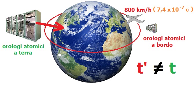
In October 1971, Joseph Hafele and Richard Keating carried four commercial cesium-beam clocks around the world on scheduled airliners, first eastward and then westward. They compared the traveling clocks with the U.S. Naval Observatory’s atomic time scale. Altitude made the airborne clocks run faster, while their speed relative to a nonrotating Earth-centered frame also affected their rates. The two directions produced different accumulated times, consistent with the combined predictions of special and general relativity within the experiment’s uncertainty. Their original report turned an airline journey into a direct test of how motion and gravity affect time.
A different experiment carried an atomic clock much higher. In 1976, Gravity Probe A launched a hydrogen maser, an atomic frequency reference, on a nearly vertical suborbital trajectory to about 6,200 miles (10,000 kilometers) above Earth. Its signal was compared by radio with a hydrogen maser on the ground during the roughly two-hour flight. The measured gravitational frequency shift agreed with general relativity to about seven parts in 100,000. The payload did not spend many orbits accumulating a difference for comparison after landing; the decisive measurement was the live frequency comparison during ascent and descent.
Long-running orbital clocks later supplied another test. Two Galileo navigation satellites launched in 2014 were accidentally placed in eccentric rather than circular orbits. As they repeatedly moved nearer to and farther from Earth, the changing gravitational potential produced a periodic signature in their hydrogen-maser clocks. Analyses of about 1,000 days of data, published in 2018, improved the previous Gravity Probe A gravitational-redshift test by as much as a factor of 5.6. An imperfect orbit had become a precise relativity experiment.
Why Optical Clocks Changed the Possibility
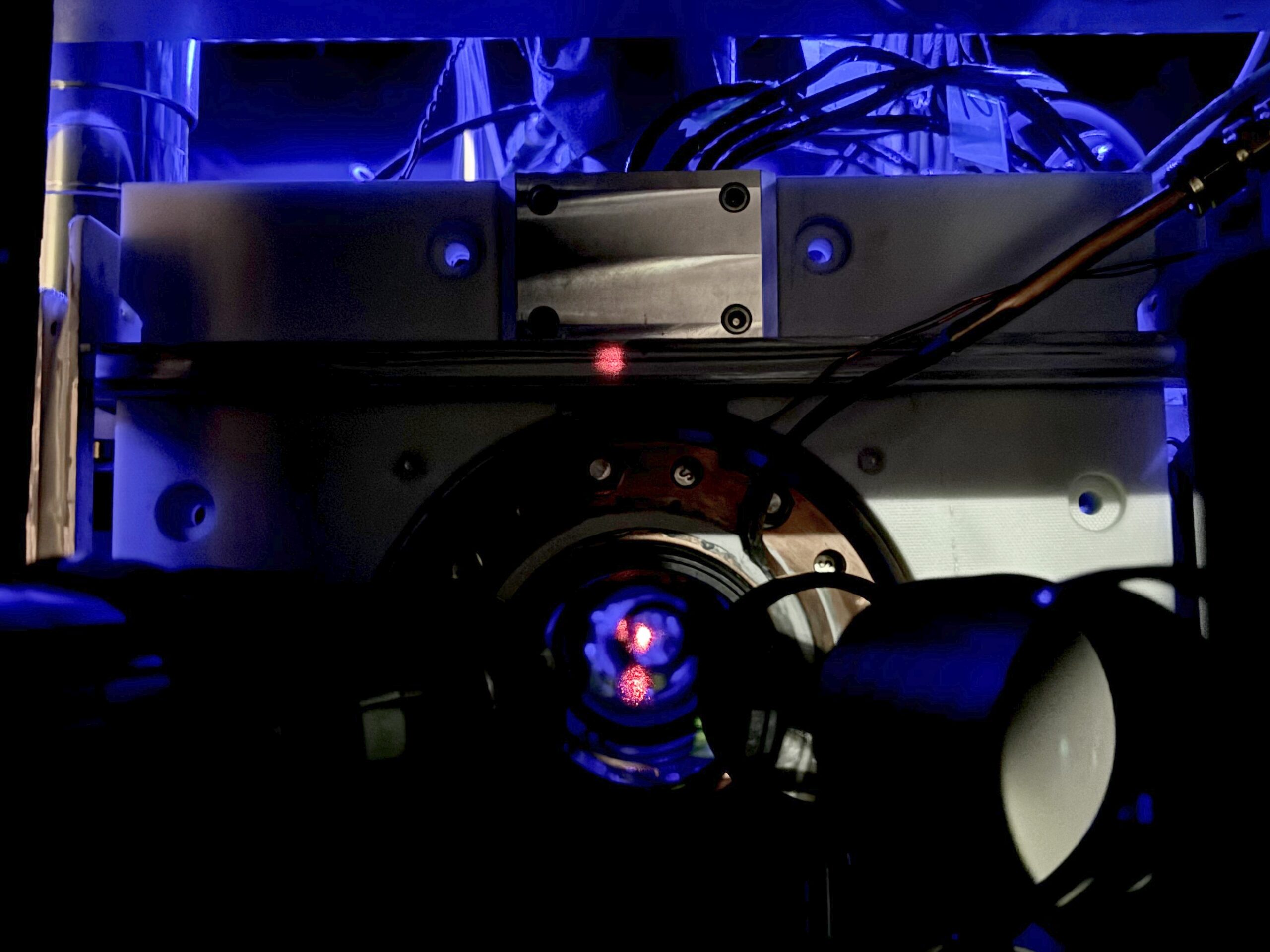
Credit: K. Palubicki/NIST. NIST requests appropriate image credit.
Atomic clocks use a natural atomic transition as a frequency reference. Traditional primary standards are based on microwave transitions in cesium. Optical clocks use much higher-frequency transitions in atoms or ions such as strontium, ytterbium, or aluminum. The faster oscillation provides a much finer scale for dividing time, much as finer graduations improve a ruler.
In 2010, researchers at the National Institute of Standards and Technology (NIST) compared two optical clocks separated vertically by about 13 inches (33 centimeters) and measured the relativistic effect. The height difference was modest enough to imagine at a workbench. Detecting its effect on time required instruments far beyond an ordinary clock.
Experiments have since pushed the observable scale much lower. In 2022, researchers at JILA, operated jointly by NIST and the University of Colorado Boulder, resolved gravitational redshift across a sample of ultracold strontium atoms only about four hundredths of an inch (one millimeter) tall. A 2024 JILA clock design was sensitive enough to detect relativistic effects across even smaller height differences within the laboratory system.
Those results demonstrate sensitivity, not a ready-made method for carrying a clock to any survey mark and assigning an elevation. A laboratory clock can reveal a tiny frequency shift under controlled conditions while a practical geodetic system must also transport or connect clocks, manage environmental effects, and relate the result to an accepted reference.
The Measured Quantity Is Gravitational Potential
A clock comparison does not directly measure geometric height above an ellipsoid, a smooth mathematical model of Earth. It measures a difference in the rate of time associated with a difference in gravitational potential. That distinction matters because gravity varies with latitude, elevation, geology, tides, groundwater, atmospheric mass, and the distribution of material inside Earth.
Physical height systems follow gravity because it determines which way water flows. Simply measuring distance above that smooth surface does not tell the whole story. Clock comparisons therefore fit naturally alongside leveling, gravity measurements, and models of the geoid.
Converting a clock comparison into a conventional height difference requires knowledge of gravity along the relevant direction and a defined reference potential. The clock supplies the observation; gravity models and agreed reference values connect it to the elevations used on a survey.
The Link Between Clocks Is Part of the Instrument
Two accurate clocks are of little help if the connection between them obscures the tiny difference in their rates. Laboratories use optical fiber, stabilized lasers, and devices called frequency combs, which let them compare different optical frequencies. The link must preserve the precision that makes the comparison worthwhile.
NIST researchers have compared different optical clocks over fiber and through free-space optical links. Other experiments are developing methods for transferring precision time over longer distances and eventually through satellite links. These connections are analogous to the observation network in a conventional survey: the quality of each instrument matters, but so does the path that ties one station to another.
Fiber offers excellent stability where infrastructure exists. Free-space and satellite methods promise wider coverage but must contend with the atmosphere, platform motion, signal strength, and link calibration. A future clock-based height network will depend as much on reliable comparison technology as on the clocks themselves.
What Clock Geodesy Could Observe
A practical network of transportable or remotely linked optical clocks could compare gravitational potential across mountains, islands, national borders, or areas where precise leveling is slow and difficult. Because the observation is tied to potential, it could help connect regional height systems and test geoid models over long distances.
Repeated measurements could also detect changes in potential. Groundwater storage, volcanic inflation, glacial mass loss, subsidence, and other geophysical processes move both the observing point and nearby mass. Clock observations would not identify the cause by themselves, but they could supply another independent measurement when combined with GNSS, gravimetry, satellite observations, and physical models.
Why Survey Crews Are Not Carrying Optical Clocks Yet
The best optical clocks remain demanding laboratory systems. Their atoms must be isolated and controlled, lasers stabilized, environmental influences monitored, and systematic uncertainties evaluated. A field instrument must survive transportation, temperature changes, vibration, power interruptions, and repeated setup without sacrificing the performance that makes relativistic geodesy useful.
Portability has improved, and transportable optical clocks have been demonstrated outside their home laboratories. Even so, the complete system includes the clock, the frequency-transfer link, reference equipment, environmental monitoring, and a method for tying the clock location to a physical monument. The operational problem is larger than shrinking one instrument rack.
The observations must also connect to a national or international height datum, the agreed reference behind published elevations. Another surveyor needs to be able to trace the result, repeat the measurement, and understand its uncertainty. Those practical requirements matter as much as the clock’s laboratory performance.
A New Instrument in an Old Geodetic System
The most useful future is likely a combined one. Satellite receivers locate points geometrically, levels transfer local heights, gravity instruments measure the field, and clocks compare potential between selected sites. Each contributes something the others do not measure in quite the same way.
The novelty lies in turning a fundamental law of physics into a surveying observation. A lower clock does not run slowly because an instrument maker chose the wrong scale. It runs slowly because its location occupies a different gravitational potential. Once clocks can reveal that difference reliably outside the laboratory, time itself becomes another way to measure the shape of Earth.
Sources and Further Reading
National Institute of Standards and Technology: Relativity and Optical Clocks
NIST: JILA Atomic Clocks Measure Einstein’s General Relativity at Millimeter Scale
NIST: Comparing Optical Clocks Over Fibre and Free-Space Links
NIST: World’s Most Accurate and Precise Atomic Clock Pushes New Frontiers
NOAA National Geodetic Survey: The Geopotential Surface
GPS.gov: Relativistic Effects Incorporated in GPS
NASA Technical Reports Server: Test of Relativistic Gravitation With a Space-Borne Hydrogen Maser
European Space Agency: Galileo Satellites Prove Einstein’s Relativity Theory to Highest Accuracy Yet