
Ancient Surveying
From the Nile to the Roman Grid: Surveying in Ancient Egypt and Rome
Cubit rods, stretched cords, the Roman groma, and the administrative systems that connected ancient measurement to land, construction, and law.
On This Page
- 01 — Introduction
- 02 — Measurement Before the Modern Surveyor
- 03 — The Egyptian Cubit
- 04 — Ropes, Rods, and Right Angles
- 05 — Measurement, Tax, and Construction
- 06 — Rome and the Professional Land Surveyor
- 07 — The Groma and Straight Alignment
- 08 — Centuriation: A Grid With a Purpose
- 09 — The Corpus of the Agrimensores
- 10 — Two Ancient Lessons for Modern Practice
- 11 — The Continuity Beneath the Technology
- 12 — Sources and Further Reading
Measurement Before the Modern Surveyor
Long before steel tapes, transits, total stations, and satellites, organized societies needed reliable ways to measure land and construction. Fields were taxed, canals maintained, temples aligned, towns laid out, and boundaries disputed. Ancient Egyptian and Roman practice developed within different cultures, but both demonstrate that surveying is as much an administrative system as a set of instruments.
The surviving evidence is incomplete. Instruments decay, records are fragmentary, and later writers may describe practices from earlier periods imperfectly. A careful history should therefore distinguish archaeological objects and surviving texts from attractive stories that cannot be documented.
The Egyptian Cubit
The cubit was a fundamental Egyptian unit of length, related conceptually to the forearm. Physical measuring rods divided the cubit into smaller units such as palms and fingers. Surviving rods show that measurement was standardized enough to be embodied in carefully marked objects.
The Metropolitan Museum of Art holds a wooden cubit rod from Egypt’s Middle Kingdom, dated roughly to 1981–1640 BCE. Its survival makes ancient measurement tangible: a working length standard created thousands of years before modern national metrology laboratories.
Different cubit standards existed in different periods and contexts, and the exact use of a particular ceremonial or working rod must be evaluated from the object and provenance. The central idea, however, is familiar to every surveyor: measurements become comparable only when people share a recognized unit and a way to reproduce it.
Ropes, Rods, and Right Angles
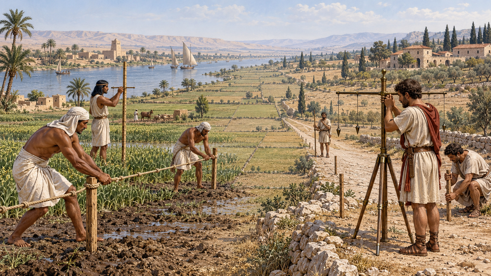
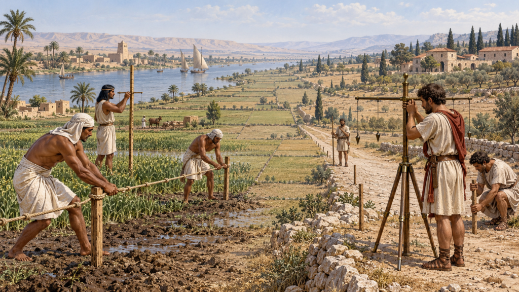
Egyptian scenes and texts refer to activities translated as stretching the cord, particularly in connection with laying out important structures. Cords could establish straight lines, while rods and geometric methods supported length and alignment. Builders also used leveling and plumbing tools. Museum collections preserve cubit rods, boning rods, and other artifacts connected with construction measurement.
Popular accounts sometimes say that Egyptian surveyors re-created every field boundary after each annual Nile flood. Flooding certainly affected agricultural land, taxation, and administration, and measurement was necessary in the Nile Valley. The claim of a universal annual resurvey is harder to demonstrate. It is safer to say that Egyptian officials maintained systems of land measurement and recordkeeping capable of addressing a landscape shaped by the river.
Measurement, Tax, and Construction
Land measurement in Egypt was connected to state administration. Agricultural production, taxation, temple estates, and labor organization required records of land and output. Surveying was therefore not an isolated craft. It operated within a literate bureaucracy that used scribes, standardized units, and recorded calculations.
Construction created another demanding measurement problem. Monumental architecture required orientation, straightness, level, proportion, and repeatable dimensions. The accuracy of surviving structures shows disciplined practice, although the exact procedure behind every alignment remains a subject of study rather than a single solved formula.
Rome and the Professional Land Surveyor
Roman land surveyors were known by several terms. Early sources use finitor or mensor, while agrimensor and gromaticus became associated with professional land measurement. Their work included laying out colonial lands, dividing agricultural territory, establishing roads and settlements, marking boundaries, and addressing technical aspects of disputes.
Unlike a simple picture of soldiers drawing squares wherever Rome advanced, Roman surveying involved law, administration, local geography, and professional literature. Scholarly work on the agrimensores shows that their writings addressed land categories, boundaries, disputes, measurement procedures, and the status of surveyed territory.
The Groma and Straight Alignment
The groma is the instrument most strongly associated with Roman surveyors. A cross with suspended plumb lines enabled the operator to establish straight alignments and right angles. It was well suited to setting perpendicular axes for roads, camps, towns, and land divisions.
The instrument’s apparent simplicity should not be confused with effortless precision. Wind could disturb the plumb lines, uneven ground complicated setup, and long alignments accumulated error. Surveying required trained assistants, repeated sighting, measurement, and judgment about terrain.
Centuriation: A Grid With a Purpose
Roman centuriation divided some territories into a regular network of roads, boundaries, and parcels. The grid was used in establishing colonies and allocating land, including land granted to veterans. Traces of ancient centuriation have been studied through surviving roads, property patterns, archaeological evidence, maps, and aerial or satellite imagery.
Not every Roman landscape was laid out as a perfect cardinal grid. Orientation could respond to existing roads, topography, drainage, earlier occupation, or local practice. As with the American Public Land Survey System many centuries later, the ideal geometry had to meet actual ground.
The Corpus of the Agrimensores
A collection commonly known as the Corpus Agrimensorum Romanorum preserves texts associated with Roman land surveyors. Authors and works in the tradition include Frontinus, Hyginus Gromaticus, Siculus Flaccus, and others. The manuscripts are complex, copied across centuries, and sometimes difficult to interpret, but they show a recognizable technical profession reflecting on its own procedures.
The writings address issues that remain familiar: how boundaries were created, how land categories differed, what to do when evidence conflicted, and how measurement interacted with legal authority. The tools have changed dramatically; the need to connect field evidence to a governing record has not.
Two Ancient Lessons for Modern Practice
Egyptian artifacts emphasize standards. A unit must be embodied, divided, communicated, and trusted. Roman sources emphasize systems. A measured line gains meaning through law, monuments, records, and administration. Together they remind us that surveying is not merely the ability to measure accurately.
Modern geomatics often focuses on coordinate precision, yet ancient practice demonstrates the other half of the profession. Measurements must be made in a shared reference, tied to recognizable evidence, and preserved in a record that institutions and communities can use.
The Continuity Beneath the Technology
An Egyptian cord, Roman groma, surveyor’s chain, optical transit, and GNSS rover do not provide the same accuracy or operate in the same conceptual system. It would be misleading to describe ancient practitioners as modern surveyors with older equipment.
Still, the continuity is real. Each tradition faced the need to establish alignment, measure distance, divide land, maintain standards, and resolve the difference between an ideal plan and an irregular Earth. The history of surveying is therefore not a march from crude guesses to perfect coordinates. It is a long record of societies creating trustworthy spatial order with the knowledge and tools available to them.
Sources and Further Reading
The Metropolitan Museum of Art: Middle Kingdom Cubit Measuring Rod
The Metropolitan Museum of Art: New Kingdom Boning Rods
Brian Campbell, “Shaping the Rural Environment: Surveyors in Ancient Rome,” Journal of Roman Studies
Encyclopedia of Global Archaeology: Centuriation and Roman Land Surveying